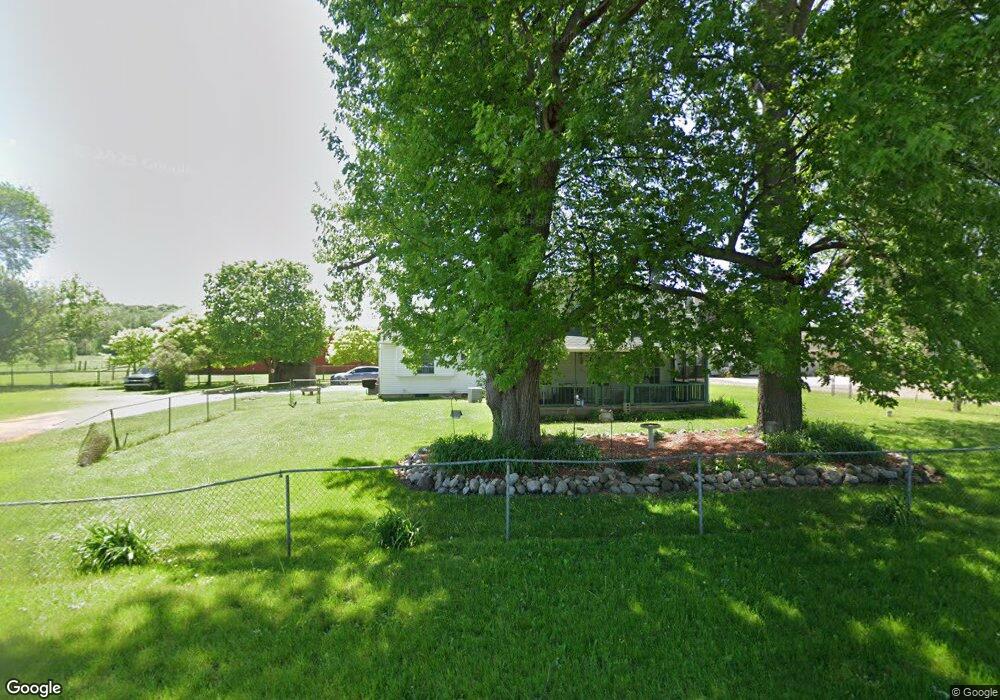
1416 92nd St SW Byron Center, MI 49315
Estimated Value: $329,985 - $398,000
3
Beds
2
Baths
1
Sq Ft
$361,746/Sq Ft
Est. Value
About This Home
This home is located at 1416 92nd St SW, Byron Center, MI 49315 and is currently estimated at $361,746, approximately $361,746 per square foot. 1416 92nd St SW is a home located in Kent County with nearby schools including Robert L. Nickels Intermediate School, Countryside Elementary School, and Byron Center West Middle School.
Ownership History
Date
Name
Owned For
Owner Type
Purchase Details
Closed on
Mar 1, 2022
Sold by
Valerie D Drummond Trust
Bought by
Drummond Valerie D
Current Estimated Value
Purchase Details
Closed on
Nov 1, 2017
Sold by
Drummond Valerie D
Bought by
Drummond Valerie D and The Valerie D Drummond Trust
Purchase Details
Closed on
Aug 9, 2009
Sold by
Drummond Valerie D
Bought by
Drummond Valerie D and Valerie D Drummond Trust
Create a Home Valuation Report for This Property
The Home Valuation Report is an in-depth analysis detailing your home's value as well as a comparison with similar homes in the area
Home Values in the Area
Average Home Value in this Area
Purchase History
| Date | Buyer | Sale Price | Title Company |
|---|---|---|---|
| Drummond Valerie D | -- | None Listed On Document | |
| Drummond Valerie D | -- | None Available | |
| Drummond Valerie D | -- | None Available |
Source: Public Records
Tax History Compared to Growth
Tax History
| Year | Tax Paid | Tax Assessment Tax Assessment Total Assessment is a certain percentage of the fair market value that is determined by local assessors to be the total taxable value of land and additions on the property. | Land | Improvement |
|---|---|---|---|---|
| 2025 | $1,565 | $114,200 | $0 | $0 |
| 2024 | $1,565 | $104,100 | $0 | $0 |
| 2023 | $1,495 | $90,800 | $0 | $0 |
| 2022 | $2,290 | $76,300 | $0 | $0 |
| 2021 | $2,225 | $76,000 | $0 | $0 |
| 2020 | $1,371 | $73,000 | $0 | $0 |
| 2019 | $2,092 | $68,700 | $0 | $0 |
| 2018 | $2,092 | $63,800 | $29,900 | $33,900 |
| 2017 | $2,047 | $58,400 | $0 | $0 |
| 2016 | $2,005 | $55,100 | $0 | $0 |
| 2015 | $1,988 | $55,100 | $0 | $0 |
| 2013 | -- | $48,400 | $0 | $0 |
Source: Public Records
Map
Nearby Homes
- 1941 Conifer Ridge Dr SW
- 1768 Hightree Dr SW
- 1861 Restoration Dr SW
- 1666 Bayleaf Dr
- The Fitzgerald Plan at Walnut Ridge
- The Marley Plan at Walnut Ridge
- The Hearthside Plan at Walnut Ridge
- The Balsam Plan at Walnut Ridge
- The Rutherford Plan at Walnut Ridge
- The Stockton Plan at Walnut Ridge
- The Georgetown Plan at Walnut Ridge
- The Mayfair Plan at Walnut Ridge
- The Birkshire II Plan at Walnut Ridge
- The Hadley Plan at Walnut Ridge
- The Jamestown Plan at Walnut Ridge
- The Crestview Plan at Walnut Ridge
- The Newport Plan at Walnut Ridge
- The Wisteria Plan at Walnut Ridge
- The Preston Plan at Walnut Ridge
- The Sanibel Plan at Walnut Ridge
- 1420 92nd St SW
- 1417 92nd St SW
- 1555 92nd St SW
- 1590 92nd St SW
- 9250 Burlingame Ave SW
- 9255 Burlingame Ave SW
- 9112 Burlingame Ave SW
- 1608 92nd St SW
- 1216 92nd St SW
- 1229 92nd St SW
- 9303 Burlingame Ave SW
- 1250 92nd St SW
- 9357 Burlingame Ave SW
- 1661 92nd St SW
- 9423 Burlingame Ave SW
- 9449 Burlingame Ave SW
- 1130 92nd St SW
- 9467 Burlingame Ave SW
- 1745 92nd St SW
- 8939 Burlingame Ave SW