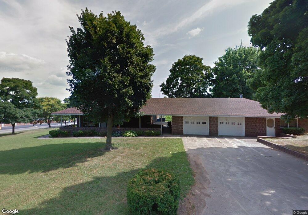
1416 Main St Cassville, MO 65625
Estimated Value: $242,000 - $398,000
3
Beds
4
Baths
4,334
Sq Ft
$70/Sq Ft
Est. Value
About This Home
This home is located at 1416 Main St, Cassville, MO 65625 and is currently estimated at $303,668, approximately $70 per square foot. 1416 Main St is a home located in Barry County with nearby schools including Eunice Thomas Elementary School, Cassville Intermediate School, and Cassville Middle School.
Ownership History
Date
Name
Owned For
Owner Type
Purchase Details
Closed on
Mar 20, 2023
Sold by
Jackson Charles Thomas and Jackson Tina
Bought by
Jackson Jennifer N and Miller Jordan
Current Estimated Value
Home Financials for this Owner
Home Financials are based on the most recent Mortgage that was taken out on this home.
Original Mortgage
$166,250
Outstanding Balance
$160,664
Interest Rate
5.75%
Mortgage Type
New Conventional
Estimated Equity
$143,004
Purchase Details
Closed on
Aug 12, 2016
Sold by
Jackson Charles and Jackson Tina
Bought by
Jackson Elma
Create a Home Valuation Report for This Property
The Home Valuation Report is an in-depth analysis detailing your home's value as well as a comparison with similar homes in the area
Home Values in the Area
Average Home Value in this Area
Purchase History
| Date | Buyer | Sale Price | Title Company |
|---|---|---|---|
| Jackson Jennifer N | -- | Meridian Title | |
| Jackson Elma | -- | None Available |
Source: Public Records
Mortgage History
| Date | Status | Borrower | Loan Amount |
|---|---|---|---|
| Open | Jackson Jennifer N | $166,250 |
Source: Public Records
Tax History
| Year | Tax Paid | Tax Assessment Tax Assessment Total Assessment is a certain percentage of the fair market value that is determined by local assessors to be the total taxable value of land and additions on the property. | Land | Improvement |
|---|---|---|---|---|
| 2025 | $1,363 | $32,452 | $4,047 | $28,405 |
| 2024 | $14 | $29,868 | $4,047 | $25,821 |
| 2023 | $1,363 | $29,868 | $4,047 | $25,821 |
| 2022 | $1,322 | $28,975 | $3,154 | $25,821 |
| 2020 | $1,333 | $29,108 | $3,154 | $25,954 |
| 2018 | $1,304 | $29,108 | $3,154 | $25,954 |
| 2017 | $1,300 | $29,108 | $3,154 | $25,954 |
| 2016 | $1,223 | $27,056 | $2,698 | $24,358 |
| 2015 | -- | $27,056 | $2,698 | $24,358 |
| 2014 | -- | $26,961 | $2,698 | $24,263 |
| 2012 | -- | $0 | $0 | $0 |
Source: Public Records
Map
Nearby Homes
- 1605 N Main St
- 304 W 14th St
- 000 Luney Dr
- 301 Blackberry Ct Unit Lot 18
- 303 Melton Way
- 1015 Harold St
- 1000 Gravel St
- 1102 Sapp St
- 000 Townsend West 9th
- 740 E 13th St
- 106 Rosedale St
- 802 Hickory
- 803 Hickory St
- 1000 Hickory St
- 1008 Wildwood Dr
- 1107 Lake Road Dr
- 106 Mountain St
- 1302 Oak St
- 1407 Nottingham Dr Unit Lot 87a
- 1408 Nottingham Dr
- 1414 Main St
- 1418 Main St
- 1415 Townsend St
- 1413 Townsend St
- 1503 Townsend St
- 1412 Main St
- 1505 Townsend St
- 1409 Townsend St
- 1502 Townsend St
- 103 Koon Dr
- 106 W 16th St
- 1506 Townsend St
- 201 W 15th St
- 1410 Townsend St
- 1509 N Main St
- 1407 Townsend St
- 1508 Townsend St
- 10700 N Business Highway 37
- 10705 N Business Highway 37
- 112 W 17th St
Your Personal Tour Guide
Ask me questions while you tour the home.