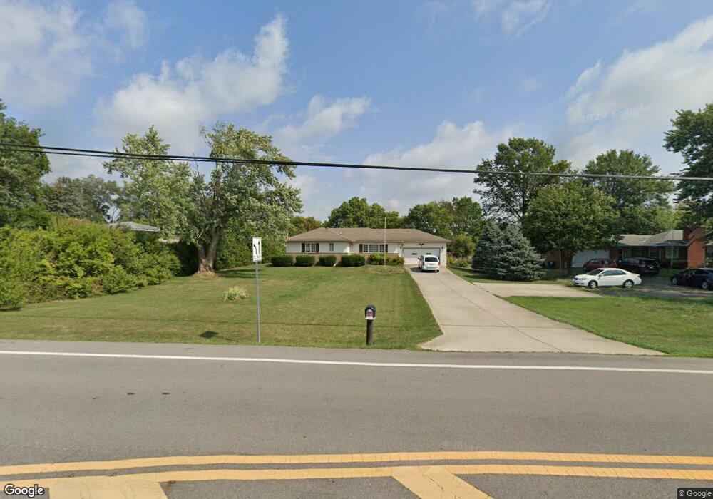
1416 Rohr Rd Lockbourne, OH 43137
Estimated Value: $243,000 - $343,000
3
Beds
2
Baths
1,384
Sq Ft
$212/Sq Ft
Est. Value
About This Home
This home is located at 1416 Rohr Rd, Lockbourne, OH 43137 and is currently estimated at $294,045, approximately $212 per square foot. 1416 Rohr Rd is a home located in Franklin County with nearby schools including Hamilton Elementary School, Hamilton Intermediate School, and Hamilton Middle School.
Ownership History
Date
Name
Owned For
Owner Type
Purchase Details
Closed on
Oct 14, 2010
Sold by
Secretary Of Housing & Urban Development
Bought by
Collins Shirley A
Current Estimated Value
Home Financials for this Owner
Home Financials are based on the most recent Mortgage that was taken out on this home.
Original Mortgage
$102,816
Outstanding Balance
$66,813
Interest Rate
4.36%
Mortgage Type
FHA
Estimated Equity
$227,232
Purchase Details
Closed on
Apr 27, 2010
Sold by
Mays Larry E and Garrison Lois M
Bought by
Midfirst Bank
Purchase Details
Closed on
Apr 20, 2010
Sold by
Midfirst Bank
Bought by
Secretary Of Housing & Urban Development
Purchase Details
Closed on
Apr 30, 2007
Sold by
Benedetti Carl
Bought by
Mays Larry E and Garrison Lois M
Home Financials for this Owner
Home Financials are based on the most recent Mortgage that was taken out on this home.
Original Mortgage
$158,646
Interest Rate
6.18%
Mortgage Type
FHA
Purchase Details
Closed on
Jul 27, 1960
Bought by
Benedetti Carl
Create a Home Valuation Report for This Property
The Home Valuation Report is an in-depth analysis detailing your home's value as well as a comparison with similar homes in the area
Home Values in the Area
Average Home Value in this Area
Purchase History
| Date | Buyer | Sale Price | Title Company |
|---|---|---|---|
| Collins Shirley A | $104,202 | Lakeside Ti | |
| Midfirst Bank | $173,812 | Allodial | |
| Secretary Of Housing & Urban Development | -- | Allodial | |
| Mays Larry E | $159,900 | Valmer Land | |
| Benedetti Carl | -- | -- |
Source: Public Records
Mortgage History
| Date | Status | Borrower | Loan Amount |
|---|---|---|---|
| Open | Collins Shirley A | $102,816 | |
| Previous Owner | Mays Larry E | $158,646 |
Source: Public Records
Tax History
| Year | Tax Paid | Tax Assessment Tax Assessment Total Assessment is a certain percentage of the fair market value that is determined by local assessors to be the total taxable value of land and additions on the property. | Land | Improvement |
|---|---|---|---|---|
| 2025 | $3,878 | $94,680 | $27,020 | $67,660 |
| 2024 | $3,878 | $94,680 | $27,020 | $67,660 |
| 2023 | $3,887 | $94,675 | $27,020 | $67,655 |
| 2022 | $3,066 | $59,150 | $13,860 | $45,290 |
| 2021 | $3,917 | $59,150 | $13,860 | $45,290 |
| 2020 | $3,644 | $59,150 | $13,860 | $45,290 |
| 2019 | $3,783 | $49,320 | $11,550 | $37,770 |
| 2018 | $2,853 | $49,320 | $11,550 | $37,770 |
| 2017 | $2,941 | $49,320 | $11,550 | $37,770 |
| 2016 | $3,014 | $42,880 | $8,680 | $34,200 |
| 2015 | $2,631 | $42,880 | $8,680 | $34,200 |
| 2014 | $2,617 | $42,880 | $8,680 | $34,200 |
| 2013 | $1,399 | $47,600 | $9,625 | $37,975 |
Source: Public Records
Map
Nearby Homes
- 1315 Webb Dr Unit Lot 93
- 1307 Webb Dr Unit Lot 92
- 5076 Ranger Dr Unit Lot 100
- 1291 Webb Dr Unit Lot 90
- 5220 Edgeview Rd
- 5112 Fairlane Rd
- 4926 Meadowbrook Dr
- 863 Cherrydale Ave
- 908 Tecumseh Ave
- 1987 Reese Ave
- 1962 Reese Ave
- 2027 Reese Ave
- 1132 Ayrshire Dr
- 4410 Holstein Dr
- 117 Buckeye Cir Unit B117
- 129 Buckeye Cir Unit B129
- 124 Buckeye Cir Unit B124
- 4436 Wesley Trail
- 134 Buckeye Cir Unit B132
- 156 Buckeye Cir
Your Personal Tour Guide
Ask me questions while you tour the home.