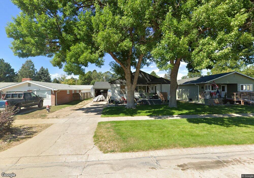
1416 Toluca Ave Alliance, NE 69301
Estimated Value: $129,000 - $190,000
3
Beds
1
Bath
1,295
Sq Ft
$130/Sq Ft
Est. Value
About This Home
This home is located at 1416 Toluca Ave, Alliance, NE 69301 and is currently estimated at $168,527, approximately $130 per square foot. 1416 Toluca Ave is a home located in Box Butte County with nearby schools including Alliance High School, St. Agnes Academy, and Immanuel Evangelical Lutheran School.
Ownership History
Date
Name
Owned For
Owner Type
Purchase Details
Closed on
Dec 5, 2013
Sold by
Niederman Keri A
Bought by
Neal Jason A and Neal Destiny S
Current Estimated Value
Purchase Details
Closed on
Sep 14, 2012
Sold by
Erickson Michael J
Bought by
Niederman Keri Ann
Home Financials for this Owner
Home Financials are based on the most recent Mortgage that was taken out on this home.
Original Mortgage
$72,000
Interest Rate
3.61%
Mortgage Type
New Conventional
Purchase Details
Closed on
Nov 10, 2011
Sold by
Erickson Kelli
Bought by
Erickson Michael J
Create a Home Valuation Report for This Property
The Home Valuation Report is an in-depth analysis detailing your home's value as well as a comparison with similar homes in the area
Home Values in the Area
Average Home Value in this Area
Purchase History
| Date | Buyer | Sale Price | Title Company |
|---|---|---|---|
| Neal Jason A | $94,500 | -- | |
| Niederman Keri Ann | -- | Kunzman Title | |
| Erickson Michael J | -- | -- | |
| Erickson Michael J | -- | Kunzman Title |
Source: Public Records
Mortgage History
| Date | Status | Borrower | Loan Amount |
|---|---|---|---|
| Previous Owner | Niederman Keri Ann | $72,000 |
Source: Public Records
Tax History Compared to Growth
Tax History
| Year | Tax Paid | Tax Assessment Tax Assessment Total Assessment is a certain percentage of the fair market value that is determined by local assessors to be the total taxable value of land and additions on the property. | Land | Improvement |
|---|---|---|---|---|
| 2024 | $2,025 | $161,725 | $8,750 | $152,975 |
| 2023 | $2,780 | $161,725 | $8,750 | $152,975 |
| 2022 | $2,597 | $142,605 | $7,875 | $134,730 |
| 2021 | $2,424 | $131,525 | $7,875 | $123,650 |
| 2020 | $2,418 | $131,525 | $7,875 | $123,650 |
| 2019 | $2,450 | $136,485 | $7,875 | $128,610 |
| 2018 | $2,438 | $136,485 | $7,875 | $128,610 |
| 2017 | $1,693 | $91,199 | $5,688 | $85,511 |
| 2016 | $1,673 | $91,201 | $5,690 | $85,511 |
| 2015 | $1,859 | $86,390 | $5,690 | $80,700 |
| 2014 | $1,859 | $86,388 | $5,688 | $80,700 |
Source: Public Records
Map
Nearby Homes
- 1239 Toluca Ave
- 1232 Cheyenne Ave
- 936 Platte Ave
- 20th St Emerson Ave To Colorado Ave
- 924 Big Horn Ave
- 1019 Laramie Ave
- 911 Emerson Ave
- 907 Toluca Ave
- 1021 Dakota Ave
- 672 W 20th St
- 819 Black Hills Ave
- 904 Laramie Ave
- 719 Toluca Ave
- 621 Emerson Ave
- 2039 Niobrara Ave
- 1004 Missouri Ave
- 917 Missouri Ave
- 420 Laramie Ave
- 615 Sweetwater Ave
- 316 Big Horn Ave
- 1422 Toluca Ave
- 1412 Toluca Ave
- 1424 Toluca Ave
- 511 W 15th St
- 504 W 14th St
- 1417 Emerson Ave
- 1411 Emerson Ave
- 1423 Emerson Ave
- 504 W 15th St
- 520 W 14th St
- 1415 Toluca Ave
- 1411 Toluca Ave
- 1419 Toluca Ave
- 1407 Toluca Ave
- 1403 Emerson Ave
- 1403 Toluca Ave
- 1503 Emerson Ave
- 1512 Toluca Ave
- 513 W 14th St
- 1316 Toluca Ave