Estimated Value: $89,000 - $278,000
--
Bed
2
Baths
2,312
Sq Ft
$90/Sq Ft
Est. Value
About This Home
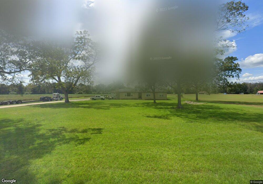
This home is located at 14167 Lanes Bridge Rd, Odum, GA 31555 and is currently estimated at $207,070, approximately $89 per square foot. 14167 Lanes Bridge Rd is a home located in Wayne County with nearby schools including Odum Elementary School, Martha Puckett Middle School, and Wayne County High School.
Ownership History
Date
Name
Owned For
Owner Type
Purchase Details
Closed on
Jan 25, 2023
Sold by
Lewis Rachael
Bought by
Sizmore Rachael Lynn
Current Estimated Value
Home Financials for this Owner
Home Financials are based on the most recent Mortgage that was taken out on this home.
Original Mortgage
$24,000
Outstanding Balance
$20,244
Interest Rate
6.31%
Mortgage Type
New Conventional
Estimated Equity
$186,826
Purchase Details
Closed on
Feb 2, 2006
Sold by
Brazell Brenda
Bought by
Lewis Rachel
Purchase Details
Closed on
Apr 18, 2005
Sold by
Cribs Verma
Bought by
Brazell Brenda
Purchase Details
Closed on
Jun 1, 2003
Purchase Details
Closed on
Jul 1, 1991
Create a Home Valuation Report for This Property
The Home Valuation Report is an in-depth analysis detailing your home's value as well as a comparison with similar homes in the area
Home Values in the Area
Average Home Value in this Area
Purchase History
| Date | Buyer | Sale Price | Title Company |
|---|---|---|---|
| Sizmore Rachael Lynn | -- | -- | |
| Lewis Rachel | $40,000 | -- | |
| Brazell Brenda | -- | -- | |
| -- | -- | -- | |
| -- | -- | -- |
Source: Public Records
Mortgage History
| Date | Status | Borrower | Loan Amount |
|---|---|---|---|
| Open | Sizmore Rachael Lynn | $24,000 |
Source: Public Records
Tax History Compared to Growth
Tax History
| Year | Tax Paid | Tax Assessment Tax Assessment Total Assessment is a certain percentage of the fair market value that is determined by local assessors to be the total taxable value of land and additions on the property. | Land | Improvement |
|---|---|---|---|---|
| 2024 | $1,125 | $47,467 | $7,496 | $39,971 |
| 2023 | $1,282 | $42,732 | $7,497 | $35,235 |
| 2022 | $895 | $36,103 | $7,497 | $28,606 |
| 2021 | $743 | $29,785 | $7,497 | $22,288 |
| 2020 | $822 | $35,216 | $12,928 | $22,288 |
| 2019 | $844 | $35,216 | $12,928 | $22,288 |
| 2018 | $836 | $35,053 | $12,928 | $22,125 |
Source: Public Records
Map
Nearby Homes
- 21 Forest Rd
- 239 Troy Pearson Rd
- 330 Troy Pearson Rd
- Morris Break Rd
- Morris Break Rd
- Morris Break Rd
- 0 Old River Rd Unit 10329316
- TRACT 1 Morris Break Rd
- TRACT 3 Morris Break Rd
- TRACT 4 Morris Break Rd
- 0 Oquinn Loop
- 440 Arnold River Rd
- 965 Oquinn Loop
- 11235 Lanes Bridge Rd
- 92 Sparrow Ln
- 761 Addies Alley
- 88 Northshore Ave
- 177 Northshore Ave
- 192 Northshore Ave
- 3610 New Hope Rd
- 14394 Lanes Bridge Rd
- 14500 Lanes Bridge Rd
- 3432 New Hope Rd
- 13823 Lanes Bridge Rd
- 3300 New Hope Rd
- 14760 Lanes Bridge Rd
- 3288 New Hope Rd
- 13818 Lanes Bridge Rd
- 13715 Lanes Bridge Rd
- 14900 Lanes Bridge Rd
- 3139 New Hope Rd
- 356 Forest Rd
- 15074 Lanes Bridge Rd
- 15176 Lanes Bridge Rd
- 0 Forest Rd Unit 7498547
- 0 Forest Rd
- 2901 New Hope Rd
- 306 Troy Pearson Rd
- 1471 Mallard and Pye Rd