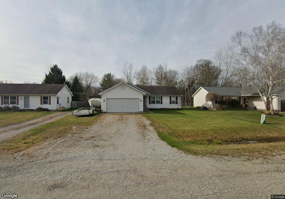
1417 Bellewood Dr Kimball, MI 48074
Estimated Value: $193,514 - $226,000
3
Beds
2
Baths
1,042
Sq Ft
$201/Sq Ft
Est. Value
About This Home
This home is located at 1417 Bellewood Dr, Kimball, MI 48074 and is currently estimated at $209,129, approximately $200 per square foot. 1417 Bellewood Dr is a home located in St. Clair County with nearby schools including Kimball Elementary School, Central Middle School, and Port Huron High School.
Ownership History
Date
Name
Owned For
Owner Type
Purchase Details
Closed on
Oct 31, 2008
Sold by
Jackson Deanna M
Bought by
Jackson Matthew R
Current Estimated Value
Purchase Details
Closed on
Sep 16, 2008
Sold by
Secretary Of Housing And Urban Developme
Bought by
Jackson Mathew R
Purchase Details
Closed on
Feb 19, 2008
Sold by
Stager Melissa
Bought by
Secretary Of Housing & Urban Development
Create a Home Valuation Report for This Property
The Home Valuation Report is an in-depth analysis detailing your home's value as well as a comparison with similar homes in the area
Home Values in the Area
Average Home Value in this Area
Purchase History
| Date | Buyer | Sale Price | Title Company |
|---|---|---|---|
| Jackson Matthew R | -- | None Available | |
| Jackson Mathew R | $85,000 | None Available | |
| Secretary Of Housing & Urban Development | -- | None Available |
Source: Public Records
Tax History Compared to Growth
Tax History
| Year | Tax Paid | Tax Assessment Tax Assessment Total Assessment is a certain percentage of the fair market value that is determined by local assessors to be the total taxable value of land and additions on the property. | Land | Improvement |
|---|---|---|---|---|
| 2025 | $52 | $83,200 | $0 | $0 |
| 2024 | $55 | $83,000 | $0 | $0 |
| 2023 | $535 | $79,000 | $0 | $0 |
| 2022 | $975 | $71,000 | $0 | $0 |
| 2021 | $860 | $59,400 | $0 | $0 |
| 2020 | $860 | $57,700 | $57,700 | $0 |
| 2019 | $847 | $50,400 | $0 | $0 |
| 2018 | $831 | $47,000 | $0 | $0 |
| 2017 | $817 | $42,100 | $0 | $0 |
| 2016 | $418 | $42,100 | $0 | $0 |
| 2015 | -- | $38,500 | $38,500 | $0 |
| 2014 | -- | $29,400 | $29,400 | $0 |
| 2013 | -- | $42,000 | $0 | $0 |
Source: Public Records
Map
Nearby Homes
- 1604 Allen Rd
- 1701 Allen Rd
- 1091 Allen Rd
- V/L Allen
- 00 Range Rd
- 4632 Cloverdale Ln
- 1979 Allen Rd
- 0 Ravenswood Rd Unit 20251017048
- 0000 Ravenswood Rd
- 1405 Range Rd
- 4595 Griswold Rd
- 5510 Griswold Rd
- 183 Nevada Ave
- 1876 Morningstar Ave
- 00 Howard Rd
- 174 Meadow Ln
- 0000 Range Rd
- 153 Meadow Ln
- 104 Oldbrook Ln
- 0000 Wisconsin Ave
- 1405 Bellewood Dr
- 1427 Bellewood Dr
- 1395 Bellewood Dr
- 1435 Bellewood Dr
- 5050 Anglewood Ct
- 1422 Bellewood Dr
- 1414 Bellewood Dr
- 5052 Anglewood Ct
- 1437 Bellewood Dr
- 1432 Bellewood Dr
- 5054 Anglewood Ct
- 1400 Bellewood Dr
- 1438 Bellewood Dr
- 1390 Bellewood Dr
- 5047 Anglewood Ct
- 5049 Anglewood Ct
- 5056 Anglewood Ct
- 1407 Allen Rd
- 1419 Allen Rd
- 1429 Allen Rd