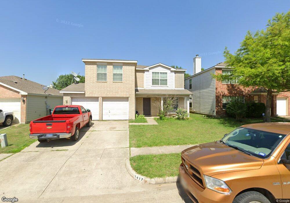
1417 Pheasant Dr Sherman, TX 75092
Estimated Value: $268,237 - $303,000
4
Beds
3
Baths
2,193
Sq Ft
$130/Sq Ft
Est. Value
About This Home
This home is located at 1417 Pheasant Dr, Sherman, TX 75092 and is currently estimated at $285,619, approximately $130 per square foot. 1417 Pheasant Dr is a home located in Grayson County with nearby schools including Henry W. Sory Elementary School, Piner Middle School, and Dillingham Intermediate School.
Ownership History
Date
Name
Owned For
Owner Type
Purchase Details
Closed on
Jul 28, 2022
Sold by
Given Not
Bought by
Country Ridge Estates No 1 Homeowners Associa
Current Estimated Value
Purchase Details
Closed on
Sep 18, 2012
Sold by
Leon Rose M and Leon Mark A
Bought by
Crei Corp
Home Financials for this Owner
Home Financials are based on the most recent Mortgage that was taken out on this home.
Original Mortgage
$72,000
Interest Rate
3.7%
Mortgage Type
New Conventional
Purchase Details
Closed on
May 26, 2004
Sold by
Pulte Homes Of Texas Lp
Bought by
Leon Rose M and Leon Mark A
Home Financials for this Owner
Home Financials are based on the most recent Mortgage that was taken out on this home.
Original Mortgage
$116,670
Interest Rate
5.97%
Mortgage Type
Purchase Money Mortgage
Create a Home Valuation Report for This Property
The Home Valuation Report is an in-depth analysis detailing your home's value as well as a comparison with similar homes in the area
Home Values in the Area
Average Home Value in this Area
Purchase History
| Date | Buyer | Sale Price | Title Company |
|---|---|---|---|
| Country Ridge Estates No 1 Homeowners Associa | -- | None Listed On Document | |
| Crei Corp | -- | Red River Title Co | |
| Leon Rose M | -- | -- |
Source: Public Records
Mortgage History
| Date | Status | Borrower | Loan Amount |
|---|---|---|---|
| Previous Owner | Crei Corp | $72,000 | |
| Previous Owner | Leon Rose M | $116,670 |
Source: Public Records
Tax History
| Year | Tax Paid | Tax Assessment Tax Assessment Total Assessment is a certain percentage of the fair market value that is determined by local assessors to be the total taxable value of land and additions on the property. | Land | Improvement |
|---|---|---|---|---|
| 2025 | $5,313 | $285,368 | $44,849 | $240,519 |
| 2024 | $5,313 | $242,241 | $45,755 | $196,486 |
| 2023 | $5,745 | $261,644 | $36,072 | $225,572 |
| 2022 | $5,894 | $251,473 | $28,314 | $223,159 |
| 2021 | $4,568 | $182,239 | $31,145 | $151,094 |
| 2020 | $4,591 | $174,929 | $21,179 | $153,750 |
| 2019 | $4,322 | $160,334 | $14,723 | $145,611 |
| 2018 | $4,023 | $160,366 | $14,723 | $145,643 |
| 2017 | $3,663 | $147,159 | $14,723 | $132,436 |
| 2016 | $3,386 | $136,033 | $14,723 | $121,310 |
Source: Public Records
Map
Nearby Homes
- 1407 Mallard Dr
- 1415 Mallard Dr
- 1412 Ascot Ave
- 4204 Quail Run Rd
- 4507 Falcon Dr
- 3723 Brookstone Dr
- 3711 Brookstone Dr
- 1404 Tejas Dr
- 4203 Parrot Ln
- 805 Cormorant Dr
- 4207 Pigeon Dr
- 4203 Pigeon Dr
- 4300 Hummingbird Dr
- 4805 Park Ave
- 6935 S Farm To Market Road 1417
- 1500 Creekview Ln
- 4515 Hummingbird Dr
- 4704 Cormorant Dr
- 1708 Creekside Ave
- 501 Seasons W
- 1413 Pheasant Dr
- 1421 Pheasant Dr
- 1409 Pheasant Dr
- 1425 Pheasant Dr
- 1418 Mallard Dr
- 1422 Mallard Dr
- 1414 Mallard Dr
- 1426 Mallard Dr
- 1410 Mallard Dr
- 1405 Pheasant Dr
- 1416 Pheasant Dr
- 1412 Pheasant Dr
- 1420 Pheasant Dr
- 1406 Mallard Dr
- 1408 Pheasant Dr
- 1424 Pheasant Dr
- 1401 Pheasant Dr
- 1404 Pheasant Dr
- 1402 Mallard Dr
- 4208 Snowbird
Your Personal Tour Guide
Ask me questions while you tour the home.