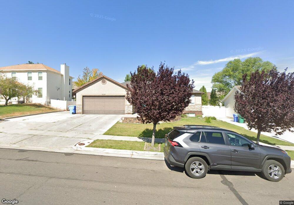
14178 Mount Ogden Peak Dr Riverton, UT 84096
Estimated Value: $640,000 - $697,043
5
Beds
3
Baths
3,147
Sq Ft
$215/Sq Ft
Est. Value
About This Home
This home is located at 14178 Mount Ogden Peak Dr, Riverton, UT 84096 and is currently estimated at $676,011, approximately $214 per square foot. 14178 Mount Ogden Peak Dr is a home located in Salt Lake County with nearby schools including Foothills School, South Hills Middle School, and Mountain Ridge High School.
Ownership History
Date
Name
Owned For
Owner Type
Purchase Details
Closed on
Dec 6, 2004
Sold by
Moleff Aaron and Moleff Amber
Bought by
Moleff Aaron and Moleff Amber
Current Estimated Value
Home Financials for this Owner
Home Financials are based on the most recent Mortgage that was taken out on this home.
Original Mortgage
$188,000
Outstanding Balance
$93,586
Interest Rate
5.64%
Mortgage Type
New Conventional
Estimated Equity
$582,425
Purchase Details
Closed on
May 3, 2004
Sold by
Peaden Gene A
Bought by
Moleff Aaron and Moleff Amber
Home Financials for this Owner
Home Financials are based on the most recent Mortgage that was taken out on this home.
Original Mortgage
$184,000
Interest Rate
5.38%
Mortgage Type
Purchase Money Mortgage
Create a Home Valuation Report for This Property
The Home Valuation Report is an in-depth analysis detailing your home's value as well as a comparison with similar homes in the area
Home Values in the Area
Average Home Value in this Area
Purchase History
| Date | Buyer | Sale Price | Title Company |
|---|---|---|---|
| Moleff Aaron | -- | Guardian Title | |
| Moleff Aaron | -- | Backman Stewart Title Svcs |
Source: Public Records
Mortgage History
| Date | Status | Borrower | Loan Amount |
|---|---|---|---|
| Open | Moleff Aaron | $188,000 | |
| Closed | Moleff Aaron | $184,000 | |
| Closed | Moleff Aaron | $20,000 |
Source: Public Records
Tax History Compared to Growth
Tax History
| Year | Tax Paid | Tax Assessment Tax Assessment Total Assessment is a certain percentage of the fair market value that is determined by local assessors to be the total taxable value of land and additions on the property. | Land | Improvement |
|---|---|---|---|---|
| 2025 | $3,618 | $723,600 | $214,700 | $508,900 |
| 2024 | $3,618 | $626,200 | $197,200 | $429,000 |
| 2023 | $3,618 | $626,700 | $182,600 | $444,100 |
| 2022 | $3,958 | $633,500 | $179,000 | $454,500 |
| 2021 | $3,308 | $471,400 | $138,100 | $333,300 |
| 2020 | $3,222 | $428,100 | $107,400 | $320,700 |
| 2019 | $3,136 | $409,600 | $102,300 | $307,300 |
| 2018 | $3,010 | $387,100 | $94,500 | $292,600 |
| 2017 | $2,884 | $361,500 | $94,500 | $267,000 |
| 2016 | $2,773 | $333,500 | $94,500 | $239,000 |
| 2015 | $2,591 | $302,100 | $94,600 | $207,500 |
| 2014 | $2,492 | $284,900 | $90,200 | $194,700 |
Source: Public Records
Map
Nearby Homes
- 4999 W Cave Peak Dr
- 14254 S Amber Rose Ln
- 14048 van Cott Peak Cir
- 14054 Elk Horn Peak Dr
- 14347 S Mount Ogden Peak Dr
- 5279 Leila Ln
- 4827 Boulder Meadow Dr
- 14328 S Sun Bloom Ln
- 5206 W Windom Rd
- 14479 Entrada Rim Ln
- 13908 S 5180 W
- 14481 S Stone Stream St
- 5033 W Boulder
- 4966 W Rose Quartz
- 5228 W Courtly Ln
- 5209 W Courtly Ln
- 13863 S Kessler Peak Dr
- 14397 Logan Falls Ln
- 5062 W Valmont Way
- 14427 S Attleboro Dr
- 14168 Mount Ogden Peak Dr
- 14192 S Mount Ogden Peak Dr
- 14192 Mount Ogden Peak Dr
- 14168 S Mount Ogden Peak Dr
- 14171 Elk Horn Peak Dr
- 14171 S Elk Horn Peak Dr
- 14156 S Mount Ogden Peak Dr
- 14156 Mount Ogden Peak Dr
- 5097 W Elk Horn Peak Dr
- 5097 Elk Horn Peak Dr
- 5039 Cave Peak Dr
- 5064 W Leila Ln
- 5064 Leila Ln
- 14157 Elk Horn Peak Dr
- 5054 W Leila Ln
- 5054 Leila Ln
- 14163 Mount Ogden Peak Dr
- 14163 S Mount Ogden Peak Dr
- 5076 Leila Ln
- 14150 S Mount Ogden Peak Dr