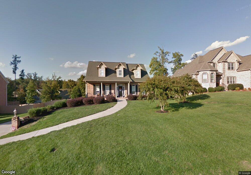
1418 Meadowlands Dr Winston Salem, NC 27107
Estimated Value: $540,292 - $582,000
4
Beds
5
Baths
4,882
Sq Ft
$116/Sq Ft
Est. Value
About This Home
This home is located at 1418 Meadowlands Dr, Winston Salem, NC 27107 and is currently estimated at $566,323, approximately $116 per square foot. 1418 Meadowlands Dr is a home located in Davidson County with nearby schools including Wallburg Elementary School, Oak Grove Middle School, and Oak Grove High School.
Ownership History
Date
Name
Owned For
Owner Type
Purchase Details
Closed on
May 5, 2009
Sold by
Samnaz Inc
Bought by
Slate Michael B and Slate Molly Elizabeth Dorsett
Current Estimated Value
Home Financials for this Owner
Home Financials are based on the most recent Mortgage that was taken out on this home.
Original Mortgage
$269,037
Outstanding Balance
$169,434
Interest Rate
4.79%
Mortgage Type
FHA
Estimated Equity
$396,889
Purchase Details
Closed on
Jul 27, 2006
Sold by
Meadowlands Development Llc
Bought by
Samnaz Inc
Create a Home Valuation Report for This Property
The Home Valuation Report is an in-depth analysis detailing your home's value as well as a comparison with similar homes in the area
Home Values in the Area
Average Home Value in this Area
Purchase History
| Date | Buyer | Sale Price | Title Company |
|---|---|---|---|
| Slate Michael B | $274,000 | None Available | |
| Samnaz Inc | $110,000 | None Available |
Source: Public Records
Mortgage History
| Date | Status | Borrower | Loan Amount |
|---|---|---|---|
| Open | Slate Michael B | $269,037 |
Source: Public Records
Tax History Compared to Growth
Tax History
| Year | Tax Paid | Tax Assessment Tax Assessment Total Assessment is a certain percentage of the fair market value that is determined by local assessors to be the total taxable value of land and additions on the property. | Land | Improvement |
|---|---|---|---|---|
| 2025 | $2,197 | $337,970 | $0 | $0 |
| 2024 | $2,131 | $337,970 | $0 | $0 |
| 2023 | $2,163 | $337,970 | $0 | $0 |
| 2022 | $2,131 | $337,970 | $0 | $0 |
| 2021 | $2,076 | $329,250 | $0 | $0 |
| 2020 | $1,928 | $305,820 | $0 | $0 |
| 2019 | $1,957 | $305,820 | $0 | $0 |
| 2018 | $1,957 | $305,820 | $0 | $0 |
| 2017 | $1,957 | $305,820 | $0 | $0 |
| 2016 | $1,957 | $305,820 | $0 | $0 |
| 2015 | $1,925 | $300,820 | $0 | $0 |
| 2014 | $1,839 | $287,380 | $0 | $0 |
Source: Public Records
Map
Nearby Homes
- 153 Turtle Bay Ct
- 282 Heatherwood Dr
- 470 Prescott Dr
- 386 Olde Lantern Dr
- 380 Olde Lantern Dr
- 387 Olde Lantern Dr
- 213 Red Hawk Ln
- 134 New Forest Dr
- 312 Olde Lantern Dr
- 150 New Forest Dr
- 298 Olde Lantern Dr
- 309 Olde Lantern Dr
- 168 New Forest Dr
- 184 New Forest Dr
- 270 Olde Lantern Dr
- 138 Green Forest Ct
- 170 Green Forest Ct
- 186 Green Forest Ct
- 221 Green Forest Ct
- 202 Green Forest Ct
- 1436 Meadowlands Dr
- 1400 Meadowlands Dr
- 299 Kiawah Island Dr
- 315 Kiawah Island Dr
- 285 Kiawah Island Dr
- 1380 Meadowlands Dr
- 1454 Meadowlands Dr
- 1409 Meadowlands Dr
- 1427 Meadowlands Dr
- 331 Kiawah Island Dr
- 269 Kiawah Island Dr
- 1391 Meadowlands Dr
- 1445 Meadowlands Dr
- 347 Kiawah Island Dr
- 1472 Meadowlands Dr
- 1356 Meadowlands Dr
- 1463 Meadowlands Dr
- 1369 Meadowlands Dr
- 253 Kiawah Island Dr
- 298 Kiawah Island Dr