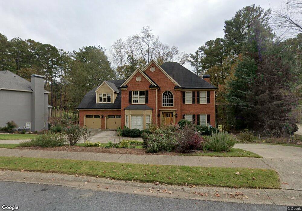
1419 Olde Forge Ln Unit 1 Woodstock, GA 30189
Oak Grove NeighborhoodEstimated Value: $657,705 - $766,000
5
Beds
5
Baths
3,050
Sq Ft
$233/Sq Ft
Est. Value
About This Home
This home is located at 1419 Olde Forge Ln Unit 1, Woodstock, GA 30189 and is currently estimated at $711,853, approximately $233 per square foot. 1419 Olde Forge Ln Unit 1 is a home located in Cherokee County with nearby schools including Bascomb Elementary School, E. T. Booth Middle School, and Etowah High School.
Ownership History
Date
Name
Owned For
Owner Type
Purchase Details
Closed on
May 22, 2025
Sold by
Kerlin Michael
Bought by
Kerlin Michael Roy Tr
Current Estimated Value
Purchase Details
Closed on
Dec 28, 2011
Sold by
Ovens John
Bought by
Kerlin Michael and Kerlin Kendall
Home Financials for this Owner
Home Financials are based on the most recent Mortgage that was taken out on this home.
Original Mortgage
$255,906
Interest Rate
4.06%
Mortgage Type
New Conventional
Purchase Details
Closed on
Jun 28, 2002
Sold by
Vaughn Vaughn L and Vaughn Teresa T
Bought by
Ovens John
Home Financials for this Owner
Home Financials are based on the most recent Mortgage that was taken out on this home.
Original Mortgage
$368,910
Interest Rate
8.5%
Mortgage Type
New Conventional
Create a Home Valuation Report for This Property
The Home Valuation Report is an in-depth analysis detailing your home's value as well as a comparison with similar homes in the area
Home Values in the Area
Average Home Value in this Area
Purchase History
| Date | Buyer | Sale Price | Title Company |
|---|---|---|---|
| Kerlin Michael Roy Tr | -- | -- | |
| Kerlin Michael | $280,000 | -- | |
| Ovens John | $409,900 | -- |
Source: Public Records
Mortgage History
| Date | Status | Borrower | Loan Amount |
|---|---|---|---|
| Previous Owner | Kerlin Michael | $255,906 | |
| Previous Owner | Ovens John | $368,910 |
Source: Public Records
Tax History Compared to Growth
Tax History
| Year | Tax Paid | Tax Assessment Tax Assessment Total Assessment is a certain percentage of the fair market value that is determined by local assessors to be the total taxable value of land and additions on the property. | Land | Improvement |
|---|---|---|---|---|
| 2025 | $6,240 | $274,056 | $56,000 | $218,056 |
| 2024 | $5,796 | $251,896 | $50,000 | $201,896 |
| 2023 | $5,322 | $250,028 | $50,000 | $200,028 |
| 2022 | $4,820 | $202,800 | $34,240 | $168,560 |
| 2021 | $4,652 | $178,212 | $34,240 | $143,972 |
| 2020 | $4,391 | $166,784 | $32,000 | $134,784 |
| 2019 | $4,212 | $159,080 | $32,000 | $127,080 |
| 2018 | $4,106 | $153,680 | $32,000 | $121,680 |
| 2017 | $4,152 | $386,100 | $32,000 | $122,440 |
| 2016 | $3,932 | $358,800 | $28,000 | $115,520 |
| 2015 | $3,696 | $329,700 | $28,000 | $103,880 |
| 2014 | $3,510 | $309,300 | $28,000 | $95,720 |
Source: Public Records
Map
Nearby Homes
- 1512 Maplewood Ct
- 1704 Amberwood Pointe
- 907 Feather Creek Ln
- 1722 Indian Ridge Dr
- 703 Overlook Point
- 1514 Mosswood Ln
- 701 Whisper Wind Ct
- 409 Misty Ridge Way
- 1202 Shallowford Trace Ct
- 258 Strawberry Ln
- 250 Strawberry Ln
- 242 Strawberry Ln
- 302 Mosswood Ct
- 523 Sycamore Point
- 1029 Chatsworth Ln
- 1404 Coventry Ct Unit 1
- 4005 Watkins Glen Dr
- 608 Wedgewood Dr
- 1028 Deer Hollow Dr
- 3129 Sandhurst Dr
- 1417 Olde Forge Ln
- 1421 Olde Forge Ln
- 1420 Olde Forge Ln
- 1418 Olde Forge Ln
- 1415 Olde Forge Ln
- 1423 Olde Forge Ln Unit 1
- 1422 Olde Forge Ln
- 1416 Olde Force Ln
- 1416 Olde Forge Ln
- 1413 Olde Forge Ln
- 1425 Olde Forge Ln
- 1424 Olde Forge Ln
- 1513 Maplewood Ct
- 1511 Maplewood Ct
- 1414 Olde Forge Ln
- 1515 Maplewood Ct Unit 43
- 1515 Maplewood Ct
- 1426 Olde Forge Ln
- 1509 Maplewood Ct Unit I
- 1427 Olde Forge Ln