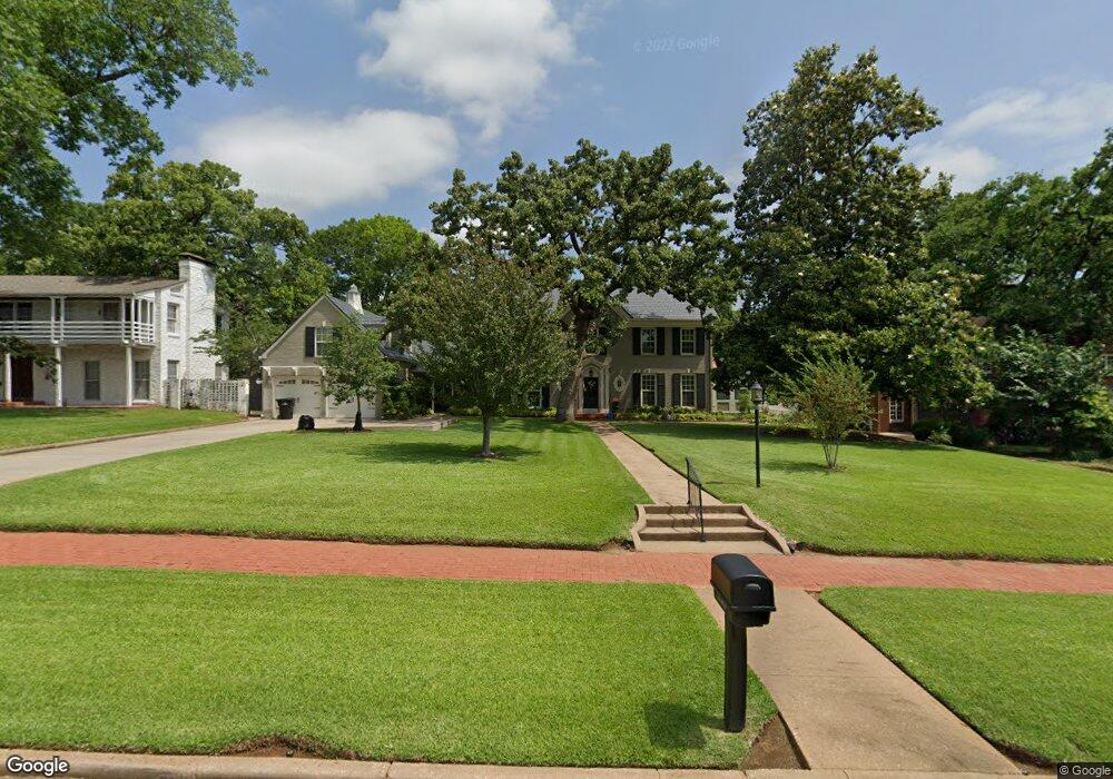
1419 W Woodard St Denison, TX 75020
Estimated Value: $373,000 - $399,422
--
Bed
--
Bath
3,766
Sq Ft
$103/Sq Ft
Est. Value
About This Home
This home is located at 1419 W Woodard St, Denison, TX 75020 and is currently estimated at $386,211, approximately $102 per square foot. 1419 W Woodard St is a home located in Grayson County with nearby schools including Mayes Elementary School, Scott Middle School, and Denison High School.
Ownership History
Date
Name
Owned For
Owner Type
Purchase Details
Closed on
Aug 21, 2008
Sold by
Darehshori M F and Darehshori Charlotte
Bought by
Cichowski Kurt A and Cichowski Laura U
Current Estimated Value
Home Financials for this Owner
Home Financials are based on the most recent Mortgage that was taken out on this home.
Original Mortgage
$200,000
Outstanding Balance
$131,844
Interest Rate
6.42%
Mortgage Type
Purchase Money Mortgage
Estimated Equity
$254,367
Create a Home Valuation Report for This Property
The Home Valuation Report is an in-depth analysis detailing your home's value as well as a comparison with similar homes in the area
Home Values in the Area
Average Home Value in this Area
Purchase History
| Date | Buyer | Sale Price | Title Company |
|---|---|---|---|
| Cichowski Kurt A | -- | Chapin Title Co Inc |
Source: Public Records
Mortgage History
| Date | Status | Borrower | Loan Amount |
|---|---|---|---|
| Open | Cichowski Kurt A | $200,000 |
Source: Public Records
Tax History Compared to Growth
Tax History
| Year | Tax Paid | Tax Assessment Tax Assessment Total Assessment is a certain percentage of the fair market value that is determined by local assessors to be the total taxable value of land and additions on the property. | Land | Improvement |
|---|---|---|---|---|
| 2025 | $3,886 | $400,740 | -- | -- |
| 2024 | $8,464 | $364,309 | $0 | $0 |
| 2023 | $3,891 | $331,190 | $0 | $0 |
| 2022 | $7,154 | $301,082 | $0 | $0 |
| 2021 | $6,903 | $273,711 | $37,700 | $236,011 |
| 2020 | $6,847 | $259,580 | $33,060 | $226,520 |
| 2019 | $7,551 | $274,423 | $33,060 | $241,363 |
| 2018 | $7,138 | $257,317 | $17,980 | $239,337 |
| 2017 | $6,930 | $247,716 | $17,980 | $229,736 |
| 2016 | $6,837 | $244,381 | $17,980 | $226,401 |
| 2015 | $6,604 | $266,286 | $13,340 | $252,946 |
| 2014 | $6,703 | $292,582 | $13,340 | $279,242 |
Source: Public Records
Map
Nearby Homes
- 1315 W Gandy St
- 1320 W Morton St
- 1609 W Woodard St
- 1309 W Morton St
- 3030 W Morton St
- 1700 W Morton St
- 3300 W Morton St
- 1531 W Main St
- 2900 W Morton St
- 3130 W Morton St
- 1230 W Woodard St
- 1208 W Sears St
- 108 N Eddy Ave
- 1231 W Main St
- 1200 W Gandy St
- 1601 W Bond St
- 1123 W Sears St
- 1111 W Sears St
- 1221 W Crawford St
- 1326 W Crawford St
- 1411 W Woodard St
- 1431 W Woodard St
- 1430 W Gandy St
- 1406 W Gandy St
- 1401 W Woodard St
- 1400 W Gandy St
- 1500 W Gandy St
- 1501 W Woodard St
- 1423 W Gandy St
- 1417 W Gandy St
- 1411 W Gandy St
- 1426 W Woodard St
- 1431 W Gandy St
- 1412 W Woodard St
- 1410 W Woodard St
- 1405 W Gandy St
- 1330 W Gandy St
- 1331 W Woodard St
- 1404 W Woodard St
- 1511 W Woodard St