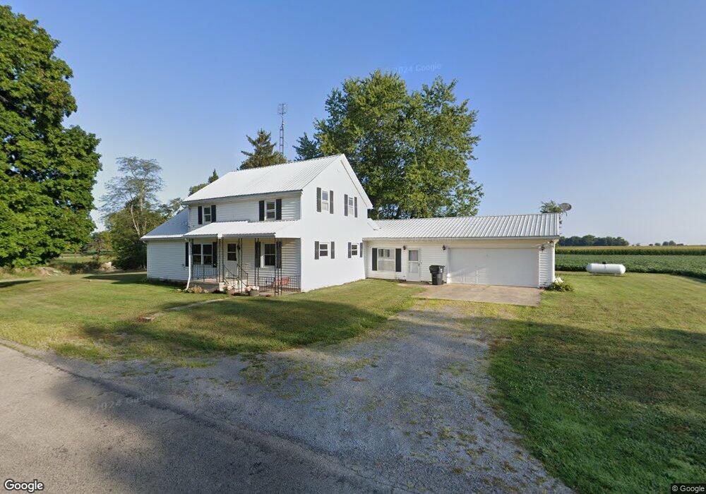
14192 Road U13 Columbus Grove, OH 45830
Estimated Value: $341,000
--
Bed
1
Bath
--
Sq Ft
38.38
Acres
About This Home
This home is located at 14192 Road U13, Columbus Grove, OH 45830 and is currently estimated at $341,000. 14192 Road U13 is a home located in Putnam County with nearby schools including Columbus Grove Elementary School, Columbus Grove Middle School, and Columbus Grove High School.
Ownership History
Date
Name
Owned For
Owner Type
Purchase Details
Closed on
Jul 18, 2023
Sold by
Jane E Firestone Living Trust
Bought by
Siefker Jared N
Current Estimated Value
Purchase Details
Closed on
Jan 16, 2018
Sold by
Friestone Jane E
Bought by
Firestone Timothy A and Firestone Chandra L
Home Financials for this Owner
Home Financials are based on the most recent Mortgage that was taken out on this home.
Original Mortgage
$241,000
Interest Rate
4.15%
Mortgage Type
Future Advance Clause Open End Mortgage
Create a Home Valuation Report for This Property
The Home Valuation Report is an in-depth analysis detailing your home's value as well as a comparison with similar homes in the area
Home Values in the Area
Average Home Value in this Area
Purchase History
| Date | Buyer | Sale Price | Title Company |
|---|---|---|---|
| Siefker Jared N | $167,000 | None Listed On Document | |
| Siefker Jared N | $167,000 | None Listed On Document | |
| Firestone Timothy A | $80,000 | None Available | |
| Firestone Jane E | -- | None Available |
Source: Public Records
Mortgage History
| Date | Status | Borrower | Loan Amount |
|---|---|---|---|
| Previous Owner | Firestone Timothy A | $241,000 |
Source: Public Records
Tax History Compared to Growth
Tax History
| Year | Tax Paid | Tax Assessment Tax Assessment Total Assessment is a certain percentage of the fair market value that is determined by local assessors to be the total taxable value of land and additions on the property. | Land | Improvement |
|---|---|---|---|---|
| 2024 | $1,146 | $36,500 | $36,500 | $0 |
| 2023 | $1,235 | $18,710 | $18,710 | $0 |
| 2022 | $750 | $97,181 | $97,181 | $0 |
| 2021 | $751 | $18,710 | $18,710 | $0 |
| 2020 | $743 | $41,770 | $41,770 | $0 |
| 2019 | $1,195 | $31,770 | $31,770 | $0 |
| 2018 | $1,170 | $31,770 | $31,770 | $0 |
| 2017 | $1,508 | $31,770 | $31,770 | $0 |
| 2016 | $1,508 | $41,770 | $41,770 | $0 |
| 2015 | $1,515 | $41,770 | $41,770 | $0 |
| 2014 | $1,532 | $41,770 | $41,770 | $0 |
| 2013 | $717 | $19,220 | $19,220 | $0 |
Source: Public Records
Map
Nearby Homes
- 147 Elm St
- 148 S Water St
- 2525 W Lincoln Hwy
- 4150 W Lincoln Hwy
- 6585 Ottawa Rd
- 300 Sweaney Ave
- 309 Wall St
- 201 Wall St
- 11059 Ottawa Rd
- 220 Parklane Dr
- 3798 Kissing Hollow Dr
- 3456 Shearin Ave
- 4995 Gomer Rd
- 0 Fraunfelter Unit 307817
- 0 N Eastown Rd Unit 1034495
- 308 Delphos Rd
- 3270 Bonnieview Dr
- 4080 Brookshore Dr
- 4050 Brookshore Dr
- 204 S Broadway St
- 14133 Road U13
- 14314 Road U13
- 14035 Road U13
- 21339 Road 14
- 13813 Road U13
- 000 Road U14
- 14246 Road U14
- 14646 Road U14
- 000 Rd U-14
- 21505 State Route 115
- 21746 State Route 115
- 21694 State Route 115
- 21778 State Route 115
- 21893 State Route 115
- 21012 Road 14
- 21496 State Route 115
- 20987 Road 14
- 21380 State Route 115