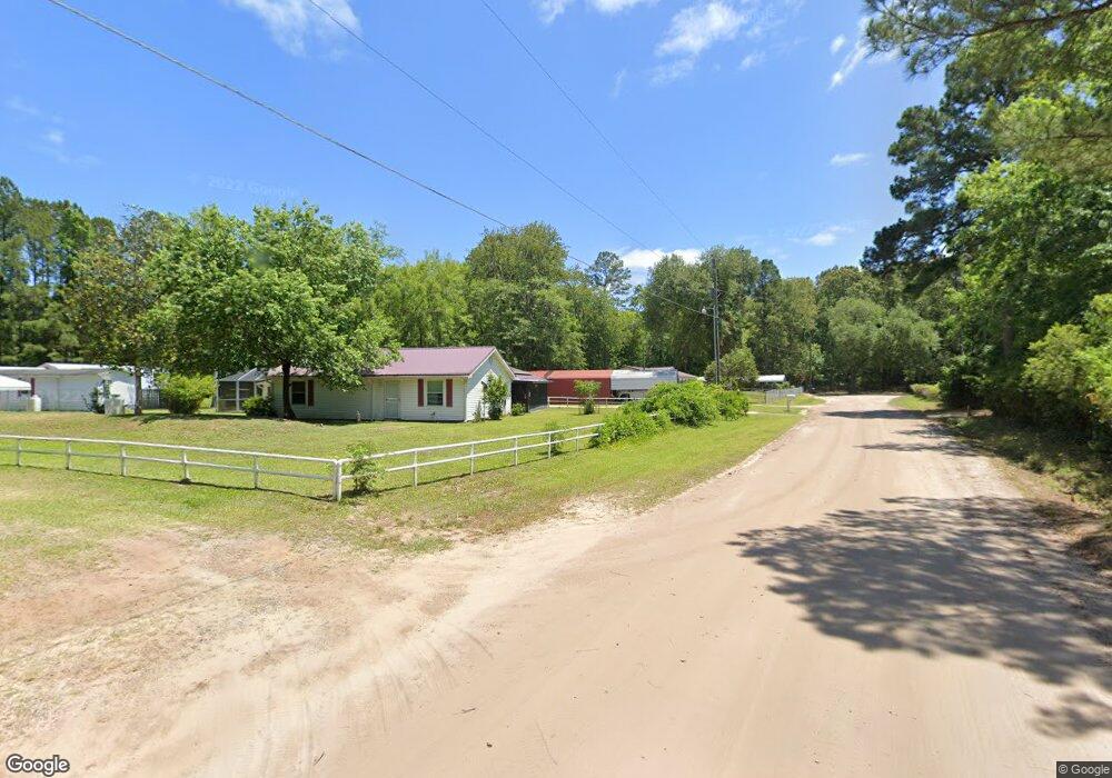
142 Briola Rd Midway, GA 31320
Estimated Value: $220,000 - $252,000
2
Beds
2
Baths
1,536
Sq Ft
$154/Sq Ft
Est. Value
About This Home
This home is located at 142 Briola Rd, Midway, GA 31320 and is currently estimated at $236,834, approximately $154 per square foot. 142 Briola Rd is a home located in Liberty County with nearby schools including Liberty Elementary School, Midway Middle School, and Liberty County High School.
Ownership History
Date
Name
Owned For
Owner Type
Purchase Details
Closed on
Feb 22, 2019
Sold by
Cappuchi Tony-Rocco
Bought by
Cappuchi Tony-Rocco and Gordon Leon Marvin
Current Estimated Value
Home Financials for this Owner
Home Financials are based on the most recent Mortgage that was taken out on this home.
Original Mortgage
$223,850
Outstanding Balance
$200,589
Interest Rate
5.5%
Mortgage Type
FHA
Estimated Equity
$36,245
Purchase Details
Closed on
Jul 17, 2014
Sold by
Cappuchi Tony-Rocco
Bought by
Cappuchi Anthony L
Purchase Details
Closed on
Dec 21, 2013
Sold by
Cappuchi Anthony L
Bought by
Cappuchi Tony-Rocco
Purchase Details
Closed on
Jun 27, 1986
Bought by
Cappuchi Anthony L and Cappuchi Kay E
Create a Home Valuation Report for This Property
The Home Valuation Report is an in-depth analysis detailing your home's value as well as a comparison with similar homes in the area
Purchase History
| Date | Buyer | Sale Price | Title Company |
|---|---|---|---|
| Cappuchi Tony-Rocco | -- | -- | |
| Cappuchi Anthony L | -- | -- | |
| Cappuchi Tony-Rocco | -- | -- | |
| Cappuchi Anthony L | $42,500 | -- |
Source: Public Records
Mortgage History
| Date | Status | Borrower | Loan Amount |
|---|---|---|---|
| Open | Cappuchi Tony-Rocco | $223,850 |
Source: Public Records
Tax History
| Year | Tax Paid | Tax Assessment Tax Assessment Total Assessment is a certain percentage of the fair market value that is determined by local assessors to be the total taxable value of land and additions on the property. | Land | Improvement |
|---|---|---|---|---|
| 2024 | $2,507 | $55,034 | $2,480 | $52,554 |
| 2023 | $2,119 | $50,316 | $2,480 | $47,836 |
| 2022 | $1,860 | $43,803 | $2,480 | $41,323 |
| 2021 | $1,771 | $41,663 | $2,480 | $39,183 |
| 2020 | $1,801 | $42,523 | $2,480 | $40,043 |
| 2019 | $1,792 | $43,402 | $2,480 | $40,922 |
| 2018 | $1,108 | $43,972 | $2,480 | $41,492 |
| 2017 | $1,480 | $44,948 | $2,480 | $42,468 |
| 2016 | $978 | $45,704 | $2,480 | $43,224 |
| 2015 | -- | $45,704 | $2,480 | $43,224 |
| 2014 | -- | $38,996 | $2,480 | $36,516 |
| 2013 | -- | $0 | $0 | $0 |
Source: Public Records
Map
Nearby Homes
- 1123 Stone Ct
- 211 Smiley Loop Rd
- 2111 Smiley Loop Rd
- 182 Gloucester Dr
- 0 S Coastal Hwy
- 0000 E Oglethorpe Hwy
- 62 Alder Pass
- 0 E Oglethorpe Unit SA341930
- 0 E Oglethorpe Unit 153327
- 0 E Oglethorpe Unit 10592168
- 0 E Oglethorpe Unit SA350017
- 0 E Oglethorpe Unit SA350025
- 1 Acre E Oglethorpe Hwy
- 1.54 Acres E Oglethorpe Hwy
- 1.54 Ac E Oglethorpe Hwy
- 1 AC E Oglethorpe Hwy
- 13208 E Oglethorpe Hwy
- 46 Carver Way
- 362 Cottage Loop
- 670 Stone Ct
- 197 Briola Rd
- 131 Briola Rd
- 56 Briola Rd
- 143 Mamies Rd
- 91 Mamies Rd
- 1931 S Coastal Hwy
- 292 S Coastal Hwy
- 1.56 AC S Coastal Hwy
- 1022 Stone Ct
- 87 Mamies Rd
- 940 S Coastal Hwy
- 1069 S Coastal Hwy
- 1049 S Coastal Hwy
- 1173 S Coastal Hwy
- 1284 S Coastal Hwy
- 906 Stone Ct
- 1238 Bacontown Rd
- 1191 Bacontown Rd
- 862 S Coastal Hwy
- 945 S Coastal Hwy
Your Personal Tour Guide
Ask me questions while you tour the home.