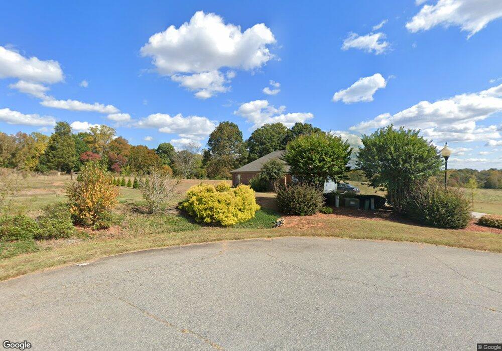
142 Bunker Way Mocksville, NC 27028
Estimated Value: $356,282 - $409,000
3
Beds
2
Baths
1,999
Sq Ft
$193/Sq Ft
Est. Value
About This Home
This home is located at 142 Bunker Way, Mocksville, NC 27028 and is currently estimated at $386,071, approximately $193 per square foot. 142 Bunker Way is a home located in Davie County with nearby schools including Cornatzer Elementary School, William Ellis Middle School, and Davie County High School.
Ownership History
Date
Name
Owned For
Owner Type
Purchase Details
Closed on
Aug 25, 2021
Sold by
Carr Robert Carl and Carr Audrey Lee
Bought by
Dalton Michael Thomas and Dalton Stacee Spillman
Current Estimated Value
Purchase Details
Closed on
Aug 31, 2006
Sold by
Jones William J and Jones Barbara A
Bought by
Carr Robert Carl and Carr Audrey Lee
Home Financials for this Owner
Home Financials are based on the most recent Mortgage that was taken out on this home.
Original Mortgage
$45,000
Interest Rate
6.73%
Mortgage Type
New Conventional
Purchase Details
Closed on
Feb 1, 2002
Purchase Details
Closed on
Apr 1, 1985
Create a Home Valuation Report for This Property
The Home Valuation Report is an in-depth analysis detailing your home's value as well as a comparison with similar homes in the area
Home Values in the Area
Average Home Value in this Area
Purchase History
| Date | Buyer | Sale Price | Title Company |
|---|---|---|---|
| Dalton Michael Thomas | $299,500 | None Available | |
| Carr Robert Carl | $215,000 | -- | |
| -- | $22,500 | -- | |
| -- | -- | -- |
Source: Public Records
Mortgage History
| Date | Status | Borrower | Loan Amount |
|---|---|---|---|
| Previous Owner | Carr Robert Carl | $45,000 |
Source: Public Records
Tax History Compared to Growth
Tax History
| Year | Tax Paid | Tax Assessment Tax Assessment Total Assessment is a certain percentage of the fair market value that is determined by local assessors to be the total taxable value of land and additions on the property. | Land | Improvement |
|---|---|---|---|---|
| 2025 | $2,309 | $335,360 | $25,000 | $310,360 |
| 2024 | $1,718 | $222,230 | $22,000 | $200,230 |
| 2023 | $1,718 | $222,230 | $22,000 | $200,230 |
| 2022 | $1,718 | $222,230 | $22,000 | $200,230 |
| 2021 | $1,718 | $222,230 | $22,000 | $200,230 |
| 2020 | $1,575 | $202,400 | $22,000 | $180,400 |
| 2019 | $1,575 | $202,400 | $22,000 | $180,400 |
| 2018 | $1,575 | $202,400 | $22,000 | $180,400 |
| 2017 | $1,554 | $202,400 | $0 | $0 |
| 2016 | $1,587 | $206,620 | $0 | $0 |
| 2015 | $1,587 | $206,620 | $0 | $0 |
| 2014 | -- | $206,620 | $0 | $0 |
| 2013 | -- | $206,620 | $0 | $0 |
Source: Public Records
Map
Nearby Homes
- 232 Walt Wilson Rd
- 124 E Chinaberry Ct
- 157 Twin Cedars Dr Unit 3
- 157 Twin Cedars Golf Rd
- 718 Deadmon Rd
- 130 Turrentine Church Rd
- 0 N Carolina 801
- 876 Deadmon Rd
- 882 Deadmon Rd
- 890 Deadmon Rd
- 898 Deadmon Rd
- 906 Deadmon Rd
- 916 Deadmon Rd
- 114 Harness Ln
- 111 Springhill Dr
- LOT 35 Rhode Island Ct
- LOT 23 Rhode Island Ct
- LOT 37 Rhode Island Ct
- LOT 54 Rhode Island Ct
- LOT 31 Rhode Island Ct
- 135 Bunker Way
- 0 Bunker Way
- Lot 112 Benson Ln
- 125 S Benson Ln
- 102 N Benson Ln
- 131 S Benson Ln
- Lot 144 Benson Ln
- 187 S Benson Ln
- 18 N Benson Ln
- 141 S Benson Ln
- 157 S Benson Ln
- 110 S Benson Ln
- 0 S Benson Ln
- 126 S Benson Ln
- 136 S Benson Ln
- 178 S Benson Ln
- 00 S Benson Ln
- 152 S Benson Ln
- 158 S Benson Ln
- 162 S Benson Ln