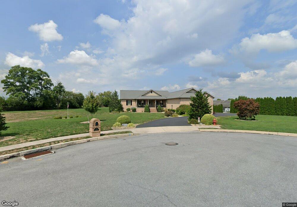
142 Carowinds Dr Greencastle, PA 17225
Estimated Value: $325,000 - $728,227
4
Beds
3
Baths
2,700
Sq Ft
$199/Sq Ft
Est. Value
About This Home
This home is located at 142 Carowinds Dr, Greencastle, PA 17225 and is currently estimated at $537,057, approximately $198 per square foot. 142 Carowinds Dr is a home located in Franklin County with nearby schools including Greencastle-Antrim Primary School, Greencastle-Antrim Elementary School, and Greencastle-Antrim Middle School.
Ownership History
Date
Name
Owned For
Owner Type
Purchase Details
Closed on
Jan 26, 2010
Sold by
Zima Joseph P and Zima Christe L
Bought by
Shafer Ronald E and Shafer Jan M
Current Estimated Value
Purchase Details
Closed on
Aug 21, 2009
Sold by
Brown Nathan E and Brown Cynthia E
Bought by
Zima Joseph P and Zima Christe L
Home Financials for this Owner
Home Financials are based on the most recent Mortgage that was taken out on this home.
Original Mortgage
$367,650
Interest Rate
5.36%
Mortgage Type
New Conventional
Create a Home Valuation Report for This Property
The Home Valuation Report is an in-depth analysis detailing your home's value as well as a comparison with similar homes in the area
Home Values in the Area
Average Home Value in this Area
Purchase History
| Date | Buyer | Sale Price | Title Company |
|---|---|---|---|
| Shafer Ronald E | $387,000 | None Available | |
| Zima Joseph P | $387,000 | None Available |
Source: Public Records
Mortgage History
| Date | Status | Borrower | Loan Amount |
|---|---|---|---|
| Previous Owner | Zima Joseph P | $367,650 |
Source: Public Records
Tax History Compared to Growth
Tax History
| Year | Tax Paid | Tax Assessment Tax Assessment Total Assessment is a certain percentage of the fair market value that is determined by local assessors to be the total taxable value of land and additions on the property. | Land | Improvement |
|---|---|---|---|---|
| 2025 | $8,999 | $52,490 | $7,550 | $44,940 |
| 2024 | $8,806 | $52,490 | $7,550 | $44,940 |
| 2023 | $8,712 | $52,490 | $7,550 | $44,940 |
| 2022 | $8,660 | $52,490 | $7,550 | $44,940 |
| 2021 | $8,507 | $52,490 | $7,550 | $44,940 |
| 2020 | $8,306 | $52,490 | $7,550 | $44,940 |
| 2019 | $8,135 | $52,490 | $7,550 | $44,940 |
| 2018 | $8,057 | $52,490 | $7,550 | $44,940 |
| 2017 | $7,820 | $52,490 | $7,550 | $44,940 |
| 2016 | $1,504 | $52,490 | $7,550 | $44,940 |
| 2015 | $1,401 | $52,490 | $7,550 | $44,940 |
| 2014 | $1,401 | $52,490 | $7,550 | $44,940 |
Source: Public Records
Map
Nearby Homes
- 102570 Delanie Dr
- 82521 Delanie Dr
- 30 Parkwood Dr
- 102505 Shannon Dr S
- 102540 Shannon Dr S
- 102560 Shannon Dr S
- 102530 Shannon Dr S
- 102510 Shannon Dr S
- 102550 Shannon Dr S
- 102535 Shannon Dr S
- 102500 Shannon Dr S
- 1014 Divinity Dr
- 171 Celestial Terrace
- 1299 Divinity Dr
- 140 Williamson Ave
- 0 Celestial Terrace
- 642 Shannon Dr S
- 533 Hilltop Cir
- 90 W Walter Ave
- 64 W Walter Ave
- 70 Homestead Dr
- 72 Homestead Dr
- 68 Homestead Dr
- 66 Homestead Dr
- 0 Homestead Dr Unit 1005895697
- 0 Homestead Dr Unit FL10145814
- 0 Homestead Dr Unit PAFL2015260
- 0 Homestead Dr Unit PAFL166606
- 76 Homestead Dr
- 64 Homestead Dr
- 62 Homestead Dr
- 134 Carowinds Dr
- 123 Carowinds Dr
- 78 Homestead Dr
- 126 Carowinds Dr
- 60 Homestead Dr
- Lot 29 Vivian Ave
- 58 Homestead Dr
- 71 Homestead Dr
- 69 Homestead Dr