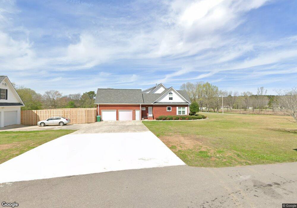
142 Curtis Richey Rd Locust Fork, AL 35097
Estimated Value: $387,000 - $507,693
4
Beds
4
Baths
3,912
Sq Ft
$115/Sq Ft
Est. Value
About This Home
This home is located at 142 Curtis Richey Rd, Locust Fork, AL 35097 and is currently estimated at $448,423, approximately $114 per square foot. 142 Curtis Richey Rd is a home located in Blount County with nearby schools including Locust Fork Elementary School and Locust Fork High School.
Ownership History
Date
Name
Owned For
Owner Type
Purchase Details
Closed on
Apr 9, 2020
Sold by
Bowman Christy
Bought by
Lesley Richard and Lesley Misty
Current Estimated Value
Home Financials for this Owner
Home Financials are based on the most recent Mortgage that was taken out on this home.
Original Mortgage
$211,500
Interest Rate
3.3%
Mortgage Type
New Conventional
Purchase Details
Closed on
Dec 17, 2012
Sold by
Landrum Paula
Bought by
Peeks Vickie
Home Financials for this Owner
Home Financials are based on the most recent Mortgage that was taken out on this home.
Original Mortgage
$188,650
Interest Rate
3.36%
Mortgage Type
Stand Alone Refi Refinance Of Original Loan
Create a Home Valuation Report for This Property
The Home Valuation Report is an in-depth analysis detailing your home's value as well as a comparison with similar homes in the area
Home Values in the Area
Average Home Value in this Area
Purchase History
| Date | Buyer | Sale Price | Title Company |
|---|---|---|---|
| Lesley Richard | $235,000 | None Available | |
| Peeks Vickie | $10,500 | -- |
Source: Public Records
Mortgage History
| Date | Status | Borrower | Loan Amount |
|---|---|---|---|
| Open | Lesley Richard | $148,900 | |
| Closed | Lesley Richard | $211,500 | |
| Previous Owner | Peeks James M | $188,650 | |
| Previous Owner | Peeks James M | $195,000 | |
| Previous Owner | Peeks James M | $162,000 |
Source: Public Records
Tax History Compared to Growth
Tax History
| Year | Tax Paid | Tax Assessment Tax Assessment Total Assessment is a certain percentage of the fair market value that is determined by local assessors to be the total taxable value of land and additions on the property. | Land | Improvement |
|---|---|---|---|---|
| 2024 | $1,842 | $50,660 | $3,000 | $47,660 |
| 2023 | $1,842 | $46,980 | $3,000 | $43,980 |
| 2022 | $1,441 | $39,960 | $3,000 | $36,960 |
| 2021 | $1,201 | $33,560 | $3,160 | $30,400 |
| 2020 | $1,141 | $29,700 | $3,000 | $26,700 |
| 2019 | $1,056 | $29,700 | $3,000 | $26,700 |
| 2018 | $1,174 | $32,840 | $3,000 | $29,840 |
| 2017 | $0 | $33,360 | $0 | $0 |
| 2015 | -- | $33,360 | $0 | $0 |
| 2014 | -- | $33,360 | $0 | $0 |
| 2013 | -- | $35,140 | $0 | $0 |
Source: Public Records
Map
Nearby Homes
- 15 Davidson Dr
- 496 Tawbush Rd
- 388 Tawbush Rd
- 0 Center Hill Rd
- 4540 Spunky Hollow Rd
- 25465 Alabama 79
- 25335 Alabama 79
- #0 Shady Point Rd Unit 18, 18 & 19
- 87 Youngblood Ln
- 60 Wortham Rd
- 640 Gilman Bend Rd
- 380 Jerry Marsh Rd
- 148 Willow Ln
- 11 Mccay Rd
- 255 Savannah Ln
- 587 Mountain Dr
- 11 AC River Terrace
- 39 Spunky Hollow Rd
- 775 Mountain Dr
- 2898 County Highway 15
- 142 Curtis Richey Rd
- 142 Curtis Richey Rd
- 40 Curtis Richey Rd
- 141 Curtis Richey Rd
- 164 Curtis Richey Rd
- 220 Curtis Richey Rd
- 27420 State Highway 79
- 27420 Alabama 79
- 27467 State Highway 79
- 271 Curtis Richey Rd
- 27437 State Highway 79
- 27617 State Highway 79
- 27617 State Highway 79
- 268 Curtis Richey Rd
- 27628 State Highway 79
- 27628 State Highway 79
- 455 Payton Ln
- 27579 State Highway 79
- 27664 State Highway 79
- 27664 Alabama 79