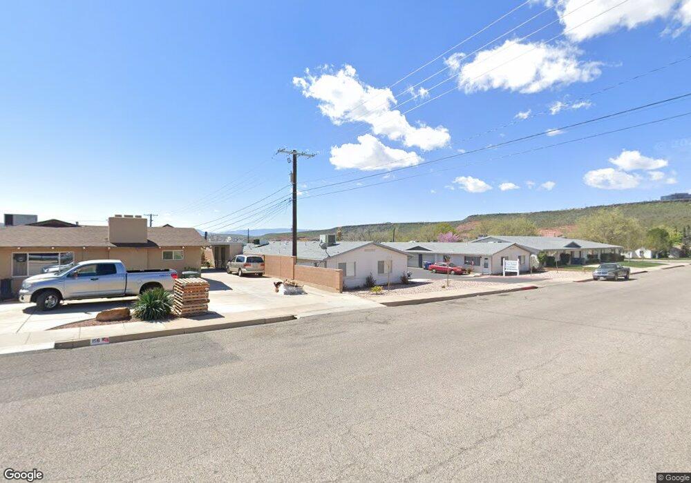
142 E 500 S Unit 27 Saint George, UT 84770
Estimated Value: $255,000 - $294,000
3
Beds
3
Baths
1,328
Sq Ft
$208/Sq Ft
Est. Value
About This Home
This home is located at 142 E 500 S Unit 27, Saint George, UT 84770 and is currently estimated at $276,537, approximately $208 per square foot. 142 E 500 S Unit 27 is a home located in Washington County with nearby schools including Legacy School, Dixie Middle School, and Dixie Intermediate School.
Ownership History
Date
Name
Owned For
Owner Type
Purchase Details
Closed on
Feb 14, 2013
Sold by
Mancinelli Lynn and Stewart Kathleen
Bought by
Allen Terry and Allen Terrie
Current Estimated Value
Purchase Details
Closed on
Jun 28, 2012
Sold by
Prince Janis E and Marie L Magill 2007 Living Tru
Bought by
Mancinelli Lynn and Stewart Kathleen
Purchase Details
Closed on
Feb 7, 2008
Sold by
Magill Marie L
Bought by
Magill Marie L and Marie L Magill 2007 Living Tru
Create a Home Valuation Report for This Property
The Home Valuation Report is an in-depth analysis detailing your home's value as well as a comparison with similar homes in the area
Home Values in the Area
Average Home Value in this Area
Purchase History
| Date | Buyer | Sale Price | Title Company |
|---|---|---|---|
| Allen Terry | -- | First American Title Company | |
| Mancinelli Lynn | -- | Accommodation | |
| Magill Marie L | -- | None Available |
Source: Public Records
Tax History Compared to Growth
Tax History
| Year | Tax Paid | Tax Assessment Tax Assessment Total Assessment is a certain percentage of the fair market value that is determined by local assessors to be the total taxable value of land and additions on the property. | Land | Improvement |
|---|---|---|---|---|
| 2025 | $847 | $127,930 | $38,500 | $89,430 |
| 2023 | $972 | $145,200 | $38,500 | $106,700 |
| 2022 | $971 | $136,455 | $33,000 | $103,455 |
| 2021 | $854 | $178,900 | $40,000 | $138,900 |
| 2020 | $827 | $163,200 | $40,000 | $123,200 |
| 2019 | $826 | $159,200 | $40,000 | $119,200 |
| 2018 | $733 | $70,840 | $0 | $0 |
| 2017 | $762 | $73,645 | $0 | $0 |
| 2016 | $758 | $67,760 | $0 | $0 |
| 2015 | $772 | $66,165 | $0 | $0 |
| 2014 | $691 | $59,620 | $0 | $0 |
Source: Public Records
Map
Nearby Homes
- 524 S 200 E Unit 17
- 524 S 200 E Unit 3
- 476 S 200 E Unit 1
- 454 S 100 E Unit 10
- 433 S 100 E
- 460 S Main St Unit 20
- 55 W 400 S Unit 15
- 544 S 100 W Unit 3
- 295 S Main St
- 443 E 700 S
- 375 S 200 W
- 155 W 300 S Unit 9
- 345 S 200 W Unit 3
- 480 S 200 W Unit 25
- 480 S 200 W Unit 25
- 31 W 200 S
- 777 S 400 E Unit 45
- 534 E 400 S
- 531 E 400 S
- 800 W Bluff St S
- 142 E 500 S Unit 1
- 142 E 500 S Unit 9
- 142 E 500 S Unit 8
- 142 E 500 S Unit 7
- 142 E 500 S Unit 6
- 142 E 500 S Unit 5
- 142 E 500 S Unit 4
- 142 E 500 S Unit 3
- 142 E 500 S Unit 26
- 142 E 500 S Unit 25
- 142 E 500 S Unit 24
- 142 E 500 S Unit 23
- 142 E 500 S Unit 22
- 142 E 500 S Unit 21
- 142 E 500 S Unit 20
- 142 E 500 S Unit A2
- 142 E 500 S Unit 19
- 142 E 500 S Unit 18
- 142 E 500 S Unit 17
- 142 E 500 S Unit 15