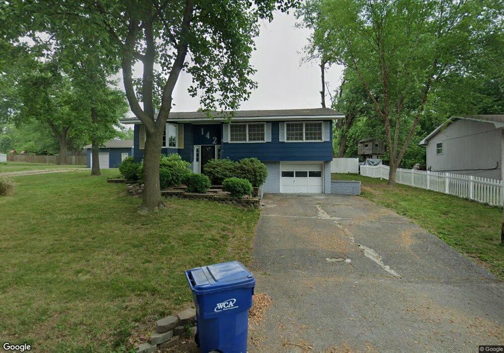
142 E Circle Dr Brookfield, MO 64628
Estimated Value: $184,000 - $222,000
4
Beds
3
Baths
2,270
Sq Ft
$91/Sq Ft
Est. Value
About This Home
This home is located at 142 E Circle Dr, Brookfield, MO 64628 and is currently estimated at $206,996, approximately $91 per square foot. 142 E Circle Dr is a home located in Linn County with nearby schools including Brookfield Elementary School, Brookfield Middle School, and Brookfield High School.
Ownership History
Date
Name
Owned For
Owner Type
Purchase Details
Closed on
May 5, 2022
Sold by
Burris Grant
Bought by
Boley Julie
Current Estimated Value
Home Financials for this Owner
Home Financials are based on the most recent Mortgage that was taken out on this home.
Original Mortgage
$82,500
Interest Rate
6.43%
Mortgage Type
New Conventional
Purchase Details
Closed on
Sep 27, 2019
Sold by
Bulldog Assets Llc
Bought by
Burris Grant and Jacquez Latisha
Purchase Details
Closed on
Mar 7, 2018
Sold by
Cameron Sensenich and Cameron Angela
Bought by
Bulldog Assets Llc
Home Financials for this Owner
Home Financials are based on the most recent Mortgage that was taken out on this home.
Original Mortgage
$130,000
Interest Rate
4.15%
Mortgage Type
New Conventional
Purchase Details
Closed on
May 19, 2008
Bought by
Sensenich Cameron and Sensenich Angela
Create a Home Valuation Report for This Property
The Home Valuation Report is an in-depth analysis detailing your home's value as well as a comparison with similar homes in the area
Home Values in the Area
Average Home Value in this Area
Purchase History
| Date | Buyer | Sale Price | Title Company |
|---|---|---|---|
| Boley Julie | $103,125 | -- | |
| Burris Grant | $123,466 | -- | |
| Bulldog Assets Llc | -- | Professional Land Title Co | |
| Sensenich Cameron | $130,000 | -- |
Source: Public Records
Mortgage History
| Date | Status | Borrower | Loan Amount |
|---|---|---|---|
| Previous Owner | Boley Julie | $82,500 | |
| Previous Owner | Bulldog Assets Llc | $130,000 | |
| Closed | Burris Grant | $122,244 |
Source: Public Records
Tax History
| Year | Tax Paid | Tax Assessment Tax Assessment Total Assessment is a certain percentage of the fair market value that is determined by local assessors to be the total taxable value of land and additions on the property. | Land | Improvement |
|---|---|---|---|---|
| 2025 | $1,198 | $19,899 | $3,838 | $16,061 |
| 2024 | $12 | $19,133 | $3,838 | $15,295 |
| 2023 | $1,194 | $19,133 | $3,838 | $15,295 |
| 2022 | $1,150 | $18,354 | $3,838 | $14,516 |
| 2021 | $1,109 | $18,354 | $3,838 | $14,516 |
| 2020 | $1,152 | $18,354 | $3,838 | $14,516 |
| 2019 | $1,152 | $18,354 | $3,838 | $14,516 |
| 2018 | $1,133 | $18,126 | $3,838 | $14,288 |
| 2015 | -- | $17,499 | $4,674 | $12,825 |
| 2011 | -- | $89,600 | $18,400 | $71,200 |
Source: Public Records
Map
Nearby Homes
- 131 Silver Ln
- 304 E Canal St
- 806 S Brunswick St
- 547 Harrison St
- 26153 Image Rd
- 415 S Livingston St
- 26049 Image Rd
- 26576 Image Rd
- 303 Shelby St
- 117 N Main St
- 316 Macon St
- 317 Macon St
- 0 S State St
- 21145 Highway 5
- 27022 Index Dr
- 0 W Wood St
- 721 Lincoln St
- 1007 Country Side Dr
- 417 Laclede Ave
- 431 Peck St
- 140 E Circle Dr
- 109 W Circle Dr
- 129 E Circle Dr
- 150 E Circle Dr
- 134 E Circle Dr
- 107 W Circle Dr
- 125 E Circle Dr
- 111 W Circle Dr
- 137 E Circle Dr
- 105 W Circle Dr
- 121 E Circle Dr
- 130 E Circle Dr
- 619 Skyline Dr
- 112 W Circle Dr
- 116 W Circle Dr
- 101 W Circle Dr
- 117 E Circle Dr
- 120 W Circle Dr
- 635 Skyline Dr
- 124 W Circle Dr
Your Personal Tour Guide
Ask me questions while you tour the home.