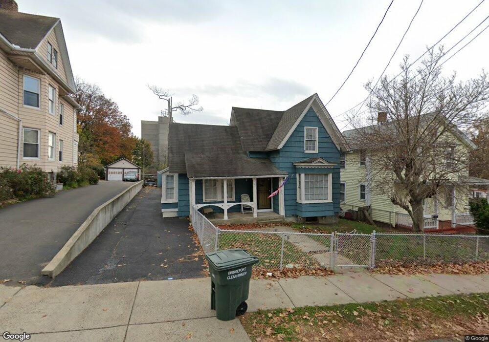
142 Grant St Bridgeport, CT 06610
Boston Ave-Mill Hill NeighborhoodEstimated Value: $264,379 - $340,000
2
Beds
1
Bath
1,176
Sq Ft
$252/Sq Ft
Est. Value
About This Home
This home is located at 142 Grant St, Bridgeport, CT 06610 and is currently estimated at $296,845, approximately $252 per square foot. 142 Grant St is a home located in Fairfield County with nearby schools including Dunbar School, Harding High School, and Achievement First Bridgeport Academy Elementary School.
Ownership History
Date
Name
Owned For
Owner Type
Purchase Details
Closed on
Feb 2, 1996
Sold by
Montes Hector E and Montes Lorraine M
Bought by
Angelucci Carmen
Current Estimated Value
Create a Home Valuation Report for This Property
The Home Valuation Report is an in-depth analysis detailing your home's value as well as a comparison with similar homes in the area
Home Values in the Area
Average Home Value in this Area
Purchase History
| Date | Buyer | Sale Price | Title Company |
|---|---|---|---|
| Angelucci Carmen | $56,500 | -- | |
| Angelucci Carmen | $56,500 | -- |
Source: Public Records
Mortgage History
| Date | Status | Borrower | Loan Amount |
|---|---|---|---|
| Open | Angelucci Carmen | $65,000 | |
| Open | Angelucci Carmen | $168,000 | |
| Closed | Angelucci Carmen | $113,000 |
Source: Public Records
Tax History Compared to Growth
Tax History
| Year | Tax Paid | Tax Assessment Tax Assessment Total Assessment is a certain percentage of the fair market value that is determined by local assessors to be the total taxable value of land and additions on the property. | Land | Improvement |
|---|---|---|---|---|
| 2025 | $4,557 | $104,870 | $43,540 | $61,330 |
| 2024 | $4,557 | $104,870 | $43,540 | $61,330 |
| 2023 | $4,557 | $104,870 | $43,540 | $61,330 |
| 2022 | $4,557 | $104,870 | $43,540 | $61,330 |
| 2021 | $4,557 | $104,870 | $43,540 | $61,330 |
| 2020 | $4,065 | $75,290 | $20,610 | $54,680 |
| 2019 | $4,065 | $75,290 | $20,610 | $54,680 |
| 2018 | $4,094 | $75,290 | $20,610 | $54,680 |
| 2017 | $4,094 | $75,290 | $20,610 | $54,680 |
| 2016 | $4,094 | $75,290 | $20,610 | $54,680 |
| 2015 | $4,713 | $111,680 | $39,890 | $71,790 |
| 2014 | $4,713 | $111,680 | $39,890 | $71,790 |
Source: Public Records
Map
Nearby Homes
- 11 Bell St
- 55 Ridgefield Ave
- 290 Ridgefield Ave
- 147 Helen St Unit 149
- 361 Ridgefield Ave Unit 363
- 1402 Boston Ave
- 123-125 Summerfield Ave
- 123 Summerfield Ave
- 30 Dover St
- 215 Summerfield Ave
- 704 Maple St
- 530 Jane St
- 1575 Boston Ave Unit B2
- 180 Holly St
- 43 Pixlee Place
- 314 Judson Place
- 106 Elizabeth St
- 819 Connecticut Ave Unit 6
- 247 6th St
- 399 Jane St
- 152 Grant St Unit 154
- 134 Grant St
- 164 Grant St
- 38 White St
- 48 White St
- 111 White St Unit 113
- 174 Grant St
- 62 White St
- 81 White St
- 81 White St Unit 2
- 103 White St
- 102 Grant St
- 110 Grant St
- 97 White St
- 97 White St Unit 3B
- 97 White St Unit 1A
- 100 Grant St
- 77 White St
- 1535 Central Ave Unit 113
- 1535 Central Ave Unit 317