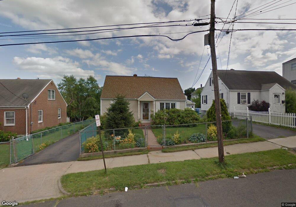
142 Hayes St New Britain, CT 06053
Estimated Value: $256,000 - $311,000
3
Beds
1
Bath
1,152
Sq Ft
$243/Sq Ft
Est. Value
About This Home
This home is located at 142 Hayes St, New Britain, CT 06053 and is currently estimated at $280,461, approximately $243 per square foot. 142 Hayes St is a home located in Hartford County with nearby schools including Jefferson School, Pulaski Middle School, and Mountain Laurel Sudbury School.
Ownership History
Date
Name
Owned For
Owner Type
Purchase Details
Closed on
Nov 25, 1987
Sold by
Faltas Bill
Bought by
Sen Jan
Current Estimated Value
Home Financials for this Owner
Home Financials are based on the most recent Mortgage that was taken out on this home.
Original Mortgage
$118,800
Interest Rate
11.59%
Create a Home Valuation Report for This Property
The Home Valuation Report is an in-depth analysis detailing your home's value as well as a comparison with similar homes in the area
Home Values in the Area
Average Home Value in this Area
Purchase History
| Date | Buyer | Sale Price | Title Company |
|---|---|---|---|
| Sen Jan | $132,000 | -- |
Source: Public Records
Mortgage History
| Date | Status | Borrower | Loan Amount |
|---|---|---|---|
| Closed | Sen Jan | $88,000 | |
| Closed | Sen Jan | $100,000 | |
| Closed | Sen Jan | $118,800 |
Source: Public Records
Tax History Compared to Growth
Tax History
| Year | Tax Paid | Tax Assessment Tax Assessment Total Assessment is a certain percentage of the fair market value that is determined by local assessors to be the total taxable value of land and additions on the property. | Land | Improvement |
|---|---|---|---|---|
| 2025 | $5,433 | $138,670 | $46,620 | $92,050 |
| 2024 | $5,490 | $138,670 | $46,620 | $92,050 |
| 2023 | $5,308 | $138,670 | $46,620 | $92,050 |
| 2022 | $4,563 | $92,190 | $21,490 | $70,700 |
| 2021 | $4,563 | $92,190 | $21,490 | $70,700 |
| 2020 | $4,656 | $92,190 | $21,490 | $70,700 |
| 2019 | $4,656 | $92,190 | $21,490 | $70,700 |
| 2018 | $4,656 | $92,190 | $21,490 | $70,700 |
| 2017 | $4,214 | $83,440 | $19,530 | $63,910 |
| 2016 | $4,214 | $83,440 | $19,530 | $63,910 |
| 2015 | $4,089 | $83,440 | $19,530 | $63,910 |
| 2014 | $4,089 | $83,440 | $19,530 | $63,910 |
Source: Public Records
Map
Nearby Homes
- 7 Doris St
- 34 Concord St
- 50 Curtin Ave
- 55 Allen St
- 25 Clinton St
- 8 Albany Ave
- 335 Broad St
- 80 Gold St
- 234 Pierremount Ave
- 179 Broad St
- 107 Allen St
- 152 Oakland Ave
- 235 High St Unit C
- 95 Pierremount Ave
- 240 Washington St
- 19 Maplehurst Ave
- 14 Beatty St
- 154 Allen St
- 108 Commonwealth Ave
- 148 Governor St