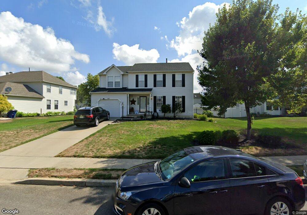
142 Kingsbridge Dr Lumberton, NJ 08048
Estimated Value: $516,861 - $566,000
--
Bed
--
Bath
1,996
Sq Ft
$274/Sq Ft
Est. Value
About This Home
This home is located at 142 Kingsbridge Dr, Lumberton, NJ 08048 and is currently estimated at $546,465, approximately $273 per square foot. 142 Kingsbridge Dr is a home located in Burlington County with nearby schools including Ashbrook Elementary School, Bobby’s Run School, and Lumberton Middle School.
Ownership History
Date
Name
Owned For
Owner Type
Purchase Details
Closed on
Oct 4, 2002
Sold by
Estate Of Ethel Geraldine Seifert and Graver Susan Geraldine
Bought by
Whartenby Michael and Whartenby Sally
Current Estimated Value
Home Financials for this Owner
Home Financials are based on the most recent Mortgage that was taken out on this home.
Original Mortgage
$190,000
Outstanding Balance
$79,772
Interest Rate
6.18%
Estimated Equity
$466,693
Purchase Details
Closed on
Feb 7, 1994
Sold by
Ryland Group
Bought by
Seifert Ethel G
Create a Home Valuation Report for This Property
The Home Valuation Report is an in-depth analysis detailing your home's value as well as a comparison with similar homes in the area
Home Values in the Area
Average Home Value in this Area
Purchase History
| Date | Buyer | Sale Price | Title Company |
|---|---|---|---|
| Whartenby Michael | $270,000 | -- | |
| Seifert Ethel G | $159,065 | -- |
Source: Public Records
Mortgage History
| Date | Status | Borrower | Loan Amount |
|---|---|---|---|
| Open | Whartenby Michael | $190,000 |
Source: Public Records
Tax History Compared to Growth
Tax History
| Year | Tax Paid | Tax Assessment Tax Assessment Total Assessment is a certain percentage of the fair market value that is determined by local assessors to be the total taxable value of land and additions on the property. | Land | Improvement |
|---|---|---|---|---|
| 2025 | $8,415 | $316,100 | $95,600 | $220,500 |
| 2024 | $7,912 | $316,100 | $95,600 | $220,500 |
| 2023 | $7,912 | $316,100 | $95,600 | $220,500 |
| 2022 | $7,729 | $316,100 | $95,600 | $220,500 |
| 2021 | $7,707 | $316,100 | $95,600 | $220,500 |
| 2020 | $7,640 | $316,100 | $95,600 | $220,500 |
| 2019 | $7,555 | $316,100 | $95,600 | $220,500 |
| 2018 | $7,441 | $316,100 | $95,600 | $220,500 |
| 2017 | $7,302 | $316,100 | $95,600 | $220,500 |
| 2016 | $7,144 | $316,100 | $95,600 | $220,500 |
| 2015 | $7,090 | $316,100 | $95,600 | $220,500 |
| 2014 | $6,821 | $316,100 | $95,600 | $220,500 |
Source: Public Records
Map
Nearby Homes
- 71 Kingsbridge Dr
- 10 Whitehaven Dr
- 49 Nassau Rd
- 18 Westminster Dr
- 87 Beechnut Ct
- 11 Abington Way
- 21 Mulberry Ct
- 587 Main St
- 39 Tynemouth Dr
- 185 South Ave
- 191 South Ave
- 48 Richmond Ave
- 692 Eayrestown Rd
- 105 Stonebrook Dr
- 16 Basil Dr
- 2 Providence Ct
- 4 Black Pine Ln
- 240 Pine St
- 11 S Hunterdon Ave
- 85 Madison Ave
- 144 Kingsbridge Dr
- 140 Kingsbridge Dr
- 25 Gateshead Dr
- 27 Gateshead Dr
- 138 Kingsbridge Dr
- 146 Kingsbridge Dr
- 125 Kingsbridge Dr
- 23 Gateshead Dr
- 127 Kingsbridge Dr
- 29 Gateshead Dr
- 123 Kingsbridge Dr
- 129 Kingsbridge Dr
- 101 Kingsbridge Dr
- 136 Kingsbridge Dr
- 21 Gateshead Dr
- 121 Kingsbridge Dr
- 103 Kingsbridge Dr
- 24 Gateshead Dr
- 19 Gateshead Dr
- 134 Kingsbridge Dr