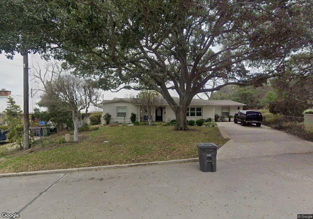
142 Kinross Dr San Antonio, TX 78209
Oak Park-Northwood NeighborhoodEstimated Value: $690,000 - $960,000
4
Beds
3
Baths
3,101
Sq Ft
$274/Sq Ft
Est. Value
About This Home
This home is located at 142 Kinross Dr, San Antonio, TX 78209 and is currently estimated at $850,955, approximately $274 per square foot. 142 Kinross Dr is a home located in Bexar County with nearby schools including Woodridge Elementary School, Alamo Heights Junior School, and Alamo Heights High School.
Ownership History
Date
Name
Owned For
Owner Type
Purchase Details
Closed on
May 25, 2001
Sold by
Bones David M and Bones Coleen P
Bought by
Brauer Steven K and Brauer Susan P
Current Estimated Value
Home Financials for this Owner
Home Financials are based on the most recent Mortgage that was taken out on this home.
Original Mortgage
$232,000
Outstanding Balance
$86,885
Interest Rate
7.07%
Estimated Equity
$764,070
Purchase Details
Closed on
Jan 10, 1997
Sold by
Fowler Rod L and Fowler Tana Perry
Bought by
Bones David M and Bones Coleen P
Home Financials for this Owner
Home Financials are based on the most recent Mortgage that was taken out on this home.
Original Mortgage
$213,750
Interest Rate
7.12%
Create a Home Valuation Report for This Property
The Home Valuation Report is an in-depth analysis detailing your home's value as well as a comparison with similar homes in the area
Home Values in the Area
Average Home Value in this Area
Purchase History
| Date | Buyer | Sale Price | Title Company |
|---|---|---|---|
| Brauer Steven K | -- | Commerce Land Title | |
| Bones David M | -- | -- |
Source: Public Records
Mortgage History
| Date | Status | Borrower | Loan Amount |
|---|---|---|---|
| Open | Brauer Steven K | $232,000 | |
| Previous Owner | Bones David M | $213,750 |
Source: Public Records
Tax History Compared to Growth
Tax History
| Year | Tax Paid | Tax Assessment Tax Assessment Total Assessment is a certain percentage of the fair market value that is determined by local assessors to be the total taxable value of land and additions on the property. | Land | Improvement |
|---|---|---|---|---|
| 2025 | $11,656 | $793,000 | $398,720 | $394,280 |
| 2024 | $11,656 | $793,000 | $398,720 | $394,280 |
| 2023 | $11,656 | $748,760 | $398,720 | $376,280 |
| 2022 | $16,479 | $680,691 | $275,290 | $487,970 |
| 2021 | $15,443 | $618,810 | $239,410 | $379,400 |
| 2020 | $14,321 | $573,210 | $239,410 | $333,800 |
| 2019 | $14,008 | $547,540 | $239,410 | $308,130 |
| 2018 | $12,655 | $505,199 | $208,130 | $322,690 |
| 2017 | $11,504 | $459,272 | $204,990 | $320,210 |
| 2016 | $10,458 | $417,520 | $102,250 | $315,270 |
| 2015 | $10,378 | $434,860 | $102,250 | $332,610 |
| 2014 | $10,378 | $417,720 | $0 | $0 |
Source: Public Records
Map
Nearby Homes
- 2603 Brookhurst Dr
- 2434 Toftrees Dr
- 8218 Country Lane Ct
- 134 Rockhill Dr
- 510 Burnside Dr
- 2300 Nacogdoches Rd Unit O-160
- 2300 Nacogdoches Rd Unit C210
- 419 Woodcrest Dr
- 530 Burnside Dr
- 215 Oakleaf Dr
- 210 Laramie Dr
- 2119 Flamingo St
- 351 Northridge Dr
- 126 Treasure Way
- 205 Larkwood Dr
- 318 Northridge Dr
- 446 Forrest Hill Dr
- 127 Larkwood Dr
- 8033 N New Braunfels Ave Unit 400D
- 8033 N New Braunfels Ave Unit 500C
- 138 Kinross Dr
- 132 Kinross Dr
- 147 Kinross Dr
- 203 Cave Ln
- 139 Kinross Dr
- 7814 Woodridge Dr
- 126 Kinross Dr
- 7818 Woodridge Dr
- 131 Kinross Dr
- 210 Cave Ln
- 242 Cave Ln
- 206 Cave Ln
- 2606 Friar Tuck Rd
- 118 Kinross Dr
- 2610 Friar Tuck Rd
- 123 Kinross Dr
- 232 Cave Ln
- 2602 Friar Tuck Rd
- 246 Cave Ln
- 2614 Friar Tuck Rd