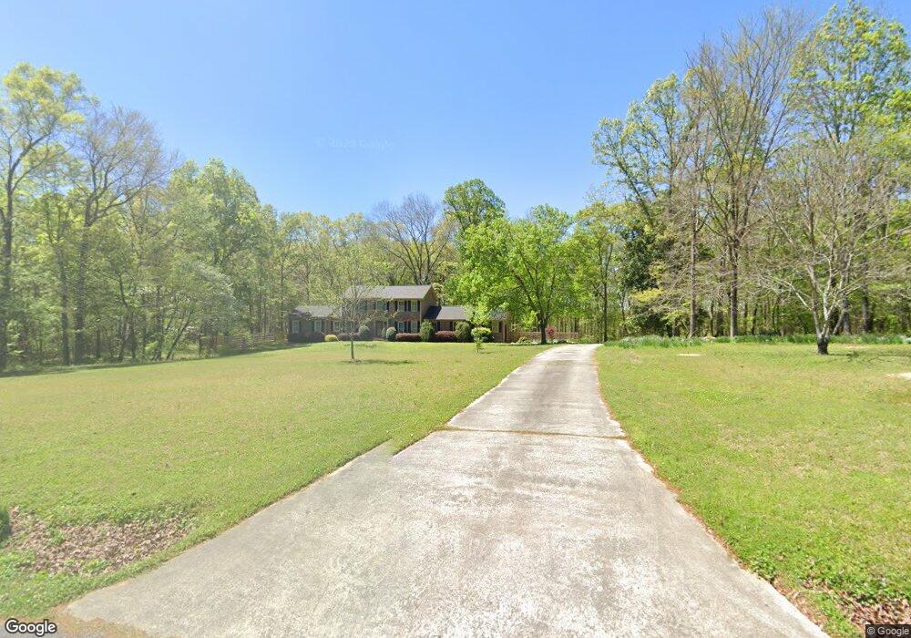
142 Mccowan Cir Rockmart, GA 30153
Estimated Value: $305,000 - $681,622
4
Beds
4
Baths
2,969
Sq Ft
$176/Sq Ft
Est. Value
About This Home
This home is located at 142 Mccowan Cir, Rockmart, GA 30153 and is currently estimated at $521,406, approximately $175 per square foot. 142 Mccowan Cir is a home located in Polk County.
Ownership History
Date
Name
Owned For
Owner Type
Purchase Details
Closed on
Feb 23, 2021
Sold by
Addison Carol Casey
Bought by
Jones Lena Clyde and Jones James Daniel
Current Estimated Value
Home Financials for this Owner
Home Financials are based on the most recent Mortgage that was taken out on this home.
Original Mortgage
$351,200
Outstanding Balance
$273,940
Interest Rate
2.2%
Mortgage Type
New Conventional
Estimated Equity
$341,893
Purchase Details
Closed on
Jul 19, 2019
Sold by
Casey Joan R
Bought by
Casey Joan R and Addison Carol Casey
Purchase Details
Closed on
Oct 20, 1999
Sold by
Casey Dan
Bought by
Casey Joan
Purchase Details
Closed on
Jul 17, 1996
Sold by
Casey Dan
Bought by
Joan Casey
Purchase Details
Closed on
Feb 27, 1978
Bought by
Casey Dan and Casey Jan
Create a Home Valuation Report for This Property
The Home Valuation Report is an in-depth analysis detailing your home's value as well as a comparison with similar homes in the area
Home Values in the Area
Average Home Value in this Area
Purchase History
| Date | Buyer | Sale Price | Title Company |
|---|---|---|---|
| Jones Lena Clyde | $439,000 | -- | |
| Casey Joan R | -- | -- | |
| Casey Joan | -- | -- | |
| Joan Casey | -- | -- | |
| Casey Dan | -- | -- |
Source: Public Records
Mortgage History
| Date | Status | Borrower | Loan Amount |
|---|---|---|---|
| Open | Jones Lena Clyde | $351,200 | |
| Closed | Jones Lena Clyde | $351,200 |
Source: Public Records
Tax History Compared to Growth
Tax History
| Year | Tax Paid | Tax Assessment Tax Assessment Total Assessment is a certain percentage of the fair market value that is determined by local assessors to be the total taxable value of land and additions on the property. | Land | Improvement |
|---|---|---|---|---|
| 2024 | $4,736 | $241,303 | $42,324 | $198,979 |
| 2023 | $3,789 | $173,063 | $42,324 | $130,739 |
| 2022 | $2,394 | $114,246 | $28,216 | $86,030 |
| 2021 | $2,308 | $109,390 | $28,216 | $81,174 |
| 2020 | $2,313 | $109,390 | $28,216 | $81,174 |
| 2019 | $1,783 | $79,714 | $28,216 | $51,498 |
| 2018 | $2,093 | $89,290 | $28,216 | $61,074 |
| 2017 | $2,062 | $89,290 | $28,216 | $61,074 |
| 2016 | $1,915 | $83,869 | $22,795 | $61,074 |
| 2015 | $1,917 | $83,869 | $22,795 | $61,074 |
| 2014 | $1,409 | $64,898 | $22,795 | $42,103 |
Source: Public Records
Map
Nearby Homes
- 63 Wheeler Rd
- 89 Wheeler Rd
- 1714 Cedartown Hwy
- 86 Pea Ridge Rd
- 742 Calloway Dr
- 1957 Bellview Rd
- 244 Old Cedartown Rd
- 205 Calloway Club Dr
- 47 Cascade
- 2056 Bellview Rd
- 94 Main Line Rd
- 250 Lowery Rd
- 18 Hillside Dr
- 49 Oak Hill Dr
- 60 Lee St
- 92 Autumn Path
- 0 Highway 278 Nathan Dean Bypass Unit 10134156
- 332 Stringer Rd
- 93 Clay Rd
- 278 Oak Hill Dr
- 142 Mccowan Cir
- 142 McCown Cir
- 187 Mccowan Cir
- 107 Mccowan Cir
- 194 Mccowan Cir
- 97 Mccowan Cir
- 336 Wheeler Ford Rd
- 219 Mccowan Cir
- 0 Mccowan Cir
- 58 Mccowan Cir
- 235 Mccowan Cir
- 235 McCown Cir
- 232 Mccowan Cir
- 271 Mccowan Cir
- 1087 Bellview Rd
- 266 Mccowan Cir
- 501 Mccowan Rd
- 24 Mccowan Cir
- 377 Mccowan Rd
- 467 Mccowan Rd