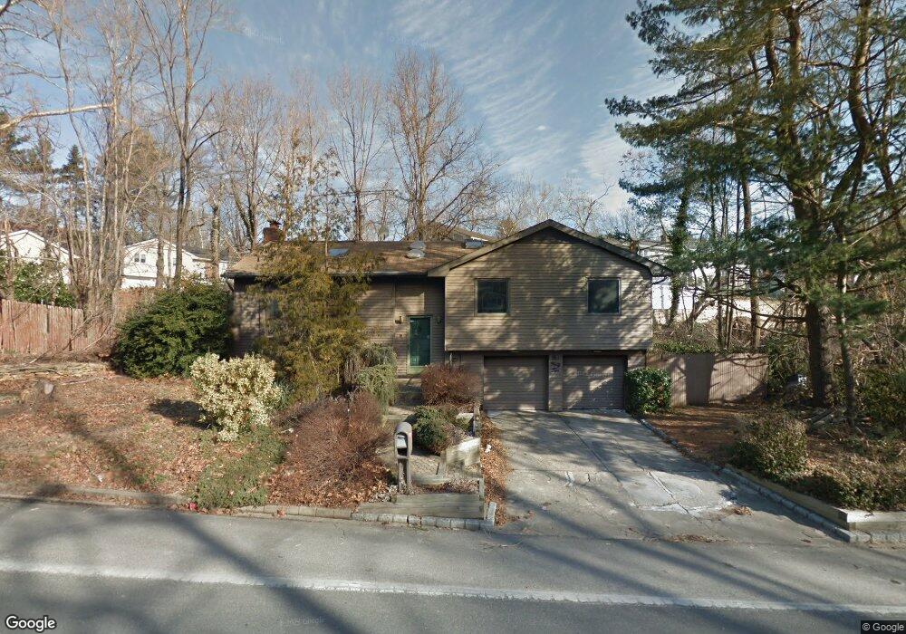
142 Mckay Rd Huntington Station, NY 11746
Estimated Value: $513,000 - $688,284
3
Beds
2
Baths
--
Sq Ft
6,098
Sq Ft Lot
About This Home
This home is located at 142 Mckay Rd, Huntington Station, NY 11746 and is currently estimated at $631,821. 142 Mckay Rd is a home located in Suffolk County with nearby schools including Jefferson Primary School, Woodhull Intermediate School, and J Taylor Finley Middle School.
Ownership History
Date
Name
Owned For
Owner Type
Purchase Details
Closed on
Jun 21, 2022
Sold by
Swann Robert D Est and Swann
Bought by
Ntoni Nikola and Ntoni Lesley
Current Estimated Value
Home Financials for this Owner
Home Financials are based on the most recent Mortgage that was taken out on this home.
Original Mortgage
$352,000
Outstanding Balance
$336,363
Interest Rate
5.78%
Mortgage Type
Purchase Money Mortgage
Estimated Equity
$295,458
Purchase Details
Closed on
Aug 6, 2001
Sold by
Myers Ronald G and Myers Carmen U
Bought by
Swann Robert
Home Financials for this Owner
Home Financials are based on the most recent Mortgage that was taken out on this home.
Original Mortgage
$207,000
Interest Rate
7.16%
Mortgage Type
Purchase Money Mortgage
Create a Home Valuation Report for This Property
The Home Valuation Report is an in-depth analysis detailing your home's value as well as a comparison with similar homes in the area
Home Values in the Area
Average Home Value in this Area
Purchase History
| Date | Buyer | Sale Price | Title Company |
|---|---|---|---|
| Ntoni Nikola | $440,000 | First American Title | |
| Swann Robert | $276,000 | Stewart Title |
Source: Public Records
Mortgage History
| Date | Status | Borrower | Loan Amount |
|---|---|---|---|
| Open | Ntoni Nikola | $352,000 | |
| Previous Owner | Swann Robert | $207,000 |
Source: Public Records
Tax History Compared to Growth
Tax History
| Year | Tax Paid | Tax Assessment Tax Assessment Total Assessment is a certain percentage of the fair market value that is determined by local assessors to be the total taxable value of land and additions on the property. | Land | Improvement |
|---|---|---|---|---|
| 2024 | $9,818 | $2,800 | $300 | $2,500 |
| 2023 | $4,909 | $2,800 | $300 | $2,500 |
| 2022 | $9,710 | $2,800 | $300 | $2,500 |
| 2021 | $9,591 | $2,800 | $300 | $2,500 |
| 2020 | $12,513 | $3,650 | $300 | $3,350 |
| 2019 | $25,026 | $0 | $0 | $0 |
| 2018 | $11,785 | $3,650 | $300 | $3,350 |
| 2017 | $11,785 | $3,650 | $300 | $3,350 |
| 2016 | $11,634 | $3,650 | $300 | $3,350 |
| 2015 | -- | $3,650 | $300 | $3,350 |
| 2014 | -- | $3,650 | $300 | $3,350 |
Source: Public Records
Map
Nearby Homes
- 12 Terrace Dr
- 137 Columbia St
- 49 Tower St
- 92 Columbia St
- 0 Tower St
- 128 Winding St
- 5 Waywood Place
- 11 Horizon Ct
- 43 Columbia St
- 269 W Pulaski Rd
- 237 Oakwood Rd
- 24 Columbia St
- 11 Edcris Ln
- 200 Lowndes Ave Unit A
- 280 Lowndes Ave Unit 111G
- 280 Lowndes Ave Unit 305G
- 280 Lowndes Ave Unit 208
- 62 Lowndes Ave
- 35 Semon Rd
- 30 3rd Ave
- 4 Pickwick Hill Dr
- 6 Pickwick Hill Dr
- 147 Mckay Rd
- 3 Pickwick Hill Dr
- 1 Pickwick Hill Dr
- 5 Pickwick Hill Dr
- 7 Pickwick Hill Dr
- 1 Richmond Place
- 8 Pickwick Hill Dr
- 9 Pickwick Hill Dr
- 149 Mckay Rd
- 6 Terrace Dr
- 8 Terrace Dr
- 10 Pickwick Hill Dr
- 10 Terrace Dr
- 4 Terrace Dr
- 11 Pickwick Hill Dr
- 3 Richmond Place
- 150 Mckay Rd
- 1 Terrace Dr