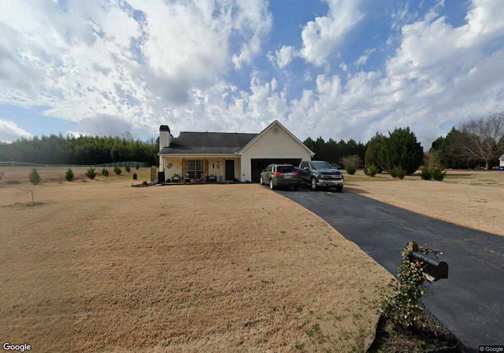
142 Michael Ln McDonough, GA 30252
Estimated Value: $269,000 - $294,000
3
Beds
2
Baths
1,509
Sq Ft
$184/Sq Ft
Est. Value
About This Home
This home is located at 142 Michael Ln, McDonough, GA 30252 and is currently estimated at $277,722, approximately $184 per square foot. 142 Michael Ln is a home located in Henry County with nearby schools including New Hope Elementary School, Locust Grove Middle School, and Locust Grove High School.
Ownership History
Date
Name
Owned For
Owner Type
Purchase Details
Closed on
May 5, 2025
Sold by
Youmans Haleigh Savanah
Bought by
Youmans Samuel Candler
Current Estimated Value
Purchase Details
Closed on
Sep 10, 2019
Sold by
Bagwell Holly
Bought by
Youmans Samuel and Youmans Haleigh
Home Financials for this Owner
Home Financials are based on the most recent Mortgage that was taken out on this home.
Original Mortgage
$159,080
Interest Rate
3.6%
Mortgage Type
FHA
Purchase Details
Closed on
Jul 12, 2011
Sold by
Schwendinger Jason and Schwendinger Jon
Bought by
Wright Holly
Home Financials for this Owner
Home Financials are based on the most recent Mortgage that was taken out on this home.
Original Mortgage
$83,100
Interest Rate
5.5%
Mortgage Type
FHA
Purchase Details
Closed on
Feb 4, 2011
Sold by
Homesales Inc
Bought by
Schwendinger Jon and Schwendinger Jason
Purchase Details
Closed on
Feb 1, 2011
Sold by
Chase Hm Fin Llc
Bought by
Homesales Inc
Purchase Details
Closed on
Jan 24, 2011
Sold by
Hldgs Lehman Brothers
Bought by
Chase Hm Fin Llc
Purchase Details
Closed on
Dec 7, 2010
Sold by
Brownlee Lisa M and Brownlee Dustin Y
Bought by
Hldgs Lehman Brothers
Purchase Details
Closed on
Dec 22, 1998
Sold by
Joe Chandler Cons Inc
Bought by
Brownlee Lisa M and Brownlee Dustin Y
Home Financials for this Owner
Home Financials are based on the most recent Mortgage that was taken out on this home.
Original Mortgage
$99,000
Interest Rate
6.8%
Mortgage Type
New Conventional
Create a Home Valuation Report for This Property
The Home Valuation Report is an in-depth analysis detailing your home's value as well as a comparison with similar homes in the area
Home Values in the Area
Average Home Value in this Area
Purchase History
We collect this data history from publicly available records. To have your information removed, we recommend requesting removal directly through your county’s website.
| Date | Buyer | Sale Price | Title Company |
|---|---|---|---|
| Youmans Samuel Candler | -- | -- | |
| Youmans Samuel | $164,000 | -- | |
| Wright Holly | $89,900 | -- | |
| Schwendinger Jon | $46,000 | -- | |
| Homesales Inc | -- | -- | |
| Chase Hm Fin Llc | -- | -- | |
| Hldgs Lehman Brothers | $50,047 | -- | |
| Brownlee Lisa M | $96,900 | -- |
Source: Public Records
Mortgage History
We collect this data history from publicly available records. To have your information removed, we recommend requesting removal directly through your county’s website.
| Date | Status | Borrower | Loan Amount |
|---|---|---|---|
| Previous Owner | Youmans Samuel | $159,080 | |
| Previous Owner | Wright Holly | $83,100 | |
| Previous Owner | Wright Holly | $89,900 | |
| Previous Owner | Brownlee Lisa M | $99,000 |
Source: Public Records
Tax History
| Year | Tax Paid | Tax Assessment Tax Assessment Total Assessment is a certain percentage of the fair market value that is determined by local assessors to be the total taxable value of land and additions on the property. | Land | Improvement |
|---|---|---|---|---|
| 2025 | $4,390 | $108,880 | $14,000 | $94,880 |
| 2024 | $4,390 | $108,880 | $14,000 | $94,880 |
| 2023 | $4,237 | $108,240 | $14,000 | $94,240 |
| 2022 | $3,616 | $92,040 | $14,000 | $78,040 |
| 2021 | $2,686 | $67,800 | $14,000 | $53,800 |
| 2020 | $2,530 | $63,720 | $12,000 | $51,720 |
| 2019 | $1,798 | $59,040 | $12,000 | $47,040 |
| 2018 | $1,698 | $54,800 | $10,800 | $44,000 |
| 2016 | $1,491 | $46,040 | $10,000 | $36,040 |
| 2015 | $1,410 | $41,320 | $8,000 | $33,320 |
| 2014 | $1,398 | $40,320 | $10,000 | $30,320 |
Source: Public Records
Map
Nearby Homes
- 690 Laney Rd
- 173 Michael Ln
- 356 Cattlemans Cir
- 145 Ducati Dr
- 1455 Laney Rd
- 383 Laney Rd
- 328 Cattlemans Cir
- 373 Laney Rd
- 895 Laney Rd
- 363 Laney Rd
- 136 Ducati Dr
- 125 Karen Dr
- 175 Laney Ct Unit 1
- 732 New Hope Rd
- 0 S Ola Rd Unit 10740969
- 0 S Ola Rd Unit 10714160
- 546 New Hope Rd
- 285 Creekside Way
- 954 New Hope Rd
- 934 New Hope Rd
Your Personal Tour Guide
Ask me questions while you tour the home.