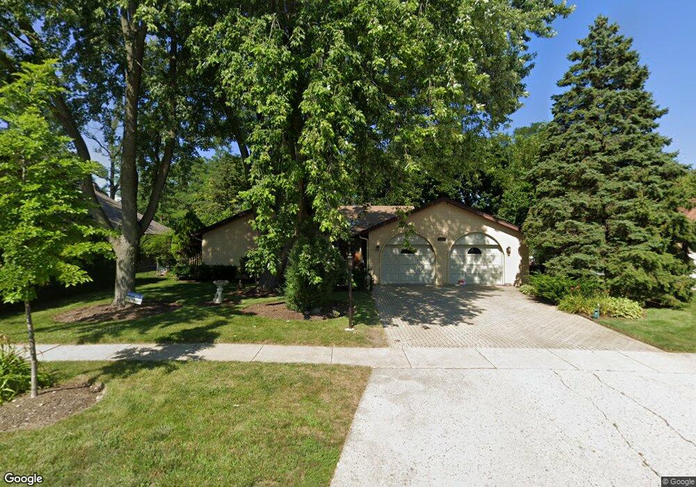
142 N Dymond Rd Libertyville, IL 60048
Estimated Value: $631,000 - $680,000
--
Bed
2
Baths
2,361
Sq Ft
$277/Sq Ft
Est. Value
About This Home
This home is located at 142 N Dymond Rd, Libertyville, IL 60048 and is currently estimated at $654,052, approximately $277 per square foot. 142 N Dymond Rd is a home located in Lake County with nearby schools including Butterfield School, Highland Middle School, and Libertyville High School.
Ownership History
Date
Name
Owned For
Owner Type
Purchase Details
Closed on
Mar 13, 2014
Sold by
White Linda and Kaste Living Family Trust
Bought by
Kaplan Jeffrey D and Kaplan Marianne
Current Estimated Value
Home Financials for this Owner
Home Financials are based on the most recent Mortgage that was taken out on this home.
Original Mortgage
$150,000
Outstanding Balance
$75,737
Interest Rate
3.25%
Mortgage Type
Credit Line Revolving
Estimated Equity
$578,315
Create a Home Valuation Report for This Property
The Home Valuation Report is an in-depth analysis detailing your home's value as well as a comparison with similar homes in the area
Home Values in the Area
Average Home Value in this Area
Purchase History
| Date | Buyer | Sale Price | Title Company |
|---|---|---|---|
| Kaplan Jeffrey D | $350,000 | Ct |
Source: Public Records
Mortgage History
| Date | Status | Borrower | Loan Amount |
|---|---|---|---|
| Open | Kaplan Jeffrey D | $150,000 |
Source: Public Records
Tax History Compared to Growth
Tax History
| Year | Tax Paid | Tax Assessment Tax Assessment Total Assessment is a certain percentage of the fair market value that is determined by local assessors to be the total taxable value of land and additions on the property. | Land | Improvement |
|---|---|---|---|---|
| 2024 | $13,466 | $189,959 | $69,809 | $120,150 |
| 2023 | $13,187 | $175,207 | $64,388 | $110,819 |
| 2022 | $13,187 | $170,882 | $61,888 | $108,994 |
| 2021 | $12,696 | $167,204 | $60,556 | $106,648 |
| 2020 | $12,219 | $164,393 | $59,538 | $104,855 |
| 2019 | $11,915 | $162,830 | $58,972 | $103,858 |
| 2018 | $11,814 | $166,835 | $53,203 | $113,632 |
| 2017 | $11,737 | $161,568 | $51,523 | $110,045 |
| 2016 | $11,264 | $153,189 | $48,851 | $104,338 |
| 2015 | $11,163 | $143,180 | $45,659 | $97,521 |
| 2014 | $9,982 | $138,489 | $44,163 | $94,326 |
| 2012 | $8,679 | $133,039 | $42,425 | $90,614 |
Source: Public Records
Map
Nearby Homes
- 551 W Park Ave Unit E
- 533 Drake St
- 1137 Pine Tree Ln
- 223 Kenloch Ave
- 1330 W Park Ave
- 423 Ames St
- 0 Ames St
- 20924 & 20902 W Park Ave
- 420 W Cook Ave
- 505 Lange Ct
- 308 Mckinley Ave
- 212 Elm Ct
- 1754 Glenmore Rd
- 832 Interlaken Ln
- 619 Parkside Ct
- 694 Parkside Ct
- 662 Parkside Ct
- 624 Parkside Ct
- 141 Johnson Ave
- 616 Parkside Ct
- 138 N Dymond Rd
- 202 Pond Ridge Rd
- 206 Pond Ridge Rd
- 130 N Dymond Rd
- 143 N Dymond Rd Unit 3
- 210 Pond Ridge Rd
- 135 N Dymond Rd
- 201 Pond Ridge Rd
- 183 Pond Ridge Rd
- 207 Pond Ridge Rd
- 214 Pond Ridge Rd
- 179 Pond Ridge Rd
- 174 Pond Ridge Rd
- 215 Pond Ridge Rd
- 173 Pond Ridge Rd
- 218 Pond Ridge Rd Unit 4
- 184 Acorn Ln
- 168 Pond Ridge Rd
- 180 Acorn Ln
- 188 Acorn Ln