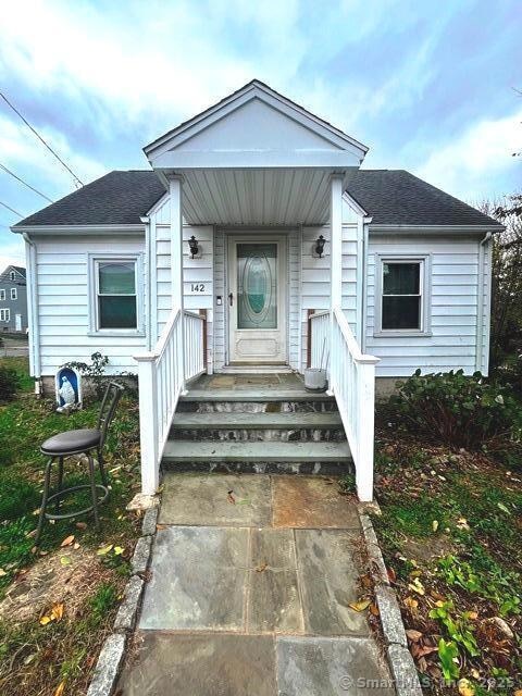
142 Palm St Bridgeport, CT 06610
North Bridgeport NeighborhoodEstimated payment $2,364/month
About This Home
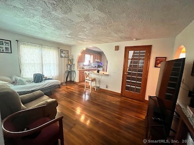
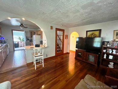
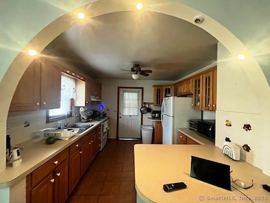
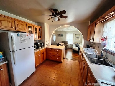
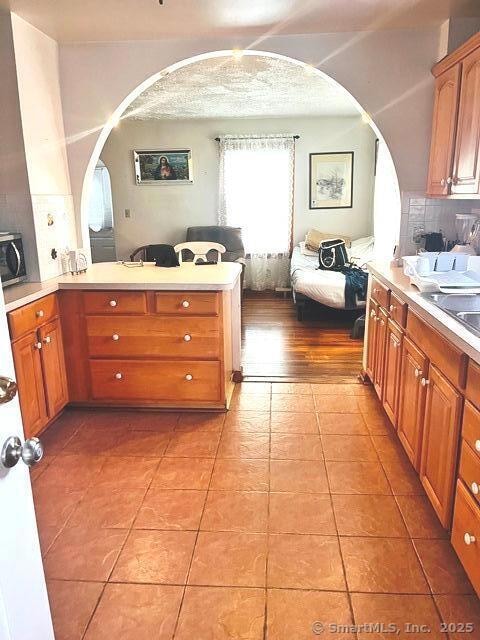
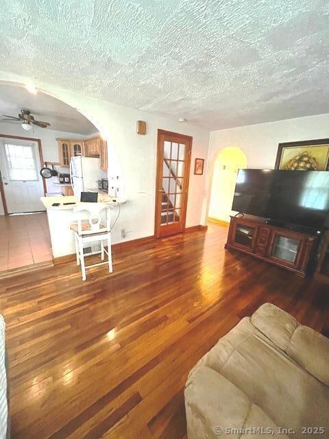
COME SEE THIS BEAUTIFUL CAPE WITH OPEN FLOOR PLAN FROM LIVING ROOM TO KITCHEN, THREE GREAT BEDROOMS WITH TWO IN THE UPSTAIRS LEVEL WITH A SKYLIGHT WINDOW. BEAUTIFUL SUN ROOM. BASEMENT HAS POTENTIAL FOR ADDITIONAL LIVING SPACE. WASHER & DRYER HOOKUP IN THE BASEMENT. 1 CAR GARAGE WITH ADDITIONAL 3 CAR PARKING IN DRIVEWAY. SITUATED ON 0.11 ACRES. THIS HOME WON'T LAST. SOLD AS IS, JUST IN NEED OF YOUR TOUCH. SCHEDULE A SHOWING... WHAT ARE YOU WAITING FOR.
Listing Agent
US Asset Realty Brokerage Phone: (203) 526-6611 License #RES.0813233 Listed on: 11/04/2025
Home Details
Home Type
- Single Family
Est. Annual Taxes
- $5,091
Year Built
- Built in 1949
Lot Details
- 6,970 Sq Ft Lot
- Property is zoned RB
Home Design
- 1,080 Sq Ft Home
- Cape Cod Architecture
- Concrete Foundation
- Asphalt Shingled Roof
- Aluminum Siding
- Masonry
Kitchen
- Gas Range
Bedrooms and Bathrooms
- 3 Bedrooms
Unfinished Basement
- Basement Fills Entire Space Under The House
- Laundry in Basement
Parking
- 1 Car Garage
- Private Driveway
Schools
- Beardsley Elementary School
Utilities
- Window Unit Cooling System
- Heating System Uses Oil
- Electric Water Heater
- Fuel Tank Located in Basement
Listing and Financial Details
- Assessor Parcel Number 28836
Map
Home Values in the Area
Average Home Value in this Area
Tax History
| Year | Tax Paid | Tax Assessment Tax Assessment Total Assessment is a certain percentage of the fair market value that is determined by local assessors to be the total taxable value of land and additions on the property. | Land | Improvement |
|---|---|---|---|---|
| 2025 | $5,091 | $117,180 | $52,110 | $65,070 |
| 2024 | $5,091 | $117,180 | $52,110 | $65,070 |
| 2023 | $5,091 | $117,180 | $52,110 | $65,070 |
| 2022 | $5,091 | $117,180 | $52,110 | $65,070 |
| 2021 | $5,091 | $117,180 | $52,110 | $65,070 |
| 2020 | $5,927 | $109,780 | $50,340 | $59,440 |
| 2019 | $5,927 | $109,780 | $50,340 | $59,440 |
| 2018 | $5,969 | $109,780 | $50,340 | $59,440 |
| 2017 | $5,969 | $109,780 | $50,340 | $59,440 |
| 2016 | $5,969 | $109,780 | $50,340 | $59,440 |
| 2015 | $5,586 | $132,360 | $55,080 | $77,280 |
| 2014 | $5,586 | $132,360 | $55,080 | $77,280 |
Property History
| Date | Event | Price | List to Sale | Price per Sq Ft |
|---|---|---|---|---|
| 11/04/2025 11/04/25 | For Sale | $368,900 | -- | $342 / Sq Ft |
Purchase History
| Date | Type | Sale Price | Title Company |
|---|---|---|---|
| Warranty Deed | $110,000 | -- | |
| Warranty Deed | $110,000 | -- | |
| Warranty Deed | $90,000 | -- | |
| Warranty Deed | $90,000 | -- |
Mortgage History
| Date | Status | Loan Amount | Loan Type |
|---|---|---|---|
| Previous Owner | $90,550 | Unknown |
Source: SmartMLS
MLS Number: 24137821
APN: BRID-002014-000015A
Disclaimer: Certain information contained herein is derived from information provided by parties other than Homes.com. All information provided is deemed reliable, but is not guaranteed to be accurate and should be independently verified.
![]() IDX information is provided exclusively for personal, non-commercial use, and may not be used for any purpose other than to identify prospective properties consumers may be interested in purchasing. Information is deemed reliable but not guaranteed.
IDX information is provided exclusively for personal, non-commercial use, and may not be used for any purpose other than to identify prospective properties consumers may be interested in purchasing. Information is deemed reliable but not guaranteed.
- 644 Huntington Rd
- 154 Rose St
- 2031 E Main St
- 44 Locust St Unit 46
- 199 Bradley St Unit 203
- 1296 Noble Ave
- 230 Hickory St
- 83 Berkeley Place Unit 85
- 202 Goddard Ave
- 744 Park St
- 50 Goddard Ave
- 51 Alpine St
- 112 Glenwood Ave
- 149 Edna Ave Unit 153
- 110 Asylum St
- 170 Livingston Place Unit 172
- 957 William St Unit A
- 1014 Noble Ave
- 1218 Kossuth St
- 178 Island Brook Ave
- 65 Palm St Unit 2
- 527 Huntington Rd Unit 3
- 330 Bradley St
- 1315 Noble Ave Unit B3
- 101 Goddard Ave Unit 3
- 942 William St Unit A
- 744 Boston Ave
- 223 Spring St
- 105 Beardsley Park Terrace Unit 107
- 819 William St Unit 2
- 644 Brooks St Unit 3
- 343 Pearl St Unit 1
- 343 Pearl St Unit 2f
- 1514 Pembroke St Unit 2R
- 1514 Pembroke St Unit 2L
- 230 Texas Ave Unit 230
- 158 Louisiana Ave
- 271 Pennsylvania Ave
- 519 Brooks St
- 519 Brooks St Unit 519 Brooks St.
