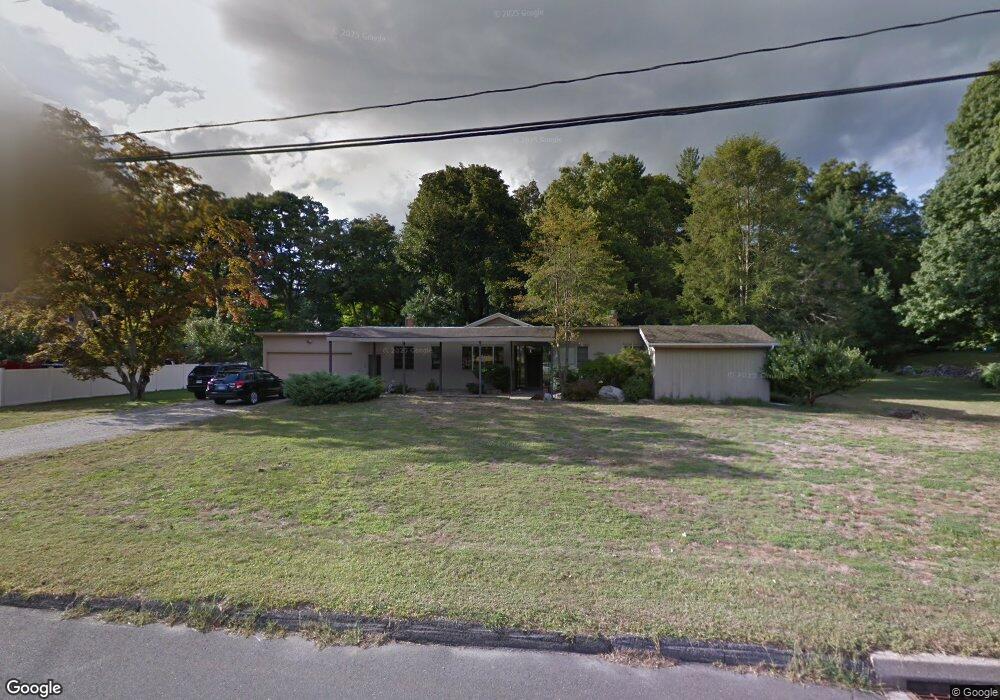
142 Partrick Ave Norwalk, CT 06851
Cranbury NeighborhoodEstimated Value: $449,000 - $879,054
3
Beds
3
Baths
2,408
Sq Ft
$301/Sq Ft
Est. Value
About This Home
This home is located at 142 Partrick Ave, Norwalk, CT 06851 and is currently estimated at $725,514, approximately $301 per square foot. 142 Partrick Ave is a home located in Fairfield County with nearby schools including Wolfpit School, Nathan Hale Middle School, and Norwalk High School.
Ownership History
Date
Name
Owned For
Owner Type
Purchase Details
Closed on
May 12, 2011
Sold by
Josem William T and Josem Marianne
Bought by
Tavello Rockne and Tavello Jill
Current Estimated Value
Purchase Details
Closed on
Dec 19, 2007
Sold by
Josem Marianne and Josem William T
Bought by
Gass Carole B and Woods Stuart
Home Financials for this Owner
Home Financials are based on the most recent Mortgage that was taken out on this home.
Original Mortgage
$500,000
Interest Rate
6.3%
Create a Home Valuation Report for This Property
The Home Valuation Report is an in-depth analysis detailing your home's value as well as a comparison with similar homes in the area
Home Values in the Area
Average Home Value in this Area
Purchase History
| Date | Buyer | Sale Price | Title Company |
|---|---|---|---|
| Tavello Rockne | $250,000 | -- | |
| Tavello Rockne | $250,000 | -- | |
| Gass Carole B | $690,000 | -- | |
| Gass Carole B | $690,000 | -- |
Source: Public Records
Mortgage History
| Date | Status | Borrower | Loan Amount |
|---|---|---|---|
| Previous Owner | Gass Carole B | $500,000 |
Source: Public Records
Tax History Compared to Growth
Tax History
| Year | Tax Paid | Tax Assessment Tax Assessment Total Assessment is a certain percentage of the fair market value that is determined by local assessors to be the total taxable value of land and additions on the property. | Land | Improvement |
|---|---|---|---|---|
| 2025 | $11,102 | $467,670 | $222,080 | $245,590 |
| 2024 | $10,932 | $467,670 | $222,080 | $245,590 |
| 2023 | $9,569 | $383,280 | $177,020 | $206,260 |
| 2022 | $9,419 | $383,280 | $177,020 | $206,260 |
| 2021 | $8,014 | $383,280 | $177,020 | $206,260 |
| 2020 | $9,048 | $383,280 | $177,020 | $206,260 |
| 2019 | $8,738 | $383,280 | $177,020 | $206,260 |
| 2018 | $8,895 | $343,030 | $191,020 | $152,010 |
| 2017 | $8,584 | $343,030 | $191,020 | $152,010 |
| 2016 | $8,727 | $343,030 | $191,020 | $152,010 |
| 2015 | $7,838 | $343,030 | $191,020 | $152,010 |
| 2014 | $8,589 | $343,030 | $191,020 | $152,010 |
Source: Public Records
Map
Nearby Homes
- 4 Frank St
- 8 Stonecrop Rd
- 9 Trailside Dr
- 101 Chestnut Hill Rd
- 27 Stonecrop Rd
- 7 Peaceful Ln
- 2 Wildgoose Ln
- 35 Mohawk Dr
- 41 Mohawk Dr
- 33 Pequot Trail
- 30 Honeysuckle Dr
- 3 Tanglewood Ln
- 9 Allen Ct
- 4 Newtown Turnpike
- 32 Thistle Rd
- 13 Orchard Hill Rd
- 180 E Rocks Rd
- 56 Partrick Rd
- 142 Wolfpit Ave
- 57 Partrick Rd
- 144 Partrick Ave
- 138 Partrick Ave
- 314 Newtown Ave
- 316 Newtown Ave
- 141 Partrick Ave
- 146 Partrick Ave
- 139 Partrick Ave
- 136 Partrick Ave
- 312 Newtown Ave
- 145 Partrick Ave
- 318 Newtown Ave
- 310 Newtown Ave
- 135 1/2 Partrick Ave
- 132 Partrick Ave
- 143 Partrick Ave
- 134 Partrick Ave
- 132 1/2 Partrick Ave
- 137 Partrick Ave
- 147 Partrick Ave
- 321 Newtown Ave