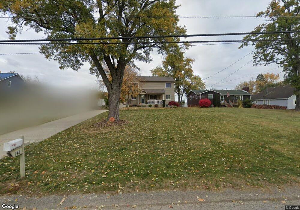
142 Pear Orchard Rd Coraopolis, PA 15108
Estimated Value: $311,000 - $430,000
4
Beds
2
Baths
1,900
Sq Ft
$202/Sq Ft
Est. Value
About This Home
This home is located at 142 Pear Orchard Rd, Coraopolis, PA 15108 and is currently estimated at $384,097, approximately $202 per square foot. 142 Pear Orchard Rd is a home located in Allegheny County with nearby schools including Moon Area High School and Montessori Children's Community.
Ownership History
Date
Name
Owned For
Owner Type
Purchase Details
Closed on
Jan 17, 2002
Sold by
Jones George S and Hillen Jones Carolyn Sue
Bought by
Jones George S and Hillen Jones Carolyn Sue
Current Estimated Value
Purchase Details
Closed on
Apr 28, 2000
Sold by
Meanor Richard G and Meanor Patricia A
Bought by
Jones George S and Hillen Carolyn Sue
Purchase Details
Closed on
Aug 19, 1998
Sold by
Wheeler Roselle C and Orourke Roselle W
Bought by
Meanor Richard C and Meanor Patricia A
Purchase Details
Closed on
Jan 1, 1900
Create a Home Valuation Report for This Property
The Home Valuation Report is an in-depth analysis detailing your home's value as well as a comparison with similar homes in the area
Home Values in the Area
Average Home Value in this Area
Purchase History
| Date | Buyer | Sale Price | Title Company |
|---|---|---|---|
| Jones George S | -- | -- | |
| Jones George S | $76,000 | -- | |
| Meanor Richard C | $49,500 | -- | |
| -- | -- | -- |
Source: Public Records
Tax History Compared to Growth
Tax History
| Year | Tax Paid | Tax Assessment Tax Assessment Total Assessment is a certain percentage of the fair market value that is determined by local assessors to be the total taxable value of land and additions on the property. | Land | Improvement |
|---|---|---|---|---|
| 2025 | $5,404 | $172,900 | $36,400 | $136,500 |
| 2024 | $5,404 | $172,900 | $36,400 | $136,500 |
| 2023 | $5,212 | $172,900 | $36,400 | $136,500 |
| 2022 | $5,212 | $172,900 | $36,400 | $136,500 |
| 2021 | $5,510 | $172,900 | $36,400 | $136,500 |
| 2020 | $4,697 | $172,900 | $36,400 | $136,500 |
| 2019 | $4,568 | $159,800 | $36,400 | $123,400 |
| 2018 | $756 | $159,800 | $36,400 | $123,400 |
| 2017 | $4,319 | $159,800 | $36,400 | $123,400 |
| 2016 | $756 | $159,800 | $36,400 | $123,400 |
| 2015 | $756 | $159,800 | $36,400 | $123,400 |
| 2014 | $4,206 | $159,800 | $36,400 | $123,400 |
Source: Public Records
Map
Nearby Homes
- 135 Pear Orchard Rd
- 204 Ascot Ct
- 203 Ascot Ct
- 162 Foxwood Rd
- 209 Lockheed Dr
- 174 Lockheed Dr
- 176 Lockheed Dr
- 178 Lockheed Dr
- 179 Lockheed Dr
- 506 Isabella Ct
- 182 Lockheed Dr
- 511 Isabella Ct
- 191 Rosemont Dr
- 134 Becks Run Rd
- 115 Elm Ln
- 824 Balmoral Ct
- 326 College Park Dr Unit 41
- 221 Springer Dr
- Eisenhower Plan at Victoria Ridge
- Cleveland Plan at Victoria Ridge
- 140 Pear Orchard Rd
- 144 Pear Orchard Rd
- 146 Pear Orchard Rd
- 138 Pear Orchard Rd
- 148 Pear Orchard Rd
- 136 Pear Orchard Rd
- 137 Pear Orchard Rd
- 139 Pear Orchard Rd
- 145 Pear Orchard Rd
- 134 Pear Orchard Rd
- 150 Pear Orchard Rd
- 147 Pear Orchard Rd
- 152 Pear Orchard Rd
- 127 Pear Orchard Rd
- 154 Pear Orchard Rd
- 123 Pear Orchard Rd
- 156 Pear Orchard Rd
- 119 Pear Orchard Rd
- 440 Moon Clinton Rd
- 444 Moon Clinton Rd