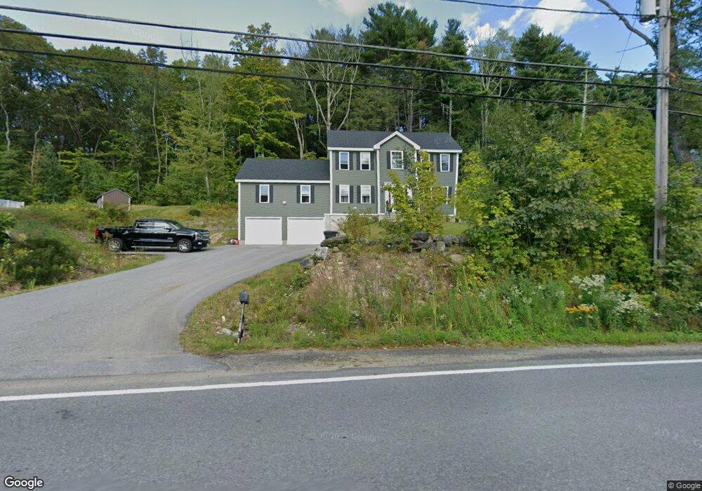
142 Pommogussett Rd Rutland, MA 01543
Estimated Value: $621,057 - $705,000
3
Beds
3
Baths
2,248
Sq Ft
$294/Sq Ft
Est. Value
About This Home
This home is located at 142 Pommogussett Rd, Rutland, MA 01543 and is currently estimated at $660,014, approximately $293 per square foot. 142 Pommogussett Rd is a home with nearby schools including Wachusett Regional High School.
Ownership History
Date
Name
Owned For
Owner Type
Purchase Details
Closed on
Oct 18, 2025
Sold by
Zarella Robert B and Sheridan Amanda
Bought by
Zarella Robert B and Sheridan Amanda
Current Estimated Value
Home Financials for this Owner
Home Financials are based on the most recent Mortgage that was taken out on this home.
Original Mortgage
$458,892
Outstanding Balance
$458,457
Interest Rate
6.26%
Mortgage Type
New Conventional
Estimated Equity
$201,557
Purchase Details
Closed on
Nov 6, 2020
Sold by
Zarella Robert B
Bought by
Zarella Robert B and Sheridan Amanda
Home Financials for this Owner
Home Financials are based on the most recent Mortgage that was taken out on this home.
Original Mortgage
$345,186
Interest Rate
2.8%
Mortgage Type
FHA
Purchase Details
Closed on
Oct 8, 2020
Sold by
Stoney Brook Estates Llc
Bought by
Zarella Robert
Home Financials for this Owner
Home Financials are based on the most recent Mortgage that was taken out on this home.
Original Mortgage
$345,186
Interest Rate
2.8%
Mortgage Type
FHA
Create a Home Valuation Report for This Property
The Home Valuation Report is an in-depth analysis detailing your home's value as well as a comparison with similar homes in the area
Home Values in the Area
Average Home Value in this Area
Purchase History
| Date | Buyer | Sale Price | Title Company |
|---|---|---|---|
| Zarella Robert B | -- | -- | |
| Zarella Robert B | -- | None Available | |
| Zarella Robert | $409,900 | None Available |
Source: Public Records
Mortgage History
| Date | Status | Borrower | Loan Amount |
|---|---|---|---|
| Open | Zarella Robert B | $458,892 | |
| Previous Owner | Zarella Robert | $345,186 |
Source: Public Records
Tax History Compared to Growth
Tax History
| Year | Tax Paid | Tax Assessment Tax Assessment Total Assessment is a certain percentage of the fair market value that is determined by local assessors to be the total taxable value of land and additions on the property. | Land | Improvement |
|---|---|---|---|---|
| 2025 | $7,611 | $534,500 | $84,000 | $450,500 |
| 2024 | $7,522 | $507,200 | $80,300 | $426,900 |
| 2023 | $6,816 | $496,800 | $75,700 | $421,100 |
| 2022 | $6,359 | $402,700 | $63,900 | $338,800 |
| 2021 | $2,315 | $138,600 | $32,000 | $106,600 |
| 2020 | $532 | $30,200 | $30,200 | $0 |
| 2019 | $1,030 | $57,600 | $57,600 | $0 |
| 2018 | $1,044 | $57,600 | $57,600 | $0 |
| 2017 | $1,055 | $57,600 | $57,600 | $0 |
| 2016 | $1,021 | $58,800 | $58,800 | $0 |
Source: Public Records
Map
Nearby Homes
- 35 Brintnal Dr
- 40 Brunelle Dr
- 2 Simon Davis Dr
- 16 Richards Ave
- 73 Brintnal Dr
- 101 Brintnal Dr
- 55 Pommogussett Rd
- 25 Watson Ln
- 5 Miles Rd
- 32 Pommogussett Rd Unit 1
- 175 Glenwood Rd
- 10 Soucy Dr
- 47 Woodside Ave
- 51 Woodside Ave
- 28 Forest Hill Dr
- 569 E County Rd
- 11 Lewis St
- 21 Lewis St
- 12 Lewis St
- 6 Lewis St
- 2 Brintnal Dr
- 140 Pommogussett Rd
- 5 Brintnal Dr
- 147 Pommogussett Rd
- 10 Brintnal Dr
- 139 Pommogussett Rd
- 4 Brintnal Dr
- 3 Brintnal Dr
- 137 Pommogussett Rd
- 13 Brintnal Dr
- 149 Pommogussett Rd
- 6 Brintnal Dr
- 8 Arrowhead Way
- 3 Arrowhead Way
- 135 Pommogussett Rd
- 1 Sassawanna Rd
- 152 Pommogussett Rd
- 16 Arrowhead Way
- 6 Arrowhead Way
- 14 Arrowhead Way