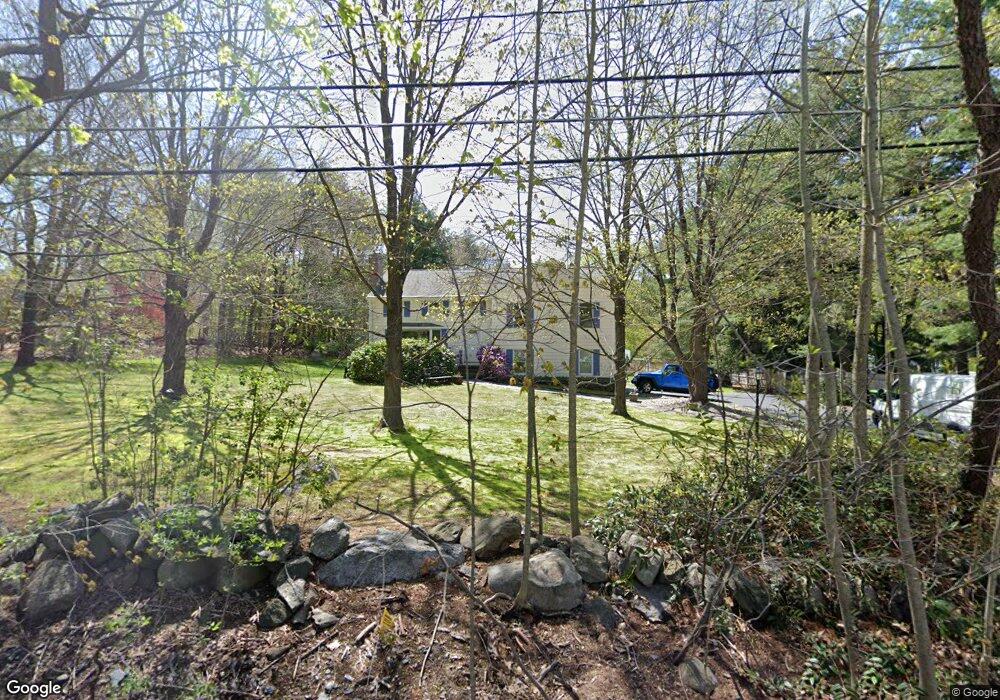
142 Powers Rd Sudbury, MA 01776
Estimated Value: $962,661 - $1,162,000
3
Beds
3
Baths
1,756
Sq Ft
$596/Sq Ft
Est. Value
About This Home
This home is located at 142 Powers Rd, Sudbury, MA 01776 and is currently estimated at $1,047,165, approximately $596 per square foot. 142 Powers Rd is a home located in Middlesex County with nearby schools including Josiah Haynes Elementary School, Ephraim Curtis Middle School, and Lincoln-Sudbury Regional High School.
Ownership History
Date
Name
Owned For
Owner Type
Purchase Details
Closed on
Mar 13, 2019
Sold by
Blazewicz Stanley J and Dixon Camille M
Bought by
Camille M Dixon Ret
Current Estimated Value
Purchase Details
Closed on
Oct 29, 1997
Sold by
Robinson Rt and Robinson Steven I
Bought by
Blazewicz Stanley J and Dixon Camille M
Home Financials for this Owner
Home Financials are based on the most recent Mortgage that was taken out on this home.
Original Mortgage
$219,600
Interest Rate
7.31%
Mortgage Type
Purchase Money Mortgage
Create a Home Valuation Report for This Property
The Home Valuation Report is an in-depth analysis detailing your home's value as well as a comparison with similar homes in the area
Home Values in the Area
Average Home Value in this Area
Purchase History
| Date | Buyer | Sale Price | Title Company |
|---|---|---|---|
| Camille M Dixon Ret | -- | -- | |
| Camille M Dixon Ret | -- | -- | |
| Blazewicz Stanley J | $244,000 | -- | |
| Blazewicz Stanley J | $244,000 | -- |
Source: Public Records
Mortgage History
| Date | Status | Borrower | Loan Amount |
|---|---|---|---|
| Previous Owner | Blazewicz Stanley J | $219,600 | |
| Previous Owner | Blazewicz Stanley J | $70,000 | |
| Previous Owner | Blazewicz Stanley J | $30,000 |
Source: Public Records
Tax History Compared to Growth
Tax History
| Year | Tax Paid | Tax Assessment Tax Assessment Total Assessment is a certain percentage of the fair market value that is determined by local assessors to be the total taxable value of land and additions on the property. | Land | Improvement |
|---|---|---|---|---|
| 2025 | $13,169 | $899,500 | $440,200 | $459,300 |
| 2024 | $12,733 | $871,500 | $427,400 | $444,100 |
| 2023 | $12,665 | $803,100 | $395,800 | $407,300 |
| 2022 | $11,664 | $646,200 | $363,400 | $282,800 |
| 2021 | $11,095 | $589,200 | $363,400 | $225,800 |
| 2020 | $10,871 | $589,200 | $363,400 | $225,800 |
| 2019 | $10,553 | $589,200 | $363,400 | $225,800 |
| 2018 | $10,328 | $576,000 | $387,400 | $188,600 |
| 2017 | $9,651 | $544,000 | $368,600 | $175,400 |
| 2016 | $9,395 | $527,800 | $354,600 | $173,200 |
| 2015 | $8,819 | $501,100 | $341,000 | $160,100 |
| 2014 | $8,775 | $486,700 | $331,000 | $155,700 |
Source: Public Records
Map
Nearby Homes
- 16 Blacksmith Dr
- 42 Dakin Rd
- 369 Border Rd
- 67 Powder Mill Rd
- 57 Longfellow Rd
- 29 Black Birch Ln Unit 29
- 589 North Rd
- 9 Black Birch Ln Unit 9
- 96 Forest Ridge Rd Unit 96
- 5 Oak Ridge Dr Unit 7
- 10 Oak Ridge Dr Unit 5
- 40 Rookery Ln Unit 5
- 72 Rookery Ln Unit 3
- 401 Emery Ln Unit 104
- 80 N Branch Rd
- 24 Rookery Ln Unit 6
- 56 Rookery Ln Unit 4
- 5 Taintor Dr
- 250 Great Rd
- 1844 Main St Unit 1844
- 150 Powers Rd
- 84 Cedar Creek Rd
- 139 Powers Rd
- 130 Powers Rd
- 130 Powers Rd Unit 1
- 105 Willard Grant Rd
- 105 Willard Grant Rd Unit 105
- 147 Powers Rd
- 111 Willard Grant Rd
- 97 Willard Grant Rd
- 158 Powers Rd
- 78 Cedar Creek Rd
- 125 Powers Rd
- 153 Powers Rd
- 91 Willard Grant Rd
- 120 Powers Rd
- 161 Powers Rd
- 112 Willard Grant Rd
- 70 Cedar Creek Rd
- 77 Cedar Creek Rd