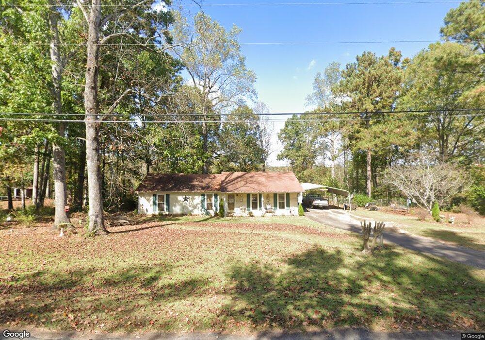
142 Rob Roy Rd Lagrange, GA 30240
Estimated Value: $183,000 - $231,000
3
Beds
2
Baths
1,444
Sq Ft
$141/Sq Ft
Est. Value
About This Home
This home is located at 142 Rob Roy Rd, Lagrange, GA 30240 and is currently estimated at $204,007, approximately $141 per square foot. 142 Rob Roy Rd is a home located in Troup County with nearby schools including Long Cane Elementary School, Berta Weathersbee Elementary School, and Whitesville Road Elementary School.
Ownership History
Date
Name
Owned For
Owner Type
Purchase Details
Closed on
Aug 11, 1999
Sold by
Toni Mcgill
Bought by
Brown Billy C and Toni Mcgill
Current Estimated Value
Purchase Details
Closed on
Apr 28, 1994
Sold by
Hans J Sabukosek
Bought by
Toni Mcgill
Purchase Details
Closed on
Dec 1, 1988
Bought by
Hans J Sabukosek
Purchase Details
Closed on
Jan 1, 1981
Purchase Details
Closed on
Dec 23, 1978
Purchase Details
Closed on
Nov 13, 1978
Purchase Details
Closed on
Sep 25, 1978
Purchase Details
Closed on
May 30, 1975
Create a Home Valuation Report for This Property
The Home Valuation Report is an in-depth analysis detailing your home's value as well as a comparison with similar homes in the area
Purchase History
| Date | Buyer | Sale Price | Title Company |
|---|---|---|---|
| Brown Billy C | -- | -- | |
| Toni Mcgill | $58,200 | -- | |
| Hans J Sabukosek | -- | -- | |
| -- | $49,400 | -- | |
| -- | $42,400 | -- | |
| -- | $4,300 | -- | |
| -- | -- | -- | |
| -- | -- | -- |
Source: Public Records
Tax History
| Year | Tax Paid | Tax Assessment Tax Assessment Total Assessment is a certain percentage of the fair market value that is determined by local assessors to be the total taxable value of land and additions on the property. | Land | Improvement |
|---|---|---|---|---|
| 2025 | $1,840 | $72,884 | $14,000 | $58,884 |
| 2024 | $1,671 | $63,276 | $14,000 | $49,276 |
| 2023 | $1,665 | $63,020 | $14,000 | $49,020 |
| 2022 | $1,511 | $56,140 | $10,000 | $46,140 |
| 2021 | $1,136 | $39,640 | $10,000 | $29,640 |
| 2020 | $1,015 | $35,640 | $6,000 | $29,640 |
| 2019 | $1,067 | $37,360 | $6,000 | $31,360 |
| 2018 | $909 | $32,120 | $6,160 | $25,960 |
| 2017 | $909 | $32,120 | $6,160 | $25,960 |
| 2016 | $887 | $31,409 | $6,160 | $25,249 |
| 2015 | $873 | $30,873 | $6,160 | $24,713 |
| 2014 | $835 | $29,572 | $6,160 | $23,412 |
| 2013 | -- | $30,791 | $6,160 | $24,631 |
Source: Public Records
Map
Nearby Homes
- 105 Redwood Dr
- 22 Freeman Rd
- 0 Glass Bridge Rd Unit 10679358
- 640 Hudson Rd
- 266 Glass Bridge Rd
- 288 Bradfield Dr
- 808 S Fling Rd
- 2239 Pegasus Pkwy
- 0 Bradfield Dr Unit 10568803
- 8 Horace Carter Rd
- 509 Connie Dr
- 112 Foxdale Dr
- 427 Fling Rd
- 119 Plymouth Dr
- 402 Ginger Cir
- 102 Bridgewater Dr
- 113 Colonial Ct Unit 100
- 311 Cumberland Dr
- 124 Lincoln Ln
- 101 Ivy Springs Dr
- 140 Rob Roy Rd
- 146 Rob Roy Rd
- 145 Rob Roy Rd
- 143 Rob Roy Rd
- 136 Rob Roy Rd
- 76 Maefield Dr
- 147 Rob Roy Rd
- 137 Rob Roy Rd
- 134 Rob Roy Rd
- 135 Rob Roy Rd
- 40 Maefield Dr
- 5038 Old West Point Rd
- 5036 Old West Point Rd
- 5036 Old Point W
- 5040 Old West Point Rd
- 5034 Old West Point Rd
- 132 Rob Roy Rd
- 55 Maefield Dr
- 133 Rob Roy Rd
- 5032 Old West Point Rd
Your Personal Tour Guide
Ask me questions while you tour the home.