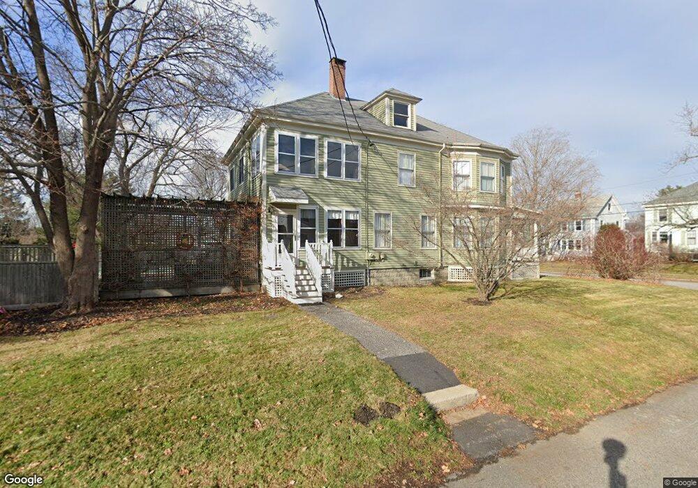
142 Rockland Ave Portland, ME 04102
Rosemont NeighborhoodEstimated Value: $966,000 - $1,508,000
5
Beds
3
Baths
3,784
Sq Ft
$330/Sq Ft
Est. Value
About This Home
This home is located at 142 Rockland Ave, Portland, ME 04102 and is currently estimated at $1,247,585, approximately $329 per square foot. 142 Rockland Ave is a home located in Cumberland County with nearby schools including Amanda C Rowe School, Lincoln Middle School, and Breakwater School.
Ownership History
Date
Name
Owned For
Owner Type
Purchase Details
Closed on
Oct 13, 2010
Sold by
Coyne Kevin P and Kemna Diann T
Bought by
Coyne Kevin P and Coyne Diann T
Current Estimated Value
Home Financials for this Owner
Home Financials are based on the most recent Mortgage that was taken out on this home.
Original Mortgage
$319,000
Interest Rate
4.36%
Mortgage Type
Purchase Money Mortgage
Create a Home Valuation Report for This Property
The Home Valuation Report is an in-depth analysis detailing your home's value as well as a comparison with similar homes in the area
Home Values in the Area
Average Home Value in this Area
Purchase History
| Date | Buyer | Sale Price | Title Company |
|---|---|---|---|
| Coyne Kevin P | -- | -- |
Source: Public Records
Mortgage History
| Date | Status | Borrower | Loan Amount |
|---|---|---|---|
| Closed | Coyne Kevin P | $319,000 |
Source: Public Records
Tax History Compared to Growth
Tax History
| Year | Tax Paid | Tax Assessment Tax Assessment Total Assessment is a certain percentage of the fair market value that is determined by local assessors to be the total taxable value of land and additions on the property. | Land | Improvement |
|---|---|---|---|---|
| 2024 | $11,196 | $745,900 | $88,500 | $657,400 |
| 2023 | $10,748 | $745,900 | $88,500 | $657,400 |
| 2022 | $10,152 | $745,900 | $88,500 | $657,400 |
| 2021 | $9,689 | $745,900 | $88,500 | $657,400 |
| 2020 | $8,988 | $385,600 | $65,600 | $320,000 |
| 2019 | $8,988 | $385,600 | $65,600 | $320,000 |
| 2018 | $8,668 | $385,600 | $65,600 | $320,000 |
| 2017 | $8,348 | $385,600 | $65,600 | $320,000 |
| 2016 | $8,140 | $385,600 | $65,600 | $320,000 |
| 2015 | $7,955 | $385,600 | $65,600 | $320,000 |
| 2014 | $7,712 | $385,600 | $65,600 | $320,000 |
Source: Public Records
Map
Nearby Homes
- 63A Capisic St
- 159 Bancroft St
- 18 Stoneledge Dr
- 4 Fairview St
- 1542 Congress St
- 37 Tremont St
- 7 Twin Knolls Ln
- 160 Craigie St
- 0 Hillcrest Ave
- 6 Highland St
- 147 Pleasant Ave Unit 2
- 296 Brighton Ave
- 1346 Westbrook St
- 24 Edwards St
- 99 Webb St
- 89 Clinton St
- 232 Brighton Ave
- 44 Pleasant Ave
- 162 Hobart St
- 65 Mcauley Way Unit 506
- 148 Rockland Ave
- 145 Rockland Ave
- 134 Rockland Ave
- 43 Hastings St
- 154 Rockland Ave
- 46 Hastings St
- 147 Rockland Ave
- 67 Hastings St
- 126 Rockland Ave
- 151 Rockland Ave
- 39 Hastings St
- 64 Hastings St
- 68 MacHigonne St
- 68 Hastings St
- 72 MacHigonne St
- 38 Hastings St
- 53 MacHigonne St
- 75 Hastings St
- 72 Hastings St
- 36 MacHigonne St