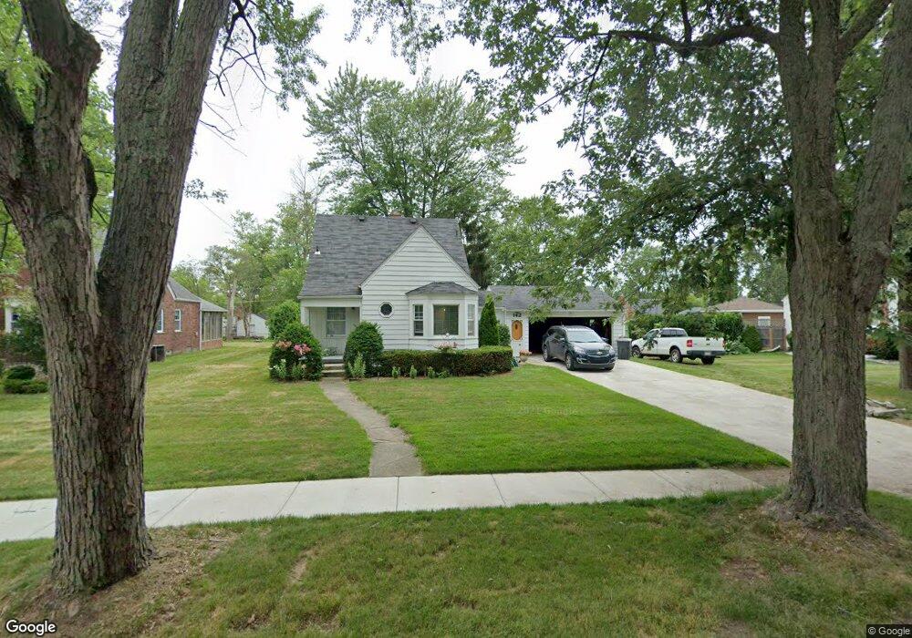
142 S Avery Rd Waterford, MI 48328
Waterford Township NeighborhoodEstimated Value: $229,000 - $253,000
3
Beds
1
Bath
916
Sq Ft
$264/Sq Ft
Est. Value
About This Home
This home is located at 142 S Avery Rd, Waterford, MI 48328 and is currently estimated at $241,623, approximately $263 per square foot. 142 S Avery Rd is a home located in Oakland County with nearby schools including Knudsen Elementary School, Mason Middle School, and Waterford Mott High School.
Ownership History
Date
Name
Owned For
Owner Type
Purchase Details
Closed on
Apr 22, 2020
Sold by
Trudell Matthew T and Trudell Kelly L
Bought by
Trudell Matthew T and Trudell Kelly L
Current Estimated Value
Purchase Details
Closed on
Feb 25, 2005
Sold by
Kirken Jon P and Kirken Brenda
Bought by
Trudell Matthew T and Trudell Kelly L
Home Financials for this Owner
Home Financials are based on the most recent Mortgage that was taken out on this home.
Original Mortgage
$147,000
Outstanding Balance
$75,018
Interest Rate
5.71%
Mortgage Type
Purchase Money Mortgage
Estimated Equity
$166,605
Purchase Details
Closed on
Feb 21, 2005
Sold by
Doll Carol A and Estate Of Harriet E Kirken
Bought by
Doll Carol A and Kirken Jon P
Home Financials for this Owner
Home Financials are based on the most recent Mortgage that was taken out on this home.
Original Mortgage
$147,000
Outstanding Balance
$75,018
Interest Rate
5.71%
Mortgage Type
Purchase Money Mortgage
Estimated Equity
$166,605
Create a Home Valuation Report for This Property
The Home Valuation Report is an in-depth analysis detailing your home's value as well as a comparison with similar homes in the area
Home Values in the Area
Average Home Value in this Area
Purchase History
| Date | Buyer | Sale Price | Title Company |
|---|---|---|---|
| Trudell Matthew T | -- | None Available | |
| Trudell Matthew T | $104,666 | -- | |
| Trudell Matthew T | $52,333 | -- | |
| Doll Carol A | -- | -- |
Source: Public Records
Mortgage History
| Date | Status | Borrower | Loan Amount |
|---|---|---|---|
| Open | Trudell Matthew T | $147,000 |
Source: Public Records
Tax History Compared to Growth
Tax History
| Year | Tax Paid | Tax Assessment Tax Assessment Total Assessment is a certain percentage of the fair market value that is determined by local assessors to be the total taxable value of land and additions on the property. | Land | Improvement |
|---|---|---|---|---|
| 2024 | $1,050 | $97,590 | $0 | $0 |
| 2023 | $995 | $81,210 | $0 | $0 |
| 2022 | $1,633 | $76,750 | $0 | $0 |
| 2021 | $1,546 | $75,190 | $0 | $0 |
| 2020 | $911 | $65,890 | $0 | $0 |
| 2019 | $1,511 | $58,550 | $0 | $0 |
| 2018 | $1,500 | $53,960 | $0 | $0 |
| 2017 | $1,382 | $53,960 | $0 | $0 |
| 2016 | $1,379 | $48,430 | $0 | $0 |
| 2015 | -- | $42,700 | $0 | $0 |
| 2014 | -- | $39,270 | $0 | $0 |
| 2011 | -- | $40,870 | $0 | $0 |
Source: Public Records
Map
Nearby Homes
- 4199 Motorway Dr
- 111 Willow Way
- 4405 Motorway Dr
- 4227 Lanette Dr
- 4433 Motorway Dr
- 549 Grixdale Ln
- 126 S Roslyn Rd
- 43 Doremus Ave
- 188 N Avery Rd
- 85 Doremus Ave
- 577 Lakeside Dr
- 445 Lakeside Dr
- 4003 Elmhurst Rd
- 87 N Roslyn Rd
- 3977 Cresthaven Dr
- 256 Madeleine Ln
- 4025 Cresthaven Dr
- 257 Madeleine Ln
- 89 Clive Ave
- 3860 Lawley Ave
- 122 S Avery Rd
- 135 Gateway Dr
- 145 Gateway Dr
- 125 Gateway Dr
- 169 Gateway Dr
- 117 Gateway Dr
- 110 S Avery Rd
- 175 Gateway Dr
- 109 Gateway Dr
- 121 S Avery Rd Unit Bldg-Unit
- 121 S Avery Rd
- 104 S Avery Rd
- 115 S Avery Rd
- 167 S Avery Rd
- 147 S Avery Rd
- 105 Gateway Dr
- 185 S Avery Rd
- 194 S Avery Rd
- 105 S Avery Rd
- 124 Exmoor Rd