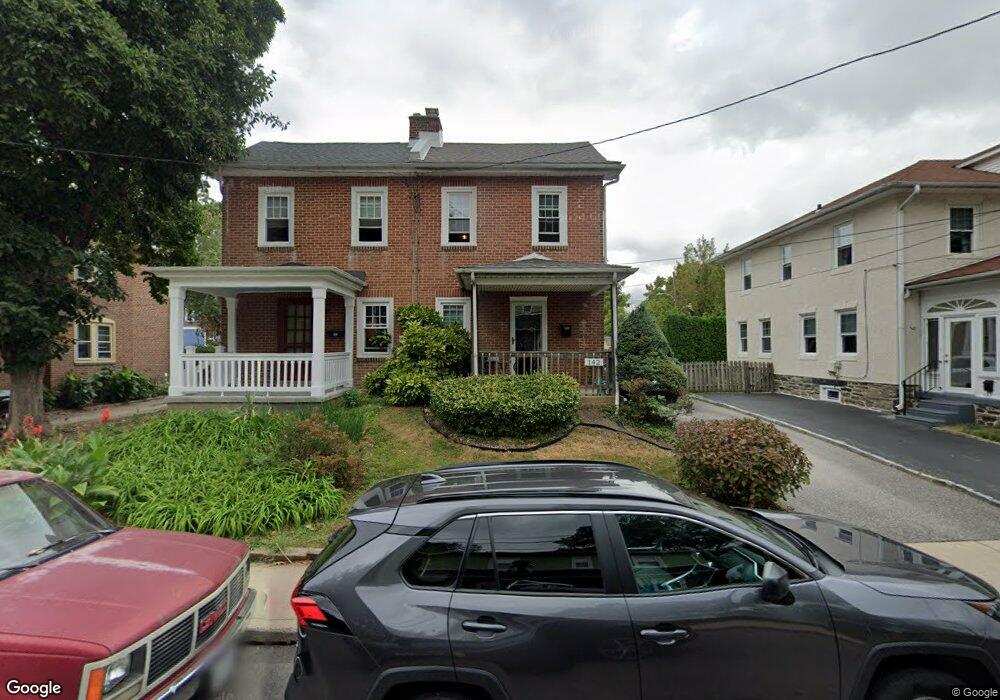
142 Saint Pauls Rd Ardmore, PA 19003
Estimated Value: $350,000 - $436,848
3
Beds
1
Bath
1,280
Sq Ft
$314/Sq Ft
Est. Value
About This Home
This home is located at 142 Saint Pauls Rd, Ardmore, PA 19003 and is currently estimated at $401,962, approximately $314 per square foot. 142 Saint Pauls Rd is a home located in Montgomery County with nearby schools including Penn Valley School, Welsh Valley Middle School, and Lower Merion High School.
Ownership History
Date
Name
Owned For
Owner Type
Purchase Details
Closed on
Oct 11, 2019
Sold by
Bitterman Anne S
Bought by
Dantis Patricia Susan
Current Estimated Value
Home Financials for this Owner
Home Financials are based on the most recent Mortgage that was taken out on this home.
Original Mortgage
$212,624
Outstanding Balance
$185,886
Interest Rate
3.4%
Mortgage Type
New Conventional
Estimated Equity
$216,076
Purchase Details
Closed on
Jun 16, 1988
Bought by
Bitterman Leroy E and Bitterman Anne S
Create a Home Valuation Report for This Property
The Home Valuation Report is an in-depth analysis detailing your home's value as well as a comparison with similar homes in the area
Home Values in the Area
Average Home Value in this Area
Purchase History
| Date | Buyer | Sale Price | Title Company |
|---|---|---|---|
| Dantis Patricia Susan | $219,200 | None Available | |
| Bitterman Leroy E | -- | -- |
Source: Public Records
Mortgage History
| Date | Status | Borrower | Loan Amount |
|---|---|---|---|
| Open | Dantis Patricia Susan | $212,624 |
Source: Public Records
Tax History Compared to Growth
Tax History
| Year | Tax Paid | Tax Assessment Tax Assessment Total Assessment is a certain percentage of the fair market value that is determined by local assessors to be the total taxable value of land and additions on the property. | Land | Improvement |
|---|---|---|---|---|
| 2025 | $4,563 | $109,250 | $36,990 | $72,260 |
| 2024 | $4,563 | $109,250 | $36,990 | $72,260 |
| 2023 | $4,373 | $109,250 | $36,990 | $72,260 |
| 2022 | $4,291 | $109,250 | $36,990 | $72,260 |
| 2021 | $4,194 | $109,250 | $36,990 | $72,260 |
| 2020 | $4,091 | $109,250 | $36,990 | $72,260 |
| 2019 | $4,019 | $109,250 | $36,990 | $72,260 |
| 2018 | $4,020 | $109,250 | $36,990 | $72,260 |
| 2017 | $3,871 | $109,250 | $36,990 | $72,260 |
| 2016 | $3,829 | $109,250 | $36,990 | $72,260 |
| 2015 | $3,570 | $109,250 | $36,990 | $72,260 |
| 2014 | $3,570 | $109,250 | $36,990 | $72,260 |
Source: Public Records
Map
Nearby Homes
- 64 E Spring Ave
- 140 Walnut Ave
- 222 Lippincott Ave
- 101 Grandview Rd
- 2814 Saint Marys Rd
- 761 Hathaway Ln
- 818 Clifford Ave
- 221 Ardmore Ave
- 754 Oak View Rd
- 14 Simpson Rd
- 1525 W Wynnewood Rd
- 2939 Berkley Rd
- 236 W Spring Ave
- 2321 Bryn Mawr Ave
- 2409 Belmont Ave
- 442 E Spring Ave
- 1968 W Montgomery Ave
- 2528 Rosemont Ave
- 383 Lakeside Rd Unit G2
- 383 Lakeside Rd Unit 105
- 144 Saint Pauls Rd Unit 408
- 140 Saint Pauls Rd
- 146 Saint Pauls Rd
- 138 Saint Pauls Rd
- 114 Brookfield Terrace
- 148 Saint Pauls Rd
- 112 Brookfield Terrace
- 108 Brookfield Terrace
- 110 Brookfield Terrace
- 124 Drexel Rd
- 136 Saint Pauls Rd
- 150 Saint Pauls Rd
- 106 Brookfield Terrace
- 126 Drexel Rd
- 134 Saint Pauls Rd
- 145 Simpson Rd
- 152 Saint Pauls Rd
- 104 Brookfield Terrace
- 147 Simpson Rd
- 137 Simpson Rd