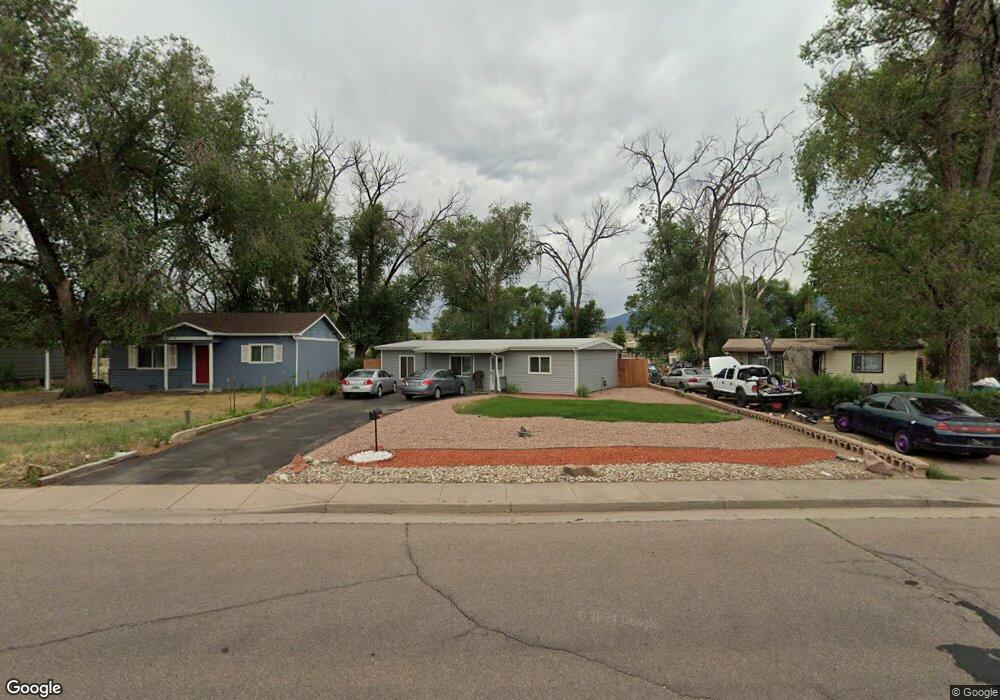
142 Security Blvd Colorado Springs, CO 80911
Fountain Valley Ranch NeighborhoodEstimated Value: $266,000 - $288,000
1
Bed
1
Bath
720
Sq Ft
$384/Sq Ft
Est. Value
About This Home
This home is located at 142 Security Blvd, Colorado Springs, CO 80911 and is currently estimated at $276,589, approximately $384 per square foot. 142 Security Blvd is a home located in El Paso County with nearby schools including Venetucci Elementary School, Watson Junior High School, and Widefield High School.
Ownership History
Date
Name
Owned For
Owner Type
Purchase Details
Closed on
Jul 19, 2018
Sold by
Walker Preston G
Bought by
Walker Charsanna and Walker Preston G
Current Estimated Value
Purchase Details
Closed on
Mar 27, 1998
Sold by
Raby William K and Raby Erin M
Bought by
Walker Preston G
Home Financials for this Owner
Home Financials are based on the most recent Mortgage that was taken out on this home.
Original Mortgage
$77,875
Outstanding Balance
$15,133
Interest Rate
7.37%
Mortgage Type
VA
Estimated Equity
$261,456
Purchase Details
Closed on
Mar 24, 1995
Sold by
Merleau Marc
Bought by
Raby William K and Raby Erin M
Home Financials for this Owner
Home Financials are based on the most recent Mortgage that was taken out on this home.
Original Mortgage
$66,198
Interest Rate
8.72%
Mortgage Type
VA
Create a Home Valuation Report for This Property
The Home Valuation Report is an in-depth analysis detailing your home's value as well as a comparison with similar homes in the area
Home Values in the Area
Average Home Value in this Area
Purchase History
| Date | Buyer | Sale Price | Title Company |
|---|---|---|---|
| Walker Charsanna | -- | None Available | |
| Walker Preston G | $77,875 | -- | |
| Raby William K | $64,900 | -- |
Source: Public Records
Mortgage History
| Date | Status | Borrower | Loan Amount |
|---|---|---|---|
| Open | Walker Preston G | $77,875 | |
| Previous Owner | Raby William K | $66,198 |
Source: Public Records
Tax History Compared to Growth
Tax History
| Year | Tax Paid | Tax Assessment Tax Assessment Total Assessment is a certain percentage of the fair market value that is determined by local assessors to be the total taxable value of land and additions on the property. | Land | Improvement |
|---|---|---|---|---|
| 2025 | $1,249 | $20,660 | -- | -- |
| 2024 | $662 | $20,650 | $3,220 | $17,430 |
| 2023 | $662 | $20,650 | $3,220 | $17,430 |
| 2022 | $491 | $13,170 | $2,220 | $10,950 |
| 2021 | $530 | $13,550 | $2,290 | $11,260 |
| 2020 | $378 | $9,390 | $2,000 | $7,390 |
| 2019 | $376 | $9,390 | $2,000 | $7,390 |
| 2018 | $331 | $7,720 | $1,500 | $6,220 |
| 2017 | $335 | $7,720 | $1,500 | $6,220 |
| 2016 | $272 | $7,660 | $1,590 | $6,070 |
| 2015 | $558 | $7,660 | $1,590 | $6,070 |
| 2014 | $508 | $7,000 | $1,430 | $5,570 |
Source: Public Records
Map
Nearby Homes
- 101 Security Blvd
- 141 Hayes Dr
- 99 Security Blvd
- 102 Security Blvd
- 89 Security Blvd
- 6380 Southmoor Dr
- 345 Libby Ct
- 335 Dix Cir
- 490 Dix Cir
- 576 Lindstrom Dr
- 817 Grand Blvd
- 402 Grand Blvd
- 80 Landoe Ln
- 422 Hackberry Dr
- 95 Landoe Ln
- 5795 Southmoor Dr Unit 17
- 5795 Southmoor Dr Unit 39
- 5795 Southmoor Dr Unit 35
- 409 Kiva Rd
- 102 Landoe Ln
- 140 Security Blvd
- 144 Security Blvd
- 146 Security Blvd
- 138 Security Blvd
- 148 Security Blvd
- 134 Security Blvd
- 150 Security Blvd
- 132 Security Blvd
- 152 Hayes Dr
- 202 Security Blvd
- 201 Security Blvd
- 130 Security Blvd
- 115 Security Blvd
- 204 Security Blvd
- 128 Security Blvd
- 153 Hayes Dr
- 113 Security Blvd
- 134 Easy St
- 132 Easy St
- 136 Easy St