Estimated Value: $62,000 - $121,000
--
Bed
2
Baths
961
Sq Ft
$97/Sq Ft
Est. Value
About This Home
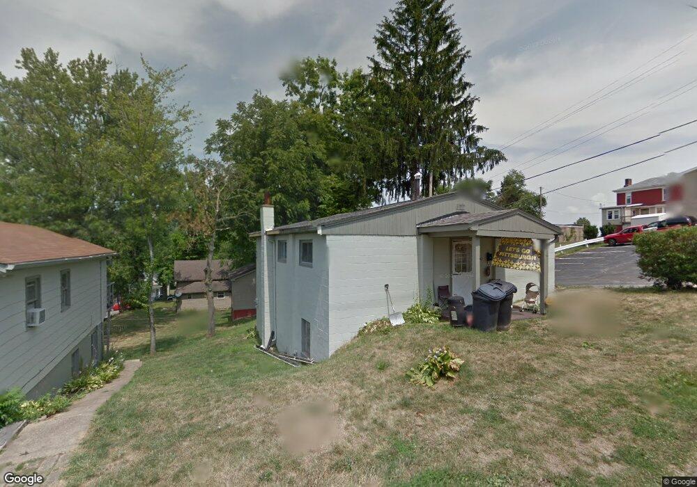
This home is located at 142 W Spring St, Cadiz, OH 43907 and is currently estimated at $93,391, approximately $97 per square foot. 142 W Spring St is a home located in Harrison County with nearby schools including Harrison Central Elementary School and Harrison Central Junior/Senior High School.
Ownership History
Date
Name
Owned For
Owner Type
Purchase Details
Closed on
Apr 23, 2011
Sold by
Bobot Allen J and Bobot Patricia
Bought by
Dean Jason R and Dean Sarah D
Current Estimated Value
Home Financials for this Owner
Home Financials are based on the most recent Mortgage that was taken out on this home.
Original Mortgage
$20,000
Interest Rate
5.5%
Mortgage Type
Adjustable Rate Mortgage/ARM
Purchase Details
Closed on
Jun 6, 1996
Create a Home Valuation Report for This Property
The Home Valuation Report is an in-depth analysis detailing your home's value as well as a comparison with similar homes in the area
Home Values in the Area
Average Home Value in this Area
Purchase History
| Date | Buyer | Sale Price | Title Company |
|---|---|---|---|
| Dean Jason R | $30,000 | None Available | |
| -- | -- | -- |
Source: Public Records
Mortgage History
| Date | Status | Borrower | Loan Amount |
|---|---|---|---|
| Closed | Dean Jason R | $20,000 |
Source: Public Records
Tax History Compared to Growth
Tax History
| Year | Tax Paid | Tax Assessment Tax Assessment Total Assessment is a certain percentage of the fair market value that is determined by local assessors to be the total taxable value of land and additions on the property. | Land | Improvement |
|---|---|---|---|---|
| 2024 | $815 | $20,510 | $3,270 | $17,240 |
| 2023 | $815 | $20,510 | $3,270 | $17,240 |
| 2022 | $698 | $16,440 | $2,090 | $14,350 |
| 2021 | $675 | $16,440 | $2,090 | $14,350 |
| 2020 | $673 | $16,440 | $2,090 | $14,350 |
| 2019 | $577 | $13,930 | $1,770 | $12,160 |
| 2018 | $577 | $13,930 | $1,770 | $12,160 |
| 2017 | $584 | $13,930 | $1,770 | $12,160 |
| 2016 | $601 | $13,390 | $1,460 | $11,930 |
| 2015 | $600 | $13,390 | $1,460 | $11,930 |
| 2014 | $492 | $12,930 | $1,330 | $11,600 |
| 2013 | $492 | $12,930 | $1,330 | $11,600 |
Source: Public Records
Map
Nearby Homes
- 608 Kerr Ave
- 254 S Buffalo St
- 413 Saint Clair Ave
- 419 Saint Clair Ave
- 545 E Market St
- 388 N Main St
- 102 Cadiz Ave
- 265 Old Steubenville Pike
- 273 Old Steubenville Pike
- 804 E Market St
- 0 N Main St Unit 5153554
- 0 E Market St
- 390 Oak Park Rd
- 78791 Kanoski Rd
- 0 Brewer Rd
- 39000 Lees Run Rd
- 77900 Slater Rd
- 85200 Merryman Rd
- 315 Euclid Ave
- 200 Cross St
- 142 W Spring St
- 138 W Spring St
- 139 W Spring St
- 143 W Spring St
- 130 W Spring St
- 139 N Muskingum St
- 147 Main St S
- 141 W Spring St
- 139 N Main St
- 157 N Main St
- 147 N Main St
- 149 W Spring St
- 201 W Spring St
- 202 W Spring St
- 207 N Main St
- 139 W Market St
- 205 W Spring St
- 127 131 W Market St Unit 27-131
- 149 W Market St
- 165 W Market St