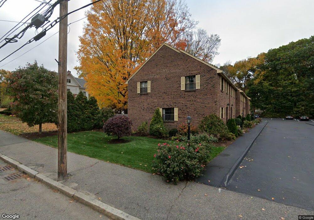
142 Walnut St Newtonville, MA 02460
Newtonville NeighborhoodEstimated Value: $756,000 - $814,000
2
Beds
2
Baths
1,211
Sq Ft
$649/Sq Ft
Est. Value
About This Home
This home is located at 142 Walnut St, Newtonville, MA 02460 and is currently estimated at $785,440, approximately $648 per square foot. 142 Walnut St is a home located in Middlesex County with nearby schools including Horace Mann Elementary School, F.A. Day Middle School, and Newton North High School.
Ownership History
Date
Name
Owned For
Owner Type
Purchase Details
Closed on
Dec 15, 2015
Sold by
James Pillion Irt
Bought by
Bernblum Jonathan and Barshal Yauheniya
Current Estimated Value
Home Financials for this Owner
Home Financials are based on the most recent Mortgage that was taken out on this home.
Original Mortgage
$285,000
Outstanding Balance
$227,609
Interest Rate
3.77%
Mortgage Type
New Conventional
Estimated Equity
$557,831
Purchase Details
Closed on
Oct 21, 2014
Sold by
Pillion Russell and Pillion James
Bought by
James Pillion Irt
Purchase Details
Closed on
Aug 16, 1996
Sold by
Bullard Robert A
Bought by
Pillion Helen M
Create a Home Valuation Report for This Property
The Home Valuation Report is an in-depth analysis detailing your home's value as well as a comparison with similar homes in the area
Home Values in the Area
Average Home Value in this Area
Purchase History
| Date | Buyer | Sale Price | Title Company |
|---|---|---|---|
| Bernblum Jonathan | $485,000 | -- | |
| James Pillion Irt | -- | -- | |
| Pillion Helen M | $184,000 | -- |
Source: Public Records
Mortgage History
| Date | Status | Borrower | Loan Amount |
|---|---|---|---|
| Open | Bernblum Jonathan | $285,000 |
Source: Public Records
Tax History
| Year | Tax Paid | Tax Assessment Tax Assessment Total Assessment is a certain percentage of the fair market value that is determined by local assessors to be the total taxable value of land and additions on the property. | Land | Improvement |
|---|---|---|---|---|
| 2025 | $7,104 | $724,900 | $0 | $724,900 |
| 2024 | $6,869 | $703,800 | $0 | $703,800 |
| 2023 | $6,746 | $662,700 | $0 | $662,700 |
| 2022 | $6,639 | $631,100 | $0 | $631,100 |
| 2021 | $6,407 | $595,400 | $0 | $595,400 |
| 2020 | $6,216 | $595,400 | $0 | $595,400 |
| 2019 | $6,041 | $578,100 | $0 | $578,100 |
| 2018 | $5,703 | $527,100 | $0 | $527,100 |
| 2017 | $5,530 | $497,300 | $0 | $497,300 |
| 2016 | $5,289 | $464,800 | $0 | $464,800 |
| 2015 | $5,140 | $442,700 | $0 | $442,700 |
Source: Public Records
Map
Nearby Homes
- 16 Prescott St
- 611 Watertown St Unit 14
- 73 Walnut St Unit 6
- 93 Central Ave Unit 93
- 77 Court St Unit 107
- 911 Washington St Lowell Ave
- 70 Walker St Unit 1
- 935 Washington St Unit 8
- 712 Watertown St
- 710 Watertown St Unit 710
- 401 Albemarle Rd Unit 2
- 321 Albemarle Rd
- 49 Hawthorn St
- 975 Washington St Unit 107
- 975 Washington St
- 3 Ashmont Ave
- 189 Linwood Ave Unit 1
- 73 Washington Park
- 55 Washington Park
- 188-190 Adams St
- 142 Walnut St Unit 142
- 144 Walnut St
- 130 Walnut St
- 146 Walnut St
- 140 Walnut St
- 138 Walnut St
- 137 Walnut St
- 154 Walnut St
- 150 Walnut St
- 148 Walnut St
- 150 Walnut St Unit 150
- 150 Walnut St Unit B8
- 148 Walnut St Unit 148
- 46 Lowell Ave
- 143 Walnut St Unit 3
- 141 Walnut St Unit 143
- 152 Walnut St
- 153 Walnut St Unit 2
- 153 Walnut St
- 153 Walnut St
Your Personal Tour Guide
Ask me questions while you tour the home.