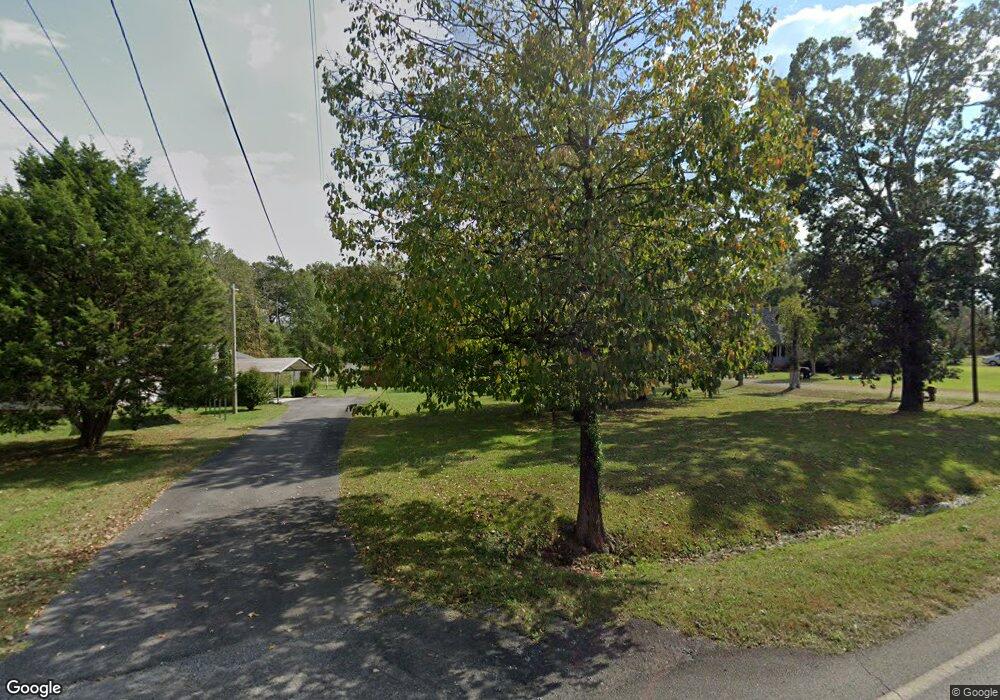
142 Yarmouth Way Dalton, GA 30721
Estimated Value: $69,509 - $278,000
--
Bed
1
Bath
1,252
Sq Ft
$131/Sq Ft
Est. Value
About This Home
This home is located at 142 Yarmouth Way, Dalton, GA 30721 and is currently estimated at $163,877, approximately $130 per square foot. 142 Yarmouth Way is a home located in Whitfield County with nearby schools including Beaverdale Elementary School, Coahulla Creek High School, and Cedar Valley Christian Academy.
Ownership History
Date
Name
Owned For
Owner Type
Purchase Details
Closed on
Jul 10, 2023
Sold by
Macias Lucila O
Bought by
Macias Lucila O and Macias Raul
Current Estimated Value
Purchase Details
Closed on
Sep 12, 2014
Sold by
American Ira Llc
Bought by
Ogle Landscaping Inc
Purchase Details
Closed on
Jun 28, 2012
Sold by
Gc Hudson Defined Benefit
Bought by
American Ira Llc Fbo and Hudson Geoffrey C Ira
Purchase Details
Closed on
Nov 3, 2009
Sold by
Fidelity Bank
Bought by
Federal National Mtg Associati
Purchase Details
Closed on
Jan 28, 2003
Sold by
Boring Sylvia
Bought by
Boring William and Boring Sylvia
Create a Home Valuation Report for This Property
The Home Valuation Report is an in-depth analysis detailing your home's value as well as a comparison with similar homes in the area
Home Values in the Area
Average Home Value in this Area
Purchase History
| Date | Buyer | Sale Price | Title Company |
|---|---|---|---|
| Macias Lucila O | -- | None Listed On Document | |
| Ogle Landscaping Inc | $7,500 | -- | |
| American Ira Llc Fbo | $5,450 | -- | |
| Federal National Mtg Associati | $43,559 | -- | |
| Fidelity Bank | $43,559 | -- | |
| Boring William | -- | -- |
Source: Public Records
Tax History Compared to Growth
Tax History
| Year | Tax Paid | Tax Assessment Tax Assessment Total Assessment is a certain percentage of the fair market value that is determined by local assessors to be the total taxable value of land and additions on the property. | Land | Improvement |
|---|---|---|---|---|
| 2024 | $81 | $3,429 | $3,429 | $0 |
| 2023 | $81 | $6,135 | $2,696 | $3,439 |
| 2022 | $260 | $8,816 | $2,272 | $6,544 |
| 2021 | $260 | $8,816 | $2,272 | $6,544 |
| 2020 | $269 | $8,816 | $2,272 | $6,544 |
| 2019 | $273 | $8,816 | $2,272 | $6,544 |
| 2018 | $267 | $8,479 | $1,935 | $6,544 |
| 2017 | $267 | $8,479 | $1,935 | $6,544 |
| 2016 | $239 | $7,886 | $1,935 | $5,951 |
| 2014 | $503 | $18,693 | $2,203 | $16,490 |
| 2013 | -- | $18,692 | $2,203 | $16,489 |
Source: Public Records
Map
Nearby Homes
- 153 Cochran Dr NE
- 106 Albertson Dr
- 2700 Lynn Dr
- 2616 Cleveland Hwy
- Hamilton Plan at The Andros
- Bradley Plan at The Andros
- Walker Plan at The Andros
- Whitfield Plan at The Andros
- 200 Andros Dr Unit 19A
- 195 Andros Drives
- 193 Andros Drives
- 112 Albertson Dr
- 204 Andros Dr
- 204 Andros Dr Unit 19C
- 175 Andros Dr
- 143 Andros Drives
- 141 Andros Dr
- 123 Andros Dr Unit 1B
- 0 Andros Dr
- 186 Andros Dr
- 170 Beaverdale Rd
- 170 Beaverdale Rd
- 160 Beaverdale Rd NE
- 174 Beaverdale Rd NE
- 125 Yarmouth Way
- 172 Beaverdale Rd NE
- 158 Beaverdale Rd NE
- 200 Beaverdale Rd NE
- 173 Beaverdale Rd NE
- 175 Beaverdale Rd NE
- 152 Beaverdale Rd NE
- 155 Beaverdale Rd NE
- 169 Beaverdale Rd NE
- 0 Beaverdale Rd
- 157 Beaverdale Rd NE
- 1907 Sosebee Dr NE
- 218 Beaverdale Rd NE
- 212 Beaverdale Rd NE
- 2828 Grove Level Dr
- 2822 Grove Level Dr
