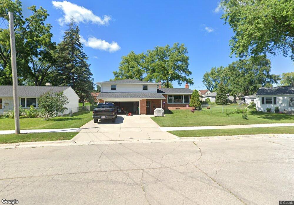
1420 Frank St Green Bay, WI 54304
Colburn NeighborhoodEstimated Value: $294,000 - $369,000
3
Beds
2
Baths
1,456
Sq Ft
$219/Sq Ft
Est. Value
About This Home
This home is located at 1420 Frank St, Green Bay, WI 54304 and is currently estimated at $319,294, approximately $219 per square foot. 1420 Frank St is a home located in Brown County with nearby schools including Jackson Elementary School, Franklin Middle School, and West High School.
Ownership History
Date
Name
Owned For
Owner Type
Purchase Details
Closed on
Jan 7, 2019
Sold by
Johnson Matthew J
Bought by
Johnson Matthew J and Johnson Dale M
Current Estimated Value
Home Financials for this Owner
Home Financials are based on the most recent Mortgage that was taken out on this home.
Original Mortgage
$140,109
Outstanding Balance
$89,852
Interest Rate
4.75%
Mortgage Type
FHA
Estimated Equity
$229,442
Purchase Details
Closed on
May 30, 2003
Sold by
Solper David J
Bought by
Johnson Matthew J
Home Financials for this Owner
Home Financials are based on the most recent Mortgage that was taken out on this home.
Original Mortgage
$104,500
Interest Rate
5.9%
Mortgage Type
Unknown
Purchase Details
Closed on
Oct 13, 1998
Sold by
Solper Sherry A
Bought by
Solper David J
Create a Home Valuation Report for This Property
The Home Valuation Report is an in-depth analysis detailing your home's value as well as a comparison with similar homes in the area
Home Values in the Area
Average Home Value in this Area
Purchase History
| Date | Buyer | Sale Price | Title Company |
|---|---|---|---|
| Johnson Matthew J | -- | Liberty Title | |
| Johnson Matthew J | $110,000 | -- | |
| Solper David J | -- | -- |
Source: Public Records
Mortgage History
| Date | Status | Borrower | Loan Amount |
|---|---|---|---|
| Open | Johnson Matthew J | $140,109 | |
| Closed | Johnson Matthew J | $104,500 |
Source: Public Records
Tax History Compared to Growth
Tax History
| Year | Tax Paid | Tax Assessment Tax Assessment Total Assessment is a certain percentage of the fair market value that is determined by local assessors to be the total taxable value of land and additions on the property. | Land | Improvement |
|---|---|---|---|---|
| 2024 | $4,093 | $220,200 | $31,300 | $188,900 |
| 2023 | $3,907 | $220,200 | $31,300 | $188,900 |
| 2022 | $3,822 | $220,200 | $31,300 | $188,900 |
| 2021 | $2,497 | $113,100 | $19,900 | $93,200 |
| 2020 | $2,545 | $113,100 | $19,900 | $93,200 |
| 2019 | $2,456 | $113,100 | $19,900 | $93,200 |
| 2018 | $2,405 | $113,100 | $19,900 | $93,200 |
| 2017 | $2,388 | $113,100 | $19,900 | $93,200 |
| 2016 | $2,348 | $113,100 | $19,900 | $93,200 |
| 2015 | $2,455 | $113,100 | $19,900 | $93,200 |
| 2014 | $2,504 | $113,100 | $19,900 | $93,200 |
| 2013 | $2,504 | $113,100 | $19,900 | $93,200 |
Source: Public Records
Map
Nearby Homes
- 1428 Beauchamp St
- 1348 Liberty St
- 1244 Liberty St
- 1212 9th St
- 1252 Marian Ln
- 1181 Roscoe St
- 1203 Spence St
- 1427 Russell St
- 1286 7th St
- 1255 Loch Dr
- 1122 Biemeret St
- 1507 Delores St
- 1444 Liberty St
- 1110 Roscoe St
- 1500 S Fisk St
- 1201 S Fisk St
- 1749 S Oneida St Unit 1751
- 1751 S Oneida St
- 1163 Thorndale St
- 1128 Marquette Ave
- 1424 Frank St
- 0 Rockdale St
- 1280 Rockdale St
- 1415 S Ridge Rd
- 1425 S Ridge Rd
- 1273 Rockdale St
- 1287 Langlade Ave
- 1432 Frank St
- 1274 Rockdale St
- 1288 Biemeret St
- 1411 S Ridge Rd
- 1283 Langlade Ave
- 1279 Langlade Ave
- 1407 S Ridge Rd
- 1429 S Ridge Rd
- 1433 Frank St
- 1265 Rockdale St
- 1275 Langlade Ave
- 1266 Rockdale St
- 1403 S Ridge Rd