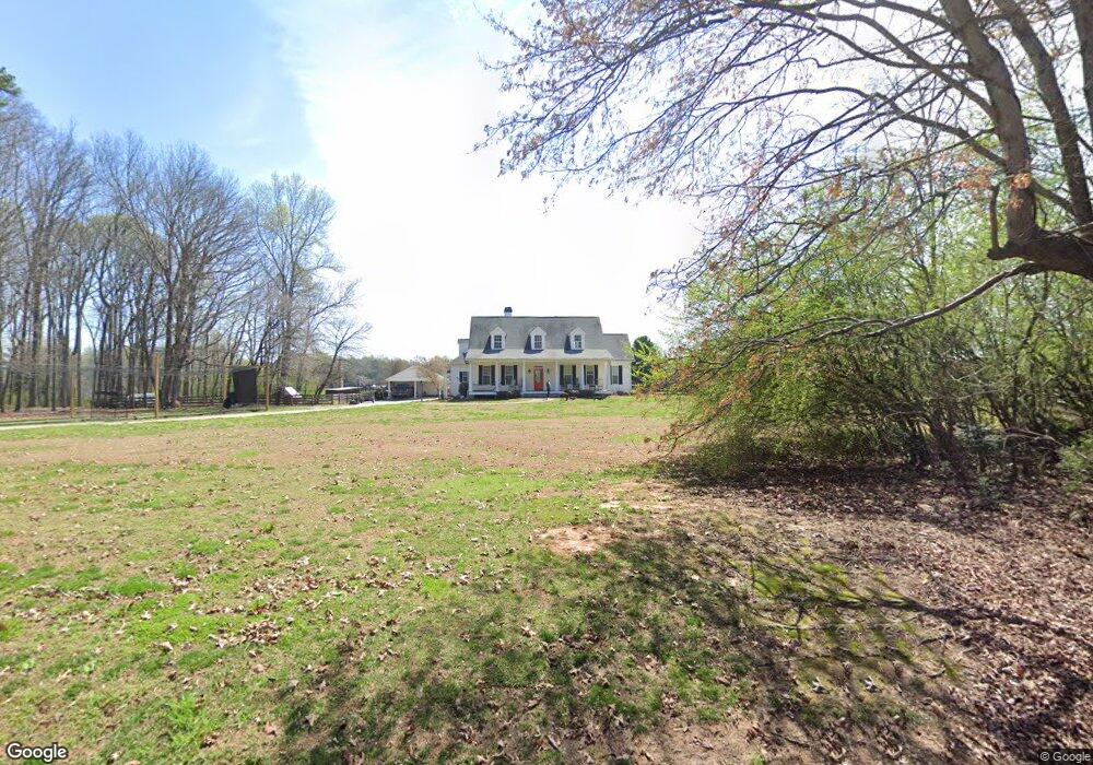
1420 Freehome Rd Canton, GA 30115
Union Hill NeighborhoodEstimated Value: $876,000 - $1,278,000
4
Beds
4
Baths
3,603
Sq Ft
$278/Sq Ft
Est. Value
About This Home
This home is located at 1420 Freehome Rd, Canton, GA 30115 and is currently estimated at $1,002,274, approximately $278 per square foot. 1420 Freehome Rd is a home located in Cherokee County with nearby schools including Free Home Elementary School, Creekland Middle School, and Creekview High School.
Ownership History
Date
Name
Owned For
Owner Type
Purchase Details
Closed on
Jan 6, 2006
Sold by
King Sally C
Bought by
King Douglas D and King Sally C
Current Estimated Value
Home Financials for this Owner
Home Financials are based on the most recent Mortgage that was taken out on this home.
Original Mortgage
$206,000
Outstanding Balance
$114,109
Interest Rate
6.22%
Mortgage Type
New Conventional
Estimated Equity
$888,165
Create a Home Valuation Report for This Property
The Home Valuation Report is an in-depth analysis detailing your home's value as well as a comparison with similar homes in the area
Home Values in the Area
Average Home Value in this Area
Purchase History
| Date | Buyer | Sale Price | Title Company |
|---|---|---|---|
| King Douglas D | -- | -- |
Source: Public Records
Mortgage History
| Date | Status | Borrower | Loan Amount |
|---|---|---|---|
| Open | King Douglas D | $206,000 |
Source: Public Records
Tax History Compared to Growth
Tax History
| Year | Tax Paid | Tax Assessment Tax Assessment Total Assessment is a certain percentage of the fair market value that is determined by local assessors to be the total taxable value of land and additions on the property. | Land | Improvement |
|---|---|---|---|---|
| 2025 | $9,408 | $382,564 | $97,360 | $285,204 |
| 2024 | $8,164 | $318,484 | $84,000 | $234,484 |
| 2023 | $7,991 | $307,484 | $69,520 | $237,964 |
| 2022 | $5,767 | $219,404 | $69,520 | $149,884 |
| 2021 | $5,050 | $177,884 | $57,920 | $119,964 |
| 2020 | $5,108 | $179,764 | $57,920 | $121,844 |
| 2019 | $5,176 | $182,160 | $57,920 | $124,240 |
| 2018 | $5,064 | $177,120 | $57,920 | $119,200 |
| 2017 | $5,002 | $434,000 | $52,600 | $121,000 |
| 2016 | $4,577 | $393,000 | $43,680 | $113,520 |
| 2015 | $3,500 | $303,400 | $43,680 | $77,680 |
| 2014 | $3,242 | $280,900 | $36,520 | $75,840 |
Source: Public Records
Map
Nearby Homes
- 995 Freehome Rd
- 889 Freehome Rd
- 949 Freehome Rd
- 14067 Cumming Hwy
- 205 Brighten Ct
- 490 Lummus Rd
- 10004 Freehome Hwy
- 146 Henderson Farm Dr
- 5615 Willowdale Ct
- 5630 Willowdale Ct
- 5765 Swamp Willow Place
- 5830 Swamp Willow Place
- 5525 Misty Glen Ln
- 5615 Willowbough Ln
- 5515 Misty Glen Ln
- 1044 Mcclure Dr
- 5385 Drew Rd
- Hedgewood with Basement Plan at Willow Glen - Highlands Collection
- Rosalynn Plan at Willow Glen - Reserve Collection
- Rhinewood with Basement Plan at Willow Glen - Reserve Collection
- 1372 Holbrook Campground Rd
- 1355 Free Home Rd
- 1355 Freehome Rd
- 1368 Holbrook Campground Rd
- 1327 Freehome Rd
- 1321 Freehome Rd
- 1290 Holbrook Campground Rd
- 1239 Freehome Rd
- 1253 Holbrook Campground Rd
- 1445 Freehome Rd
- 1148 Freehome Rd
- 1190 Freehome Rd
- 1455 Holbrook Campground Rd
- 1255 Holbrook Campground Rd
- 197 Bill Bagwell Dr
- 1475 Holbrook Campground Rd
- 1514 Holbrook Campground Rd
- 1017 Freehome Rd
- 1136 Freehome Rd
- 1600 Holbrook Campground Rd