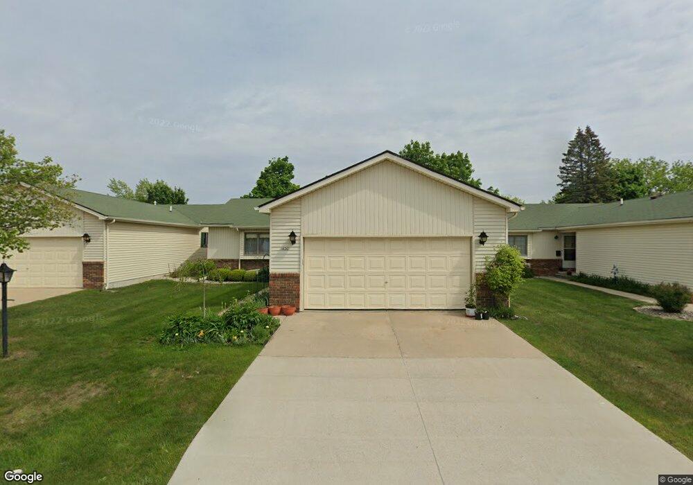
1420 Grant Ct Unit 12 Lapeer, MI 48446
Estimated Value: $188,000 - $235,000
2
Beds
1
Bath
1,216
Sq Ft
$178/Sq Ft
Est. Value
About This Home
This home is located at 1420 Grant Ct Unit 12, Lapeer, MI 48446 and is currently estimated at $216,498, approximately $178 per square foot. 1420 Grant Ct Unit 12 is a home located in Lapeer County with nearby schools including C.K. Schickler Elementary School, Rolland-Warner Middle School, and Lapeer High School.
Ownership History
Date
Name
Owned For
Owner Type
Purchase Details
Closed on
May 23, 2024
Sold by
Lagalski Nancy E
Bought by
Nancy Ellen Davis Lagalski Revocable Trust and Lagalski
Current Estimated Value
Purchase Details
Closed on
Aug 15, 2011
Sold by
Malzahn Isabel M
Bought by
Lagalski Robert Walter and Lagalski Nancy E
Home Financials for this Owner
Home Financials are based on the most recent Mortgage that was taken out on this home.
Original Mortgage
$50,940
Interest Rate
4.64%
Mortgage Type
Unknown
Create a Home Valuation Report for This Property
The Home Valuation Report is an in-depth analysis detailing your home's value as well as a comparison with similar homes in the area
Home Values in the Area
Average Home Value in this Area
Purchase History
| Date | Buyer | Sale Price | Title Company |
|---|---|---|---|
| Nancy Ellen Davis Lagalski Revocable Trust | -- | None Listed On Document | |
| Lagalski Robert Walter | $56,603 | -- |
Source: Public Records
Mortgage History
| Date | Status | Borrower | Loan Amount |
|---|---|---|---|
| Previous Owner | Lagalski Robert Walter | $50,940 |
Source: Public Records
Tax History Compared to Growth
Tax History
| Year | Tax Paid | Tax Assessment Tax Assessment Total Assessment is a certain percentage of the fair market value that is determined by local assessors to be the total taxable value of land and additions on the property. | Land | Improvement |
|---|---|---|---|---|
| 2025 | $1,273 | $95,900 | $0 | $0 |
| 2024 | $838 | $81,600 | $0 | $0 |
| 2023 | $800 | $73,500 | $0 | $0 |
| 2022 | $1,139 | $62,600 | $0 | $0 |
| 2021 | $1,055 | $57,400 | $0 | $0 |
| 2020 | $1,044 | $57,700 | $0 | $0 |
| 2019 | $1,054 | $53,300 | $0 | $0 |
| 2018 | $1,029 | $54,800 | $54,800 | $0 |
| 2017 | $1,009 | $53,400 | $0 | $0 |
| 2016 | $1,003 | $41,700 | $41,700 | $0 |
| 2015 | -- | $38,600 | $0 | $0 |
| 2014 | -- | $34,400 | $34,400 | $0 |
| 2013 | -- | $33,300 | $33,300 | $0 |
Source: Public Records
Map
Nearby Homes
- 1760 A St
- 1227 N Jackson St
- 350 N Jackson St
- 1389 Luxington Dr
- 1138 W Oregon St
- 1408 Lincoln St
- 1120 W Oregon St
- 1441 Candace Dr
- 1423 Luxington Dr
- 1468 Lincoln St
- 1440 Lincoln St
- 1762 Westbrooke Dr
- 1747 Westbrooke Dr
- 1470 Lincoln St
- 2765 Naples Ct
- 244 Riviera Dr
- Lot F Newark Rd
- 2760 Naples Ct
- Lot H Newark Rd
- 250 Riviera Dr
- 1420 Grant Ct
- 1414 Grant Ct
- 1426 Grant Ct
- 1408 Grant Ct
- 1407 Grant Ct Unit Bldg-Unit
- 1407 Grant Ct
- 1421 Sherman Ct
- 1425 Sherman Ct
- 1425 Sherman Ct Unit 18
- 1413 Sherman Ct
- 1413 Sherman Ct Unit 16
- 1432 Grant Ct
- 1421 Grant Ct
- 1407 Sherman Ct
- 1407 Sherman Ct Unit 5
- 1413 Grant Ct Unit 2
- 1413 Grant Ct
- 1431 Sherman Ct
- 1425 Grant Ct Unit 4
- 1425 Grant Ct