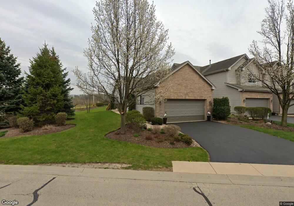
1420 Mackenzie Ln Elgin, IL 60120
Bluff City NeighborhoodEstimated Value: $315,312 - $362,000
2
Beds
2
Baths
1,399
Sq Ft
$239/Sq Ft
Est. Value
About This Home
This home is located at 1420 Mackenzie Ln, Elgin, IL 60120 and is currently estimated at $333,828, approximately $238 per square foot. 1420 Mackenzie Ln is a home located in Cook County with nearby schools including Timber Trails Elementary School, Larsen Middle School, and Elgin High School.
Ownership History
Date
Name
Owned For
Owner Type
Purchase Details
Closed on
Nov 10, 2005
Sold by
Miller Charles P
Bought by
Wehnert Glenn S
Current Estimated Value
Home Financials for this Owner
Home Financials are based on the most recent Mortgage that was taken out on this home.
Original Mortgage
$149,000
Outstanding Balance
$80,820
Interest Rate
6.17%
Mortgage Type
Fannie Mae Freddie Mac
Estimated Equity
$253,008
Create a Home Valuation Report for This Property
The Home Valuation Report is an in-depth analysis detailing your home's value as well as a comparison with similar homes in the area
Home Values in the Area
Average Home Value in this Area
Purchase History
| Date | Buyer | Sale Price | Title Company |
|---|---|---|---|
| Wehnert Glenn S | $248,500 | Cti |
Source: Public Records
Mortgage History
| Date | Status | Borrower | Loan Amount |
|---|---|---|---|
| Open | Wehnert Glenn S | $149,000 |
Source: Public Records
Tax History
| Year | Tax Paid | Tax Assessment Tax Assessment Total Assessment is a certain percentage of the fair market value that is determined by local assessors to be the total taxable value of land and additions on the property. | Land | Improvement |
|---|---|---|---|---|
| 2025 | $5,666 | $28,000 | $3,709 | $24,291 |
| 2024 | $5,666 | $23,000 | $3,500 | $19,500 |
| 2023 | $5,477 | $23,000 | $3,500 | $19,500 |
| 2022 | $5,477 | $23,000 | $3,500 | $19,500 |
| 2021 | $5,463 | $19,184 | $2,251 | $16,933 |
| 2020 | $5,507 | $19,184 | $2,251 | $16,933 |
| 2019 | $5,555 | $21,555 | $2,251 | $19,304 |
| 2018 | $5,943 | $20,928 | $1,986 | $18,942 |
| 2017 | $5,945 | $20,928 | $1,986 | $18,942 |
| 2016 | $5,873 | $20,928 | $1,986 | $18,942 |
| 2015 | $5,551 | $18,422 | $1,788 | $16,634 |
| 2014 | $5,395 | $18,422 | $1,788 | $16,634 |
| 2013 | $5,198 | $18,422 | $1,788 | $16,634 |
Source: Public Records
Map
Nearby Homes
- 12N100 Berner Dr
- 1440 Eliot Trail
- 600 Countryfield Ln
- 110 Gloria Dr
- 5761 Providence Dr Unit 4
- 103 Fawn Ln
- 1385 Caribou Ln Unit 4
- 11N575 Rohrssen Rd
- 1590 Russell Dr
- 1160 Case Ln
- 5670 Brentwood Dr Unit 5
- 6085 Irene Dr
- 130 Stonehurst Dr
- 1254 Red Oak Ct
- 713 Bent Ridge Ln Unit 3
- 1089 Quaker Hill Ct Unit 711
- 362 Chaparral Ct
- 1812 Kelberg Ave Unit 482
- 1139 Ironwood Ct
- 149 Highbury Dr
- 1424 Mackenzie Ln
- 1428 Mackenzie Ln
- 1432 Mackenzie Ln
- 1436 Mackenzie Ln
- 1440 Mackenzie Ln
- 1444 Mackenzie Ln
- 1419 Mackenzie Ln
- 1423 Mackenzie Ln
- 1427 Mackenzie Ln
- 1448 Mackenzie Ln
- 1431 Mackenzie Ln
- 1435 Mackenzie Ln
- 1439 Mackenzie Ln
- 1443 Mackenzie Ln
- 1456 Mackenzie Ln
- 1447 Mackenzie Ln
- 1447 Mackenzie Ln Unit 1447
- 1451 Mackenzie Ln
- 1460 Mackenzie Ln
- 435 Ginger Ln
Your Personal Tour Guide
Ask me questions while you tour the home.