Estimated Value: $219,823
Studio
--
Bath
2,020
Sq Ft
$109/Sq Ft
Est. Value
About This Home
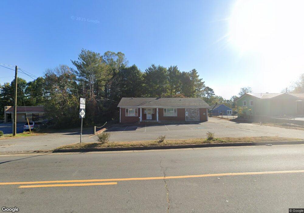
This home is located at 1420 N Bridge St, Elkin, NC 28621 and is currently estimated at $219,823, approximately $108 per square foot. 1420 N Bridge St is a home located in Surry County with nearby schools including Elkin Elementary School, Elkin Middle School, and Elkin High School.
Ownership History
Date
Name
Owned For
Owner Type
Purchase Details
Closed on
Aug 17, 2023
Sold by
Gilreath Charles S and Gilreath Lelia C
Bought by
Bdw Llc
Current Estimated Value
Purchase Details
Closed on
Apr 4, 2017
Sold by
Gilreath Charles S
Bought by
Gilreath Lelia C
Purchase Details
Closed on
Feb 1, 2003
Purchase Details
Closed on
Jan 1, 2002
Purchase Details
Closed on
Jun 1, 1999
Purchase Details
Closed on
Feb 1, 1999
Purchase Details
Closed on
Apr 1, 1959
Create a Home Valuation Report for This Property
The Home Valuation Report is an in-depth analysis detailing your home's value as well as a comparison with similar homes in the area
Home Values in the Area
Average Home Value in this Area
Purchase History
| Date | Buyer | Sale Price | Title Company |
|---|---|---|---|
| Bdw Llc | $195,000 | None Listed On Document | |
| Gilreath Lelia C | -- | None Available | |
| -- | -- | -- | |
| -- | -- | -- | |
| -- | $185,000 | -- | |
| -- | -- | -- | |
| -- | -- | -- |
Source: Public Records
Tax History
| Year | Tax Paid | Tax Assessment Tax Assessment Total Assessment is a certain percentage of the fair market value that is determined by local assessors to be the total taxable value of land and additions on the property. | Land | Improvement |
|---|---|---|---|---|
| 2025 | $1,400 | $222,520 | $93,160 | $129,360 |
| 2024 | $1,288 | $189,900 | $88,640 | $101,260 |
| 2023 | $1,029 | $186,350 | $88,640 | $97,710 |
| 2022 | $1,330 | $199,460 | $101,750 | $97,710 |
| 2021 | $1,352 | $199,460 | $101,750 | $97,710 |
| 2020 | $1,421 | $198,960 | $101,750 | $97,210 |
| 2019 | $1,421 | $198,960 | $0 | $0 |
| 2018 | $1,397 | $198,960 | $0 | $0 |
| 2017 | $1,421 | $198,960 | $0 | $0 |
| 2016 | $1,401 | $198,960 | $0 | $0 |
| 2013 | -- | $210,210 | $0 | $0 |
Source: Public Records
Map
Nearby Homes
- 119 Cox Ave
- 219 W Highland Ave Unit AVW
- 132 Oak Grove Rd
- 229 Woodland Dr
- 348 Woodland Dr
- 129 Lake St
- 120 Skyline Dr
- Lot 142,143,144,145 Claremont Dr
- TBD Claremont Dr
- 0 Claremont Dr
- 0 Johnson Ridge Rd
- 00 Johnson Ridge Rd
- 490 Oakland Dr
- 0 Hickory St
- 211 Dutchman Creek Rd
- 340 Hillcrest Dr
- 363 Hawthorne Rd
- 734 Oakland Dr
- 000 Johnson Ridge Rd
- 121 Park Ridge Dr
- 1404 N Bridge St
- 107 E Robin Rd
- 119 E Robin Rd Unit RDE
- 114 E Robin Rd
- 1425 N Bridge St
- 1077 N Bridge St
- 120 E Robin Rd
- 122 W Robin Rd Unit RDW
- 130 E Robin Rd
- 107 Cox Ave
- 1328 N Bridge St
- 113 Cox Ave
- 1327 N Bridge St
- 125 W Robin Rd
- 130 W Robin Rd Unit RDW
- 136 E Robin Rd
- 1321 N Bridge St
- 127 Cox Ave
- 200 Lyles St
- 135 Cox Ave
Your Personal Tour Guide
Ask me questions while you tour the home.