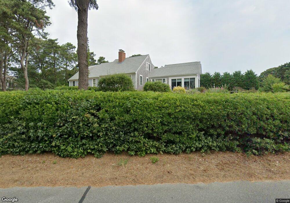
1420 Samoset Rd Eastham, MA 02642
Estimated Value: $1,028,000 - $1,504,000
4
Beds
3
Baths
2,660
Sq Ft
$470/Sq Ft
Est. Value
About This Home
This home is located at 1420 Samoset Rd, Eastham, MA 02642 and is currently estimated at $1,249,964, approximately $469 per square foot. 1420 Samoset Rd is a home located in Barnstable County with nearby schools including Eastham Elementary School, Nauset Regional Middle School, and Nauset Regional High School.
Ownership History
Date
Name
Owned For
Owner Type
Purchase Details
Closed on
Feb 13, 2024
Sold by
Weber
Bought by
A Weber G
Current Estimated Value
Purchase Details
Closed on
May 20, 2010
Sold by
Weber Frederick E and Weber Alice J
Bought by
Frederick & A Weber Ret and Weber
Purchase Details
Closed on
Feb 1, 1977
Bought by
Frederick & Alice Weber Ret
Create a Home Valuation Report for This Property
The Home Valuation Report is an in-depth analysis detailing your home's value as well as a comparison with similar homes in the area
Home Values in the Area
Average Home Value in this Area
Purchase History
| Date | Buyer | Sale Price | Title Company |
|---|---|---|---|
| A Weber G | -- | None Available | |
| Frederick & A Weber Ret | -- | -- | |
| Frederick & Alice Weber Ret | $23,500 | -- |
Source: Public Records
Tax History
| Year | Tax Paid | Tax Assessment Tax Assessment Total Assessment is a certain percentage of the fair market value that is determined by local assessors to be the total taxable value of land and additions on the property. | Land | Improvement |
|---|---|---|---|---|
| 2025 | $9,260 | $1,201,000 | $372,300 | $828,700 |
| 2024 | $8,170 | $1,165,500 | $361,400 | $804,100 |
| 2023 | $7,492 | $1,034,800 | $334,700 | $700,100 |
| 2022 | $6,909 | $805,200 | $298,800 | $506,400 |
| 2021 | $6,715 | $731,500 | $271,600 | $459,900 |
| 2020 | $6,216 | $712,800 | $277,200 | $435,600 |
| 2019 | $5,711 | $692,200 | $269,100 | $423,100 |
| 2018 | $5,613 | $672,200 | $261,300 | $410,900 |
| 2017 | $5,244 | $663,800 | $256,200 | $407,600 |
| 2016 | $4,611 | $619,700 | $237,900 | $381,800 |
| 2015 | $4,320 | $608,400 | $233,200 | $375,200 |
Source: Public Records
Map
Nearby Homes
- 10 Cartway N
- 600 Kingsbury Beach Rd
- 55 Grandfathers Way
- 20 Stone Ct
- 40 Bayview Rd
- 2705 State Hwy
- 2705 State Hwy Unit 1-8
- 330 Hay Rd
- 21 Locust Rd Unit 21
- 339 Dyer Prince Rd
- 82 Old Orchard Rd
- 1061 State Hwy Unit 4
- 1061 State Hwy Unit 1061
- 85 Huckleberry Ln
- 6 Penny Ln
- 300 School House Rd
- 25 Twin Rocks Dr
- 255 Massasoit Rd
- 20 Kittiwake Ln
- 60 Smith Heights Way
- 1400 Samoset Rd
- 15 Clayton Rd
- 10 Sunset Ln
- 1415 Samoset Rd
- 20 Sunset Ln
- 1405 Samoset Rd
- 25 Clayton Rd
- 30 Sunset Ln
- 1395 Samoset Rd
- 1515 Samoset Rd
- 1 Beach Plum Ln
- 10 Bayshore Ln
- 1380 Samoset Rd
- 2 Beach Plum Ln
- 35 Clayton Rd
- 1355 Samoset Rd
- 5 Pilgrims Path
- 40 Cobbett Ln
- 4 Beach Plum Ln
- 6 Beach Plum Ln
Your Personal Tour Guide
Ask me questions while you tour the home.