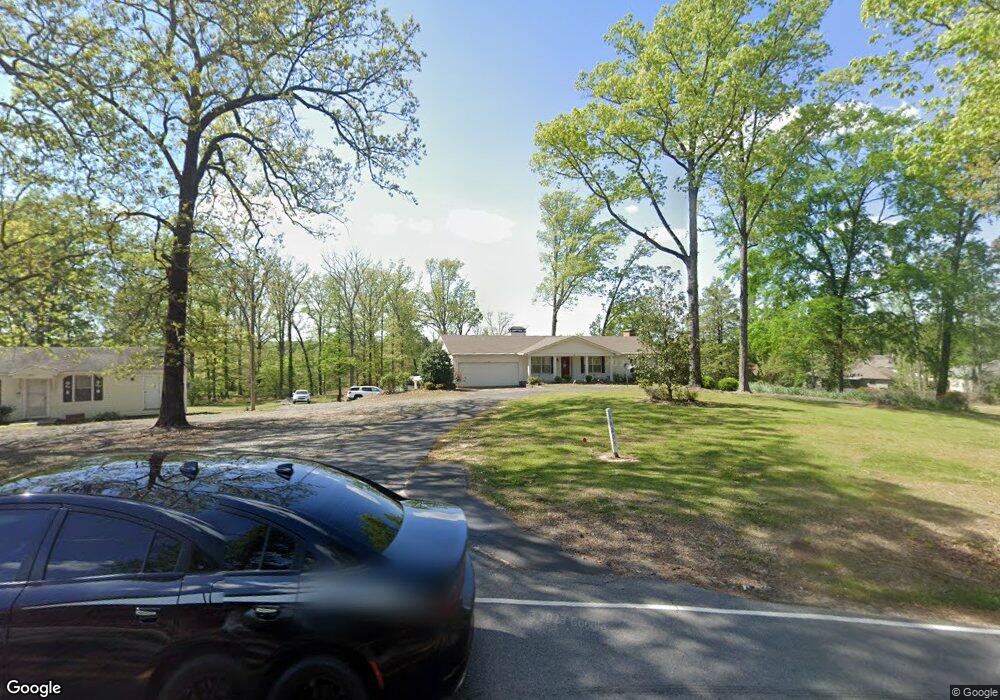
14203 Highway 111 Alexander, AR 72002
Estimated Value: $203,000 - $644,426
--
Bed
3
Baths
2,872
Sq Ft
$115/Sq Ft
Est. Value
About This Home
This home is located at 14203 Highway 111, Alexander, AR 72002 and is currently estimated at $330,607, approximately $115 per square foot. 14203 Highway 111 is a home located in Saline County with nearby schools including Hill Farm Elementary School, Bryant Middle School, and Bethel Middle School.
Ownership History
Date
Name
Owned For
Owner Type
Purchase Details
Closed on
Oct 17, 2019
Sold by
Knight Tony S and Knight Anthony Stephen
Bought by
Plant Joyce
Current Estimated Value
Purchase Details
Closed on
Oct 6, 2016
Sold by
Knight Mandi
Bought by
Knight Tony S
Purchase Details
Closed on
Mar 22, 2012
Sold by
Knight Marietta and Knight Larry Stephen
Bought by
Knight Tony S
Home Financials for this Owner
Home Financials are based on the most recent Mortgage that was taken out on this home.
Original Mortgage
$236,087
Interest Rate
3.91%
Mortgage Type
FHA
Purchase Details
Closed on
Jul 9, 2003
Bought by
Knight
Purchase Details
Closed on
Dec 1, 1995
Bought by
Wilbern Trust
Create a Home Valuation Report for This Property
The Home Valuation Report is an in-depth analysis detailing your home's value as well as a comparison with similar homes in the area
Home Values in the Area
Average Home Value in this Area
Purchase History
| Date | Buyer | Sale Price | Title Company |
|---|---|---|---|
| Plant Joyce | $345,000 | American Abstract & Title Co | |
| Knight Tony S | -- | None Available | |
| Knight Tony S | $275,000 | None Available | |
| Knight | $153,000 | -- | |
| Wilbern Trust | -- | -- | |
| Trust | -- | -- |
Source: Public Records
Mortgage History
| Date | Status | Borrower | Loan Amount |
|---|---|---|---|
| Previous Owner | Knight Tony S | $236,087 |
Source: Public Records
Tax History Compared to Growth
Tax History
| Year | Tax Paid | Tax Assessment Tax Assessment Total Assessment is a certain percentage of the fair market value that is determined by local assessors to be the total taxable value of land and additions on the property. | Land | Improvement |
|---|---|---|---|---|
| 2025 | $1,407 | $27,160 | $2,419 | $24,741 |
| 2024 | $1,410 | $27,160 | $2,419 | $24,741 |
| 2023 | $1,410 | $27,160 | $2,419 | $24,741 |
| 2022 | $1,032 | $27,160 | $2,419 | $24,741 |
| 2021 | $1,837 | $42,540 | $9,500 | $33,040 |
| 2020 | $1,837 | $42,540 | $9,500 | $33,040 |
| 2019 | $1,256 | $31,370 | $2,020 | $29,350 |
| 2018 | $1,328 | $31,370 | $2,020 | $29,350 |
| 2017 | $1,328 | $31,370 | $2,020 | $29,350 |
| 2016 | $1,654 | $31,870 | $2,020 | $29,850 |
| 2015 | $1,304 | $31,870 | $2,020 | $29,850 |
| 2014 | $1,304 | $31,870 | $2,020 | $29,850 |
Source: Public Records
Map
Nearby Homes
- 13868 Cherry Glen Cove
- 5001 Woodstream Dr
- 2193 Fern Valley Dr
- 14810 Parkway Meadows Dr
- 7041 Cold Creek Dr
- 14914 E Azalea Dr
- 3819 S Shobe Rd
- Tract B Alexander Rd
- 7009 Woodsgate Cove
- 15315 Birch Dr
- 28 Kelli Place
- 2000 Reagan Cove
- 12104 Big Ridge Cir
- 1015 Clinton Ct
- 1007 Clinton Ct
- 3413 N Cresent Dr
- 4507 Lexington Park Cir
- 15505 Dogwood Ranchette Dr
- 27 Mountain Vista Dr
- 3418 Lacross Dr
- 14203 Highway 111
- 15407 Walnut Glen Dr
- 15401 Walnut Glen Dr
- 13846 Hickory Glen Dr
- 15413 Walnut Glen Dr
- 0 Hickory Glen Dr Unit 17017532
- 15419 Walnut Glen Dr
- 15425 Walnut Glen Dr
- 13840 Hickory Glen Dr
- 15404 Walnut Glen Dr
- 15431 Walnut Glen Dr
- 13834 Hickory Glen Dr
- 13833 Hickory Glen Dr
- 15418 Walnut Glen Dr
- 15437 Walnut Glen Dr
- 15412 Walnut Glen Dr
- 14095 Magnolia Glen Dr
- 15424 Walnut Glen Dr
- 14099 Magnolia Glen Dr
- 14091 Magnolia Glen Dr