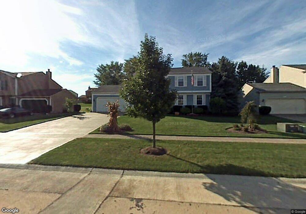
14207 Walking Stick Way Strongsville, OH 44136
Estimated Value: $379,854 - $406,000
4
Beds
3
Baths
2,032
Sq Ft
$192/Sq Ft
Est. Value
About This Home
This home is located at 14207 Walking Stick Way, Strongsville, OH 44136 and is currently estimated at $390,714, approximately $192 per square foot. 14207 Walking Stick Way is a home located in Cuyahoga County with nearby schools including Strongsville High School and Royal Redeemer Lutheran School.
Ownership History
Date
Name
Owned For
Owner Type
Purchase Details
Closed on
Jul 16, 1987
Sold by
Egleston Paul M
Bought by
Muckley Thomasj
Current Estimated Value
Purchase Details
Closed on
Mar 26, 1982
Bought by
Egleston Paul M
Purchase Details
Closed on
Jan 5, 1982
Bought by
Dean Homes Inc
Purchase Details
Closed on
Dec 18, 1981
Bought by
Hunting Valley Bldrs Inc
Purchase Details
Closed on
Jan 1, 1979
Bought by
North East Land Co
Create a Home Valuation Report for This Property
The Home Valuation Report is an in-depth analysis detailing your home's value as well as a comparison with similar homes in the area
Home Values in the Area
Average Home Value in this Area
Purchase History
| Date | Buyer | Sale Price | Title Company |
|---|---|---|---|
| Muckley Thomasj | $111,000 | -- | |
| Egleston Paul M | $91,500 | -- | |
| Dean Homes Inc | -- | -- | |
| Hunting Valley Bldrs Inc | -- | -- | |
| North East Land Co | -- | -- |
Source: Public Records
Tax History Compared to Growth
Tax History
| Year | Tax Paid | Tax Assessment Tax Assessment Total Assessment is a certain percentage of the fair market value that is determined by local assessors to be the total taxable value of land and additions on the property. | Land | Improvement |
|---|---|---|---|---|
| 2024 | $4,774 | $101,675 | $21,105 | $80,570 |
| 2023 | $5,096 | $81,380 | $20,760 | $60,620 |
| 2022 | $5,059 | $81,380 | $20,760 | $60,620 |
| 2021 | $5,019 | $81,380 | $20,760 | $60,620 |
| 2020 | $4,650 | $66,710 | $17,010 | $49,700 |
| 2019 | $4,514 | $190,600 | $48,600 | $142,000 |
| 2018 | $4,078 | $66,710 | $17,010 | $49,700 |
| 2017 | $4,136 | $62,340 | $13,620 | $48,720 |
| 2016 | $4,102 | $62,340 | $13,620 | $48,720 |
| 2015 | $4,160 | $62,340 | $13,620 | $48,720 |
| 2014 | $4,160 | $62,340 | $13,620 | $48,720 |
Source: Public Records
Map
Nearby Homes
- 14132 Walking Stick Way
- 14558 Drake Rd
- 13448 Compass Point Dr
- 13335 Tradewinds Dr
- 18987 Laurell Cir
- 19252 Hidden Woods Ln
- 14292 Trenton Ave
- 19297 Hunt Rd
- 14985 Camden Cir
- 18229 Howe Rd
- 17130 Golden Star Dr
- 19813 Cross Trail S
- 15188 Trails Landing
- 19694 Benbow Rd
- 19740 Benbow Rd
- 15604-REAR Boston Rd
- 3137 Blackburn Ln
- 106 Briarleigh Dr
- 15772 Boston Rd
- 18680 Bennett Rd
- 14169 Walking Stick Way
- 18609 Butternut Cir
- 14131 Walking Stick Way
- 14283 Walking Stick Way
- 18571 Butternut Cir
- 18115 Alpine Cir
- 14208 Walking Stick Way
- 14170 Walking Stick Way
- 18077 Alpine Cir
- 14246 Walking Stick Way
- 14093 Walking Stick Way
- 18647 Butternut Cir
- 18533 Butternut Cir
- 14284 Walking Stick Way
- 18039 Alpine Cir
- 14094 Walking Stick Way
- 14361 Walking Stick Way
- 14322 Walking Stick Way
- 18495 Butternut Cir
- 18646 Butternut Cir