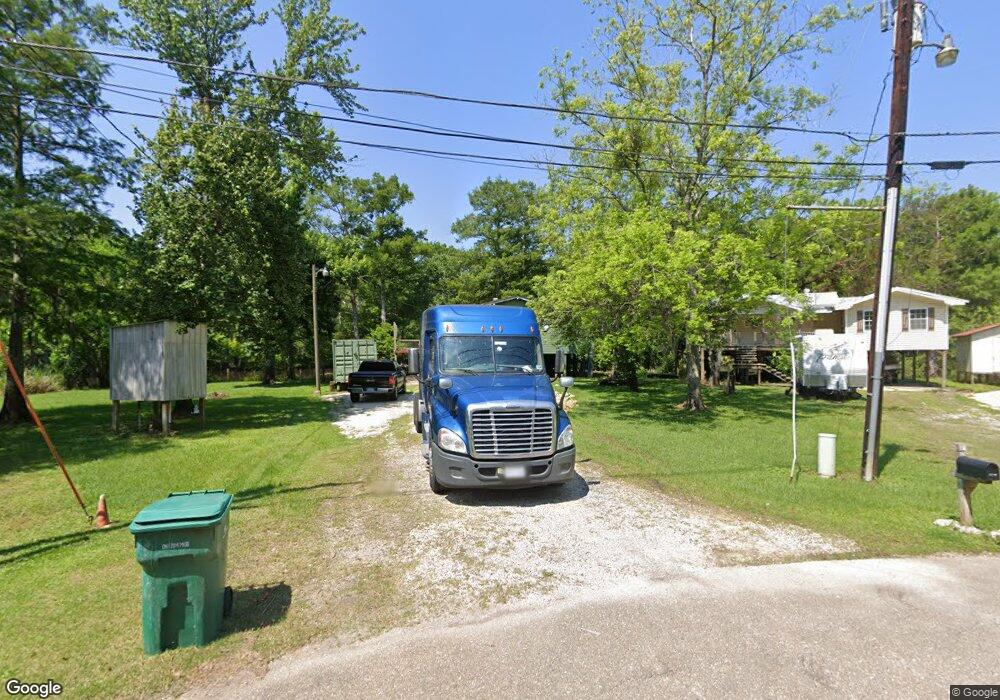
14209 Gibson Rd Maurepas, LA 70449
Livingston Parish NeighborhoodEstimated Value: $146,000 - $234,000
4
Beds
3
Baths
1,792
Sq Ft
$105/Sq Ft
Est. Value
About This Home
This home is located at 14209 Gibson Rd, Maurepas, LA 70449 and is currently estimated at $187,997, approximately $104 per square foot. 14209 Gibson Rd is a home located in Livingston Parish with nearby schools including Maurepas School.
Ownership History
Date
Name
Owned For
Owner Type
Purchase Details
Closed on
Apr 21, 2011
Sold by
Federal National Mortgage Association
Bought by
Werther Nancy S
Current Estimated Value
Purchase Details
Closed on
Jun 29, 2010
Sold by
Citimortgage Inc
Bought by
Federal National Mortgage Association
Purchase Details
Closed on
Jul 26, 2007
Sold by
Smith Thomas E and Smith Daisey G
Bought by
Wunstel Robert
Home Financials for this Owner
Home Financials are based on the most recent Mortgage that was taken out on this home.
Original Mortgage
$89,000
Interest Rate
6.69%
Mortgage Type
New Conventional
Create a Home Valuation Report for This Property
The Home Valuation Report is an in-depth analysis detailing your home's value as well as a comparison with similar homes in the area
Home Values in the Area
Average Home Value in this Area
Purchase History
| Date | Buyer | Sale Price | Title Company |
|---|---|---|---|
| Werther Nancy S | $40,000 | None Available | |
| Federal National Mortgage Association | $87,751 | None Available | |
| Wunstel Robert | $89,000 | None Available |
Source: Public Records
Mortgage History
| Date | Status | Borrower | Loan Amount |
|---|---|---|---|
| Previous Owner | Wunstel Robert | $89,000 |
Source: Public Records
Tax History Compared to Growth
Tax History
| Year | Tax Paid | Tax Assessment Tax Assessment Total Assessment is a certain percentage of the fair market value that is determined by local assessors to be the total taxable value of land and additions on the property. | Land | Improvement |
|---|---|---|---|---|
| 2024 | $435 | $5,050 | $940 | $4,110 |
| 2023 | $527 | $5,050 | $940 | $4,110 |
| 2022 | $539 | $5,050 | $940 | $4,110 |
| 2021 | $541 | $5,050 | $940 | $4,110 |
| 2020 | $538 | $5,050 | $940 | $4,110 |
| 2019 | $581 | $5,430 | $600 | $4,830 |
| 2018 | $581 | $5,430 | $600 | $4,830 |
| 2017 | $579 | $5,430 | $600 | $4,830 |
| 2015 | $32 | $4,820 | $500 | $4,320 |
| 2014 | $32 | $4,820 | $500 | $4,320 |
Source: Public Records
Map
Nearby Homes
- 13935 Old River Rd
- 22259 Chinquapin Ave
- 22343 Louisiana 22
- 13548 Almas Rd
- 22400 Chinquapin Ave
- 14239 Old River Rd
- 14245 Old River Rd
- 14251 Old River Rd
- 14257 Old River Rd
- 13093 Dove St
- 14263 Old River Rd
- 14269 Old River Rd
- 14275 Old River Rd
- 14281 Old River Rd
- 14287 Old River Rd
- 14293 Old River Rd
- 14299 Old River Rd
- 14305 Old River Rd
- 14311 Old River Rd
- 22962 Chene Blanc Ln
- 14209 Gibson St
- 14205 Gibson St
- 14251 Gibson St
- 14201 Gibson St
- 14201 Gibson Rd
- 14195 Gibson Rd
- 14191 Gibson Rd
- 14283 Gibson Rd
- 0 Tbd Home Port Dr
- 14181 Gibson St
- 14181 Gibson Rd
- 11435 Gibson St
- 14333 Gibson Rd
- 14339 Gibson Rd
- 14165 Gibson Rd
- 12808 St Lucia Dr
- 48259 Amite River Rd
- TBD S St Croix Ct
- 0 Vicknair Rd
- 10348 Deer St
