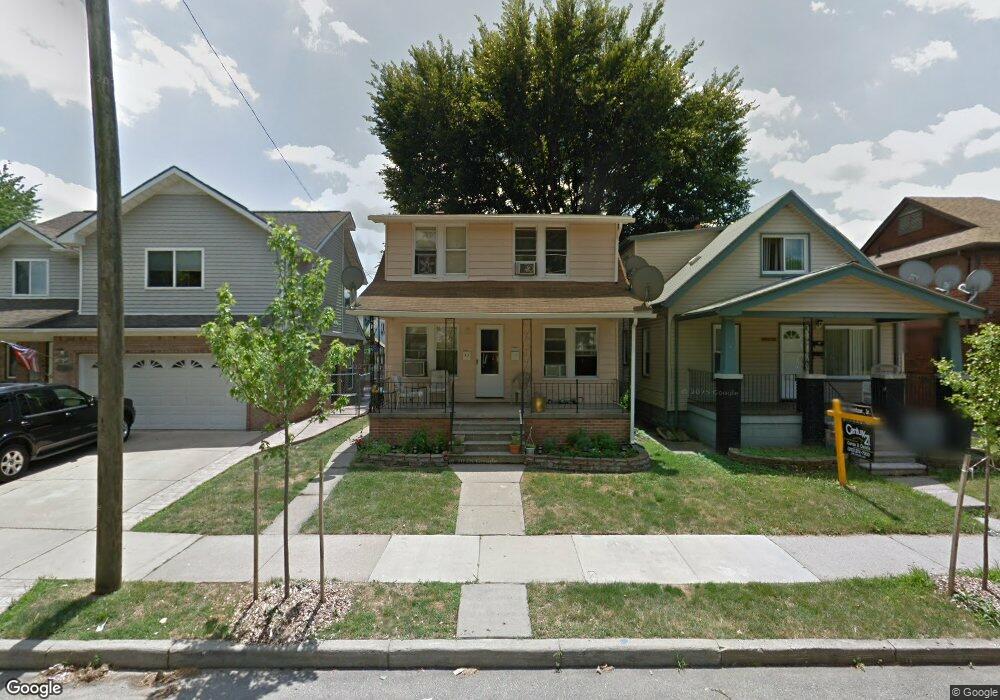
14209 Robertson St Dearborn, MI 48126
Schaefer-Greenfield NeighborhoodEstimated Value: $182,000 - $236,000
3
Beds
2
Baths
1,822
Sq Ft
$113/Sq Ft
Est. Value
About This Home
This home is located at 14209 Robertson St, Dearborn, MI 48126 and is currently estimated at $206,510, approximately $113 per square foot. 14209 Robertson St is a home located in Wayne County with nearby schools including Geer Park Elementary School, Stout Middle School, and Fordson High School.
Ownership History
Date
Name
Owned For
Owner Type
Purchase Details
Closed on
Aug 27, 2018
Sold by
Mohamed Jaber
Bought by
Mutawakel Nafaa Al
Current Estimated Value
Home Financials for this Owner
Home Financials are based on the most recent Mortgage that was taken out on this home.
Original Mortgage
$90,250
Outstanding Balance
$78,541
Interest Rate
4.5%
Mortgage Type
New Conventional
Estimated Equity
$127,969
Purchase Details
Closed on
Jul 26, 2011
Sold by
Kowalewski Lois Irene and Kowalewski Lois I
Bought by
Mohamed Jaber
Create a Home Valuation Report for This Property
The Home Valuation Report is an in-depth analysis detailing your home's value as well as a comparison with similar homes in the area
Home Values in the Area
Average Home Value in this Area
Purchase History
| Date | Buyer | Sale Price | Title Company |
|---|---|---|---|
| Mutawakel Nafaa Al | $95,000 | Title One Inc | |
| Mohamed Jaber | $23,000 | Title One Inc |
Source: Public Records
Mortgage History
| Date | Status | Borrower | Loan Amount |
|---|---|---|---|
| Open | Mutawakel Nafaa Al | $90,250 |
Source: Public Records
Tax History
| Year | Tax Paid | Tax Assessment Tax Assessment Total Assessment is a certain percentage of the fair market value that is determined by local assessors to be the total taxable value of land and additions on the property. | Land | Improvement |
|---|---|---|---|---|
| 2025 | $1,844 | $87,100 | $0 | $0 |
| 2024 | $1,803 | $71,000 | $0 | $0 |
| 2023 | $1,707 | $66,500 | $0 | $0 |
| 2022 | $1,920 | $48,300 | $0 | $0 |
| 2021 | $2,232 | $44,100 | $0 | $0 |
| 2019 | $2,209 | $35,000 | $0 | $0 |
| 2018 | $1,590 | $31,200 | $0 | $0 |
| 2017 | $438 | $30,100 | $0 | $0 |
| 2016 | $1,430 | $32,100 | $0 | $0 |
| 2015 | $2,703 | $29,250 | $0 | $0 |
| 2013 | $2,660 | $26,600 | $0 | $0 |
| 2011 | -- | $31,300 | $0 | $0 |
Source: Public Records
Map
Nearby Homes
- 14203 Barclay St
- 4215 Schaefer Rd
- 7 Georgetown Ct
- 4236 Schaefer Rd Unit 4
- 4315 Bingham St
- 4913 Middlesex St
- 7800 Schaefer Rd
- 5003 Middlesex St
- 4200 Lois St
- 4342 Lois St
- 4051 Lapham St
- 4616 Chovin St
- 5059 Hartwell St
- 5444 Kenilworth St
- 5430 Kendal St
- 4835 Chovin St
- 5424 Bingham St
- 4836 Firestone St
- 5411 Reuter St
- 5510 Bingham St
- 14215 Robertson St
- 14201 Robertson St
- 13871 Robertson St
- 14221 Robertson St
- 14227 Robertson St
- 14226 Barclay St
- 14232 Barclay St
- 14220 Barclay St
- 13863 Robertson St
- 14233 Robertson St
- 14214 Barclay St
- 14246 Barclay St
- 14202 Robertson St
- 14214 Robertson St
- 14202 Barclay St
- 14238 Barclay St
- 13872 Robertson St
- 13853 Robertson St
- 14254 Barclay St
- 13866 Robertson St
Your Personal Tour Guide
Ask me questions while you tour the home.