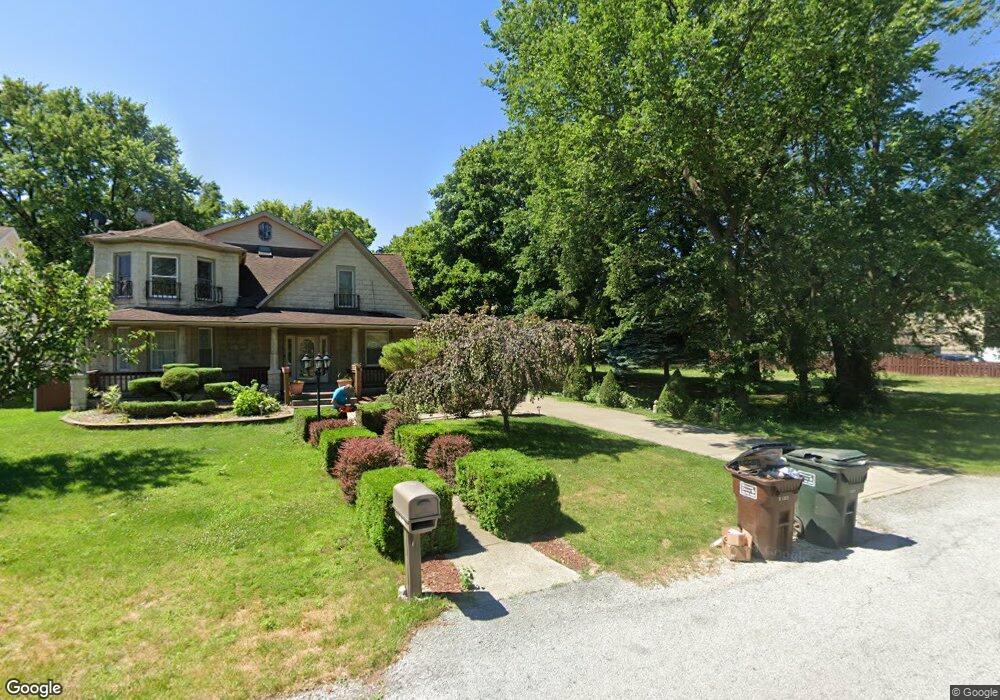
1421 172nd St Hazel Crest, IL 60429
Estimated Value: $218,000
--
Bed
--
Bath
--
Sq Ft
0.78
Acres
About This Home
This home is located at 1421 172nd St, Hazel Crest, IL 60429 and is currently estimated at $218,000. 1421 172nd St is a home located in Cook County with nearby schools including Thornwood High School.
Ownership History
Date
Name
Owned For
Owner Type
Purchase Details
Closed on
Nov 9, 2005
Sold by
Village Of East Hazel Crest
Bought by
Vazquez Ramon and Vazquez Guillermina
Current Estimated Value
Purchase Details
Closed on
Aug 8, 2004
Sold by
Johnsen Martin E
Bought by
Village Of East Hazel Crest
Purchase Details
Closed on
Sep 23, 2002
Sold by
Standard Bank & Trust Company
Bought by
Martin Yolanda Stacy
Home Financials for this Owner
Home Financials are based on the most recent Mortgage that was taken out on this home.
Original Mortgage
$73,742
Interest Rate
6.24%
Mortgage Type
FHA
Create a Home Valuation Report for This Property
The Home Valuation Report is an in-depth analysis detailing your home's value as well as a comparison with similar homes in the area
Home Values in the Area
Average Home Value in this Area
Purchase History
| Date | Buyer | Sale Price | Title Company |
|---|---|---|---|
| Vazquez Ramon | -- | -- | |
| Village Of East Hazel Crest | -- | -- | |
| Martin Yolanda Stacy | $75,000 | Stewart Title |
Source: Public Records
Mortgage History
| Date | Status | Borrower | Loan Amount |
|---|---|---|---|
| Previous Owner | Martin Yolanda Stacy | $73,742 |
Source: Public Records
Tax History Compared to Growth
Tax History
| Year | Tax Paid | Tax Assessment Tax Assessment Total Assessment is a certain percentage of the fair market value that is determined by local assessors to be the total taxable value of land and additions on the property. | Land | Improvement |
|---|---|---|---|---|
| 2024 | $4,208 | $8,098 | $8,098 | -- |
| 2023 | $4,684 | $8,098 | $8,098 | -- |
| 2022 | $4,684 | $7,198 | $7,198 | $0 |
| 2021 | $4,597 | $7,197 | $7,197 | $0 |
| 2020 | $7,718 | $12,596 | $12,596 | $0 |
| 2019 | $3,766 | $6,298 | $6,298 | $0 |
| 2018 | $3,725 | $6,298 | $6,298 | $0 |
| 2017 | $3,743 | $6,298 | $6,298 | $0 |
| 2016 | $3,029 | $5,398 | $5,398 | $0 |
| 2015 | $2,929 | $5,398 | $5,398 | $0 |
| 2014 | $2,873 | $5,398 | $5,398 | $0 |
| 2013 | $2,652 | $5,398 | $5,398 | $0 |
Source: Public Records
Map
Nearby Homes
- 1415 172nd St
- 17213 Laflin Ave
- 1427 172nd St
- 1413 172nd St
- 17219 Laflin Ave
- 1422 173rd St
- 17204 Laflin Ave
- 1412 173rd St
- 1503 172nd St
- 17208 Loomis Ave
- 17204 Loomis Ave
- 1410 173rd St
- 17216 Loomis Ave
- 1505 172nd St
- 17216 Laflin Ave
- 17220 Loomis Ave
- 1511 172nd St
- 1511 172nd St Unit 2nd floor rear
- 1506 173rd St
- 1402 173rd St